Prince's Bay on Staten Island in Richmond County, New York — The American Northeast (Mid-Atlantic)
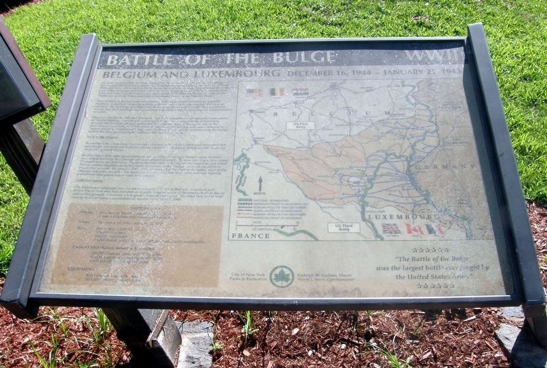
Battle of the Bulge
Belgium and Luxembourg, December 16, 1944 - January 25, 1943
— WWII —
[Much of the marker was illegible at the time the photo was taken.]
Conclusion
The Ardennes Campaign was crucial to ending the war in Europe. American and Allied Forces had met and defeated an exceptionally large number of the enemy, both in the air and on the ground. Germany's last great offensive had failed. The road now led to victory and Germany's unconditional surrender on May 7, 1945.
Erected by NYC Parks.
Topics and series. This historical marker is listed in these topic lists: Air & Space • War, World II. In addition, it is included in the NYC Parks series list. A significant historical date for this entry is May 7, 1945.
Location. This marker has been replaced by another marker nearby. It was located near 40° 31.123′ N, 74° 11.274′ W. Marker was on Staten Island, New York, in Richmond County. It was in Prince's Bay. Marker could be reached from Chester Avenue west of Cornelia Avenue, on the left when traveling west. Touch for map. Marker was at or near this postal address: 245 Chester Ave, Staten Island NY 10312, United States of America. Touch for directions.
Other nearby markers. At least 8 other markers are within 2 miles of this location, measured as the crow flies. World War II: Battle of the Bulge (here, next to this marker); Battle of the Bulge Memorial (here, next to this marker); Seguine Mansion (approx. half a mile away); 5910 Amboy Road (approx. one mile away); Our Veterans Memorial (approx. 1.3 miles away); Pleasant Plains Memorial (approx. 1˝ miles away); John Cardinal O'Connor Lighthouse (approx. 1.6 miles away); Welcome to Mount Loretto Unique Area (approx. 1.7 miles away). Touch for a list and map of all markers in Staten Island.
Related marker. Click here for another marker that is related to this marker. This marker has been replaced with the linked marker.
Credits. This page was last revised on January 15, 2024. It was originally submitted on January 15, 2024, by Larry Gertner of New York, New York. This page has been viewed 43 times since then. Photo 1. submitted on August 18, 2020, by Larry Gertner of New York, New York. • Devry Becker Jones was the editor who published this page.
