Marker Logo HMdb.org THE HISTORICAL
MARKER DATABASE
“Bite-Size Bits of Local, National, and Global History”
White Plains in Greene County, Georgia — The American South (South Atlantic)
 

White Plains Baptist Church


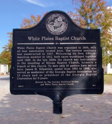
White Plains Baptist Church Marker image. Click for full size.
Photographed By David Seibert, October 28, 2009
1. White Plains Baptist Church Marker
Inscription. White Plains Baptist Church was organized in 1806, with all four sanctuaries located here. The current sanctuary was constructed in 1887. Welcoming its first African-American member in 1812, both races worshipped together until 1869. In the late 1820s the church was instrumental in the founding of Siloam Baptist Church, formerly a branch of this church. To date only 20 pastors have served here. James H. Kilpatrick, pastor from 1854 to 1908, also served as moderator of the Georgia Baptist Association for 23 years and as president of the Georgia Baptist Convention for 6 years.
 
Erected 1999 by Georgia Historical Society and the White Plains Baptist Church. (Marker Number 66-1.)
 
Topics and series. This historical marker is listed in these topic lists: African AmericansChurches & Religion. In addition, it is included in the Georgia Historical Society series list. A significant historical year for this entry is 1806.
 
Location. 33° 28.326′ N, 83° 2.094′ W. Marker is in White Plains, Georgia, in Greene County. Marker is on Main Street, 0 miles east of Sparta Road (Georgia Route 77), on the left when traveling east. Touch for map. Marker is at or near this postal address: 1040 Main Street, White Plains GA 30678, United States of America. Touch for directions.
 
Other nearby markers. At least 8 other markers are within 10 miles of this marker, measured
Paid Advertisement
Click on the ad for more information.
Please report objectionable advertising to the Editor.
Click or scan to see
this page online
as the crow flies. Bethany Presbyterian Church (approx. 5.9 miles away); Liberty Chapel (approx. 6.6 miles away); Camilla and Zack Hubert Homesite (approx. 6.7 miles away); Gov. William Jonathan Northen (approx. 7.8 miles away); Confederate Gun Shop (approx. 7.9 miles away); Mt. Zion Church (approx. 8.1 miles away); Nathan S.S. Beman at Mt. Zion (approx. 8.1 miles away); Great Buffalo Lick (approx. 9.3 miles away). Touch for a list and map of all markers in White Plains.
 
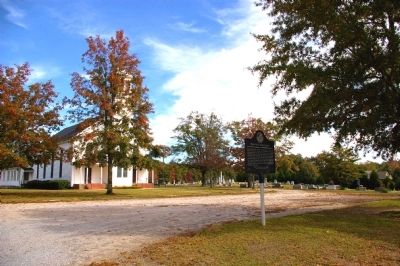
White Plains Baptist Church Marker and the Church image. Click for full size.
Photographed By David Seibert, October 28, 2009
2. White Plains Baptist Church Marker and the Church
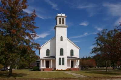
White Plains Baptist Church image. Click for full size.
Photographed By David Seibert, October 28, 2009
3. White Plains Baptist Church
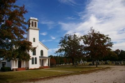
White Plains Baptist Church and Cemetery image. Click for full size.
Photographed By David Seibert, October 28, 2009
4. White Plains Baptist Church and Cemetery
 
 
Credits. This page was last revised on January 30, 2020. It was originally submitted on November 2, 2009, by David Seibert of Sandy Springs, Georgia. This page has been viewed 1,171 times since then and 53 times this year. Photos:   1, 2, 3, 4. submitted on November 2, 2009, by David Seibert of Sandy Springs, Georgia. • Kevin W. was the editor who published this page.
Share this page.  
Share on Tumblr
m=23997

CeraNet Cloud Computing sponsors the Historical Marker Database.
This website earns income from purchases you make after using our links to Amazon.com. We appreciate your support.
Paid Advertisement
Apr. 26, 2024