Calhoun Isles in Minneapolis in Hennepin County, Minnesota — The American Midwest (Upper Plains)
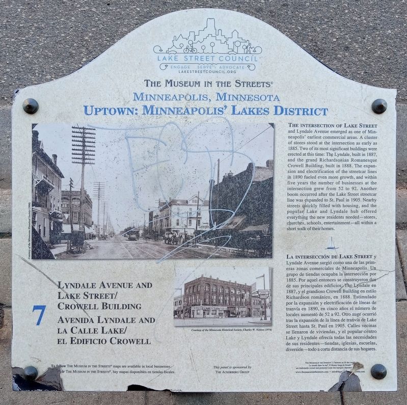
Lyndale Avenue and Lake Street/Crowell Building
The Museum in the Streets: Minneapolis, Minnesota
| — | Uptown: Minneapolis' Lake District | — |
Photographed by McGhiever, October 22, 2023
1. Lyndale Avenue and Lake Street/Crowell Building Marker

this page online
Erected by The Museum in the Streets®. (Marker Number 7.)
Topics and series. This historical marker is listed in these topic lists: Architecture • Industry & Commerce • Railroads & Streetcars. In addition, it is included in the The Museum in the Streets: Minneapolis, Minnesota series list. A significant historical year for this entry is 1885.
Location. 44° 56.897′ N, 93° 17.315′ W. Marker is in Minneapolis, Minnesota, in Hennepin County. It is in Calhoun Isles. It is at the intersection of W. Lake Street and Lyndale Avenue S., on the right when traveling east on W. Lake Street. Touch for map. Marker is at or near this postal address: 707 W Lake Street, Minneapolis MN 55408, United States
Photographed by McGhiever, October 22, 2023
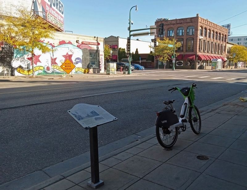
2. Marker at the southwest corner of Lake and Lyndale, with the Crowell Building catercorner

Regionally, this marker is in the Twin Cities Metropolitan Area. It is also in the American Midwest, in the Corn Belt, and in the Great River Road Region. Globally, it is in North America, the Western Hemisphere, the Western World, and the Anglosphere. Historically, it finds itself in what was once Rupert’s Land, the territory of the Mississippian Culture, and the Louisiana Purchase.
Other nearby markers. At least 8 other markers are within walking distance of this marker: 609 West Lake Street: Schatzlein Saddle Shop / Calle West Lake 609: Tienda de Monturas Schaltzlein (about 400 feet away, measured in a direct line); 2916 Lyndale Avenue: James J. Ballentine VFW Post 246 (about 500 feet away); Grade Separation Project (1912–16) (about 700 feet away); 925 West Lake Street: The Minneapolis Mercantile Company (approx. 0.2 miles away); 1006 West Lake: The Buzza Building (approx. 0.2 miles away); Flour, Fuel and Baseball (approx. 0.2 miles away); Building the Corridor (approx. ¼ mile away); 2924 Hennepin Avenue: Abdallah's (approx. half a mile away). Touch for a list and map of all markers in Minneapolis.
Credits. This page was last revised on January 31, 2024. It was originally submitted on January 28, 2024, by McGhiever of Minneapolis, Minnesota. This page has been viewed 366 times since then and 45 times this year. Photos: 1, 2. submitted on January 28, 2024, by McGhiever of Minneapolis, Minnesota. • J. Makali Bruton was the editor who published this page.
