Parowan in Iron County, Utah — The American Mountains (Southwest)
Parowan Adobe Fort
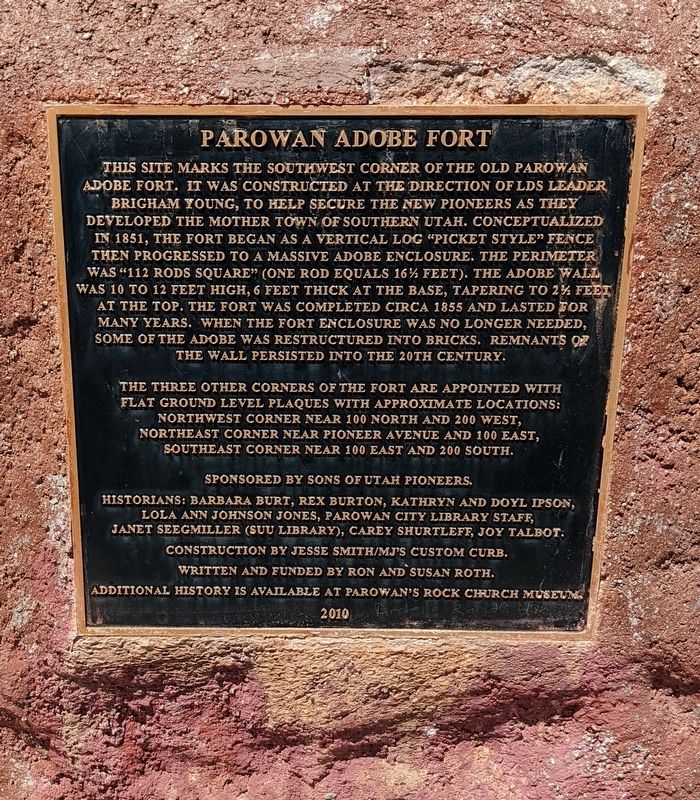
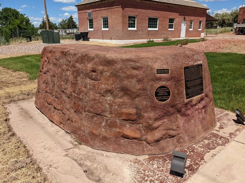
This site marks the southwest corner of the old Parowan adobe fort. It was constructed at the direction of LDS leader Brigham Young, to help secure the new pioneers as they developed the mother town of Southern Utah. Conceptualized in 1851, the fort began as a vertical log "picket style" fence then progressed to a massive adobe enclosure. The perimeter was "112 rods square" (one rod equals 16½ feet). The adobe wall was 10 to 12 feet high, 6 feet thick at the base, tapering to 2½ feet at the top. The fort was completed circa 1855 and lasted for many years. When the fort enclosure was no longer needed, some of the adobe was restructured into bricks. Remnants of the wall persisted into the 20th century.
The three other corners of the fort are appointed with flat ground level plaques with approximate locations:
Northwest corner near 100 North and 200 West,
Northeast corner near Pioneer Avenue and 100 East,
Southeast corner near 100 East and 200 South.
Sponsored by Sons of Utah Pioneers.
Historians: Barbara Burt, Rex Burton, Kathryn and Doyl Ipson, Lola Ann Johnson Jones, Parowan City Library staff, Janet Seegmiller (SUU Library), Carey Shurtleff, Joy Talbot.
Construction by Jesse Smith/MJ's Custom Curb.
Written and funded by Fon and Susan Roth.
Additional history is available at Parowan's Rock Church Museum.
Erected 2010 by Sons of Utah Pioneers.
Topics and series. This historical marker is listed in these topic lists: Forts and Castles • Settlements & Settlers. In addition, it is included in the Sons of Utah Pioneers series list. A significant historical year for this entry is 1855.
Location. 37° 50.339′ N, 112° 49.914′ W. Marker is in Parowan, Utah, in Iron County. Marker is at the intersection of West 200 South and 200 West and 200 South, on the right when traveling north on West 200 South. Touch for map. Marker is at or near this postal address: 198 W 200 S, Paragonah UT 84760, United States of America. Touch for directions.
Other nearby markers. At least 8 other markers are within walking distance of this marker. Parowan Cotton Factory (about 500 feet away, measured in a direct line); Jesse N. Smith Home (approx. 0.2 miles away); a different marker also named Jesse N. Smith Home (approx. 0.2 miles away); Old Comedy Hall (approx. 0.2 miles away); D.U.P. Relic Hall (approx. ¼ mile away); John C. Freemont Memorial (approx. ¼ mile away); Pioneer Sundial (approx. ¼ mile away); William and Julia Lyman House (approx. ¼ mile away). Touch for a list and map of all markers in Parowan.
Also see . . .
1. Parowan Adobe Fort (YouTube, 4:41). (Submitted on February 7, 2024.)
2. Parowan Adobe Fort (FortWiki).
Excerpt: Established first as Fort Louisa in January 1851 at the founding of the town by George A. Smith. The town was established by request of Brigham Young who visited the new town in May 1851. He renamed the town Parowan, paraphrasing an Indian word for the area. Parowan was the first settlement south of Provo and was known as the “Mother Town” because many of the original settlers were called to colonize other areas in southern Utah and beyond.(Submitted on February 7, 2024.)
Credits. This page was last revised on February 7, 2024. It was originally submitted on February 6, 2024, by Jeremy Snow of Cedar City, Utah. This page has been viewed 71 times since then. Photos: 1, 2. submitted on February 6, 2024, by Jeremy Snow of Cedar City, Utah. • Andrew Ruppenstein was the editor who published this page.

