Perry in Box Elder County, Utah — The American Mountains (Southwest)
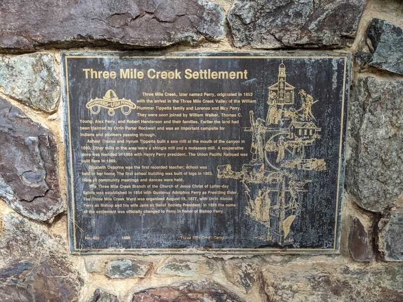
Three Mile Creek Settlement
Three Mile Creek, later named Perry, originated in 1853 with the arrival in the Three Mile Creek Valley of the William Plummer Tippetts family and Lorenzo and May Perry. They were soon joined by William Walker, Thomas C. Young, Alex Perry, and Robert Henderson and their families. Earlier the land had been claimed by Orrin Porter Rockwell and was an important campsite for Indians and pioneers passing through.
Ashael Thorne and Hyrum Tippetts built a saw mill at the mouth of the canyon in 1860. Other mills in the area were a shingle mill and a molasses mill. A cooperative store was founded in 1865 with Henry Perry president. The Union Pacific Railroad was built here in 1869.
Elizabeth Osborne was the first recorded teacher; school was held in her home. The first school building was built of logs in 1863. Here all community meetings and dances were held. The Three Mile Creek Branch of the Church of Jesus Christ of Latter-day Saints was established in 1854 with Gustavus Adolphus Perry as Presiding Elder. The Three Mile Creek Ward was organized August 19, 1877, with Orrin Alonzo Perry as Bishop and his wife Jane as Rellef Society President. In 1898 the name of the settlement was officially changed to Perry In honor of Bishop Perry.
No. 439 1988 Three Mile Creek Camp
Erected 1988 by Daughters of Utah Pioneers. (Marker Number 439.)
Topics and series. This historical marker is listed in these topic lists: Churches & Religion • Education • Industry & Commerce • Settlements & Settlers. In addition, it is included in the Daughters of Utah Pioneers series list. A significant historical year for this entry is 1853.
Location. 41° 27.948′ N, 112° 1.499′ W. Marker is in Perry, Utah, in Box Elder County. Marker is on Elm Grove Dr. south of W 2400 S, on the right when traveling north. Touch for map. Marker is in this post office area: Brigham City UT 84302, United States of America. Touch for directions.
Other nearby markers. At least 8 other markers are within 4 miles of this marker, measured as the crow flies. Pioneer Care Center (approx. 2 miles away); Bushnell Hospital/Intermountain Indian School (approx. 2.2 miles away); Lorenzo Snow Burial Site (approx. 2.7 miles away); Historical Rail (approx. 3.1 miles away); Union Pacific Depot-Built 1907 (approx. 3.1 miles away); Erected in Honor of Brigham Young (approx. 3.1 miles away); A Pioneer Home (approx. 3.1 miles away); Brigham City Co-Op (approx. 3.1 miles away).
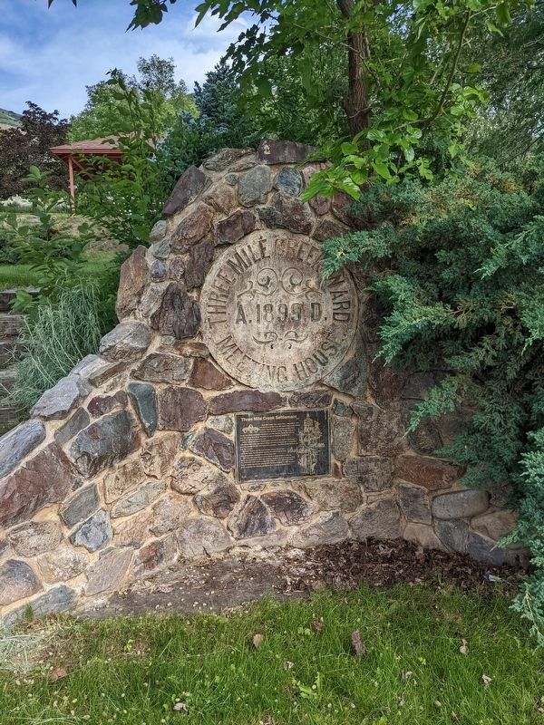
More about this marker. The marker is mounted to a rock feature next to some steps on the west side of Mt. View Park.
Credits. This page was last revised on February 7, 2024. It was originally submitted on February 6, 2024, by Jeremy Snow of Cedar City, Utah. This page has been viewed 42 times since then. Photos: 1, 2. submitted on February 6, 2024, by Jeremy Snow of Cedar City, Utah. • Andrew Ruppenstein was the editor who published this page.

