Brigham City in Box Elder County, Utah — The American Mountains (Southwest)
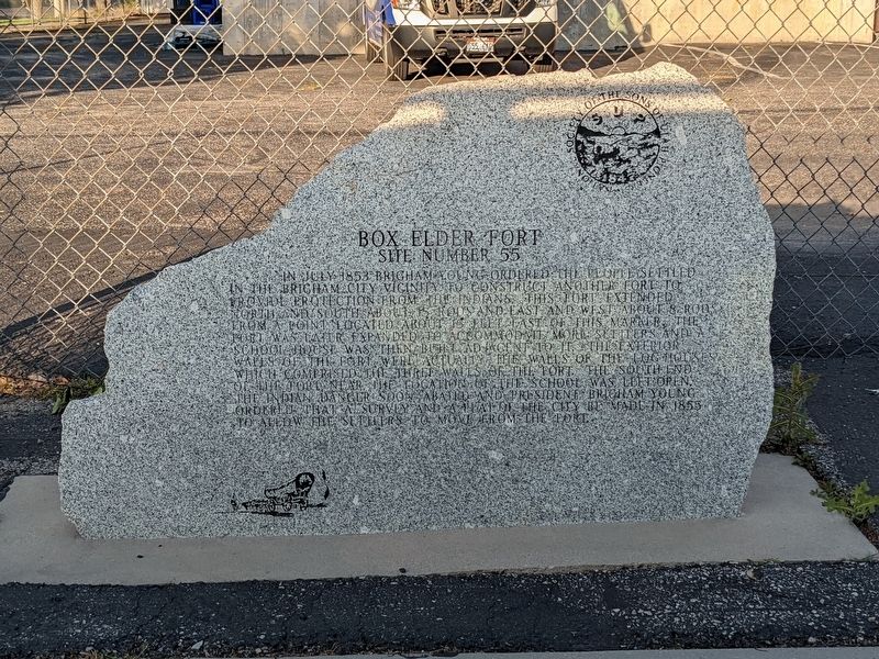
Box Elder Fort
In July 1853 Brigham Young ordered the people settled in the Brigham City vicinity, construct another fort to provide protection from the Indians. This fort extended North and South about 15 rods and East and West about 8 rods. From a point located about 15 feet east of this marker. The Fort was later expanded to accomodate more settlers and a school house was then built adjacent to it. The exterior walls of the fort were actually the walls of the log houses which comprised the three walls of the fort. The south end the school near the location of the school was left open. The Indian danger soon abated and President Brigham Young ordered that a survey and a plat of the city be made in 1855 to allow the settlers to move from the fort. om the fort.
Erected by Sons of Utah Pioneers. (Marker Number 55.)
Topics. This historical marker is listed in this topic list: Settlements & Settlers. A significant historical year for this entry is 1853.
Location. 41° 31.003′ N, 112° 1.123′ W. Marker is in Brigham City, Utah, in Box Elder County. Marker is on 275 North 200 West. Touch for map. Marker is at or near this postal address: 275 N 200 W, Brigham City UT 84302, United States of America. Touch for directions.
Other nearby markers. At least 8 other markers are within walking distance of this marker. Brigham City Co-Op (approx. 0.4 miles away); A Pioneer Home (approx. 0.4 miles away); Erected in Honor of Brigham Young (approx. 0.4 miles away); Brigham City Co-op Store (approx. 0.4 miles away); Brigham City Fire Station/City Hall (approx. half a mile away); Historic Brigham City Relief Society Granary (approx. 0.6 miles away); The Davis Fort-Built 1851 (approx. 0.6 miles away); Historical Rail (approx. 0.7 miles away). Touch for a list and map of all markers in Brigham City.
Credits. This page was last revised on February 26, 2024. It was originally submitted on February 6, 2024, by Jeremy Snow of Cedar City, Utah. This page has been viewed 58 times since then. Photo 1. submitted on February 6, 2024, by Jeremy Snow of Cedar City, Utah. • Bill Pfingsten was the editor who published this page.
