La Grande in Union County, Oregon — The American West (Northwest)
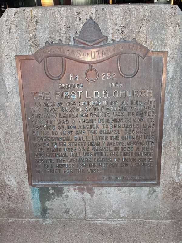
The First L.D.S. Church
La Grande was founded in 1861 on this site. The first chapel of the Church of Jesus Christ of Latter Day Saints was erected (1901) it was a frame building 34 x 60 ft. costing $2,100. A brick tabernacle was built in 1907 and the chapel became a recreational hall. Later the church was moved to Fir Street near Y Avenue, renovated and again used as a chapel. In 1929 a new recreational hall was built. The first church became the welfare center of Union Stake. It is a refuge for the hungry and a symbol of thrift for the wise.
Union County, Oregon
Erected 1959 by Daughters of Utah Pioneers. (Marker Number 252.)
Topics and series. This historical marker is listed in these topic lists: Charity & Public Work • Churches & Religion • Settlements & Settlers. In addition, it is included in the Daughters of Utah Pioneers series list. A significant historical year for this entry is 1959.
Location. 45° 19.437′ N, 118° 5.784′ W. Marker is in La Grande, Oregon, in Union County. Marker is at the intersection of N Avenue and Fourth Street, on the right when traveling west on N Avenue. Touch for map. Marker is in this post office area: La Grande OR 97850, United States of America. Touch for directions.
Other nearby markers. At least 6 other markers are within 12 miles of this marker, measured as the crow flies. Historic La Grande (approx. one mile away); Conde B. McCullough and Upper Perry Arch Bridge (approx. 4.1 miles away); Highway US30 and Perry, Oregon (approx. 4.1 miles away); Hilgard Junction Oregon Trail Kiosk (approx. 6.8 miles away); "Wagons East " 1975-1976 (approx. 6.8 miles away); Imbler Church (approx. 11.3 miles away).
Credits. This page was last revised on February 7, 2024. It was originally submitted on February 6, 2024, by Jeremy Snow of Cedar City, Utah. This page has been viewed 60 times since then. Photo 1. submitted on February 6, 2024, by Jeremy Snow of Cedar City, Utah. • Andrew Ruppenstein was the editor who published this page.
