Millerstown in Perry County, Pennsylvania — The American Northeast (Mid-Atlantic)
Millerstown United Methodist Church
Perry County Bicentennial
— 1820 - 2020 —

Photographed By Devry Becker Jones (CC0), February 23, 2024
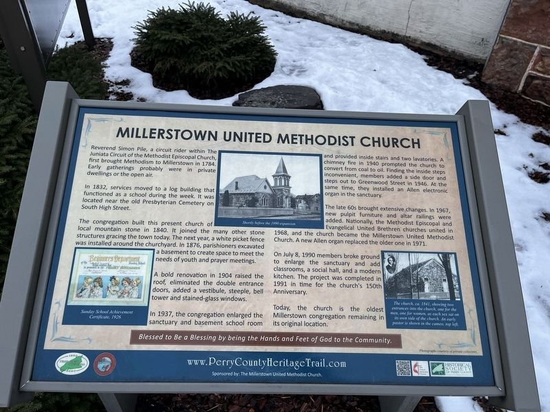
1. Millerstown United Methodist Church Marker
Reverend Simon Pile, a circuit rider within The Juniata Circuit of the Methodist Episcopal Church, first brought Methodism to Millerstown in 1784. Early gatherings probably were in private dwellings or the open air.
In 1832, services moved to a log building that functioned as a school during the week. It was located near the old Presbyterian Cemetery on South High Street.
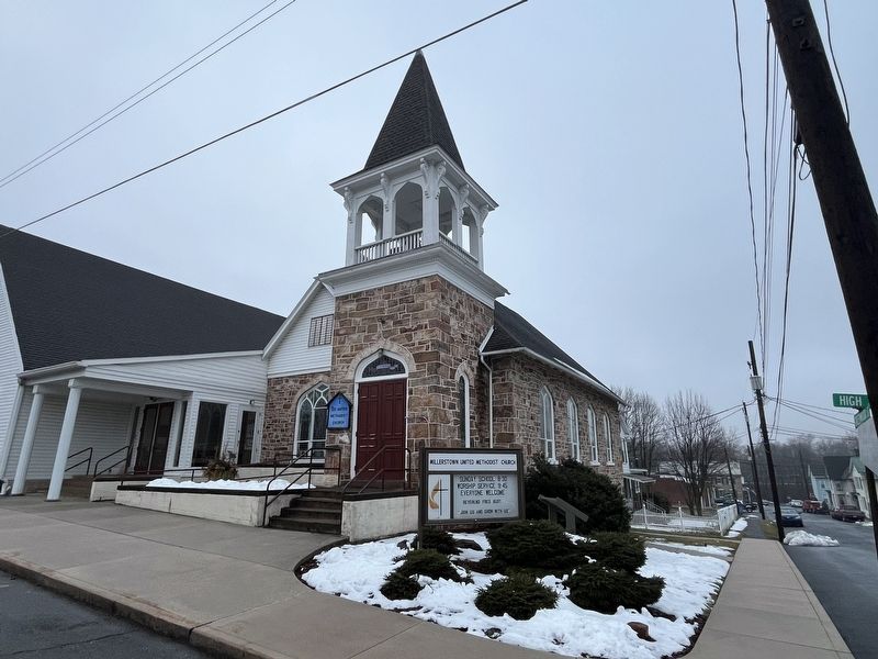
The congregation built this present church of local mountain stone in 1840. It joined many other stone structures gracing the town today. The next year, a white picket fence was installed around the churchyard. In 1876, parishioners excavated a basement to create space to meet the needs of youth and prayer meetings.
A bold renovation in 1904 raised the roof, eliminated the double entrance doors, added a vestibule, steeple, bell tower and stained glass windows.
In 1937, the congregation enlarged the sanctuary and basement school room and provided the inside stairs and two lavatories. A chimney fire in 1940 prompted the church to convert from coal to oil. Finding the inside steps inconvenient, members added a side door and steps out to Greenwood Street in 1946. At the same time, they installed an Allen electronic organ in the sanctuary.
The late 60s brought extensive changes. In 1967, new pulpit furniture and altar railings were added. Nationally, the Methodist Episcopal and Evangelical United Brethren churches united in 1968, and the church became the Millerstown United Methodist Church. A new Allen organ replaced the older one in 1971.
On July 8, 1990 members broke ground to enlarge the sanctuary and add classrooms, a social hall, and a modern kitchen. The project was completed in 1991 in time for the church's 150th Anniversary.
Today, the church is the oldest Millerstown congregation remaining in its original location.
[Caption:]
The church, ca. 1841, showing two entrances to the church, one for the men, one for women, as each sex sat on its own side of the church. An early pastor is shown in the cameo, top left.
Erected by Borough of Millerstown; Historical Society of Perry County; The United Methodist Church.
Topics and series. This historical marker is listed in these topic lists: Architecture • Churches & Religion. In addition, it is included in the Perry County Heritage Trail in Pennsylvania. series list. A significant historical date for this entry is July 8, 1990.
Location. 40° 33.077′ N, 77° 9.274′ W. Marker is in Millerstown
Other nearby markers. At least 8 other markers are within walking distance of this marker. Cochran-Anspach House (about 400 feet away, measured in a direct line); Millerstown (about 500 feet away); The Founding of Millerstown (about 500 feet away); David Miller (about 500 feet away); a different marker also named Millerstown (about 600 feet away); a different marker also named Millerstown (about 600 feet away); James A. Beaver (about 600 feet away); Governor James Addams Beaver (about 700 feet away). Touch for a list and map of all markers in Millerstown.
Credits. This page was last revised on February 25, 2024. It was originally submitted on February 24, 2024, by Devry Becker Jones of Washington, District of Columbia. This page has been viewed 42 times since then. Photos: 1, 2. submitted on February 24, 2024, by Devry Becker Jones of Washington, District of Columbia.
