Great Bridge in Chesapeake, Virginia — The American South (Mid-Atlantic)
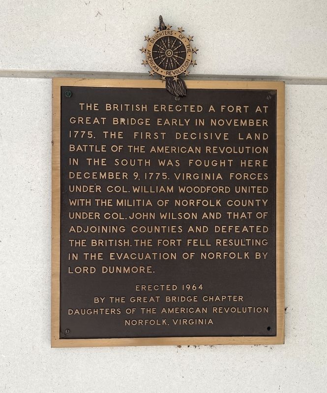
Battle of Great Bridge
by the Great Bridge Chapter
Daughters of the American Revolution
Norfolk, Virginia
Erected 1964 by Great Bridge Chapter, Daughters of the American Revolution (DAR).
Topics and series. This historical marker is listed in these topic lists: Forts and Castles • War, US Revolutionary. In addition, it is included in the Daughters of the American Revolution series list. A significant historical date for this entry is December 9, 1975.
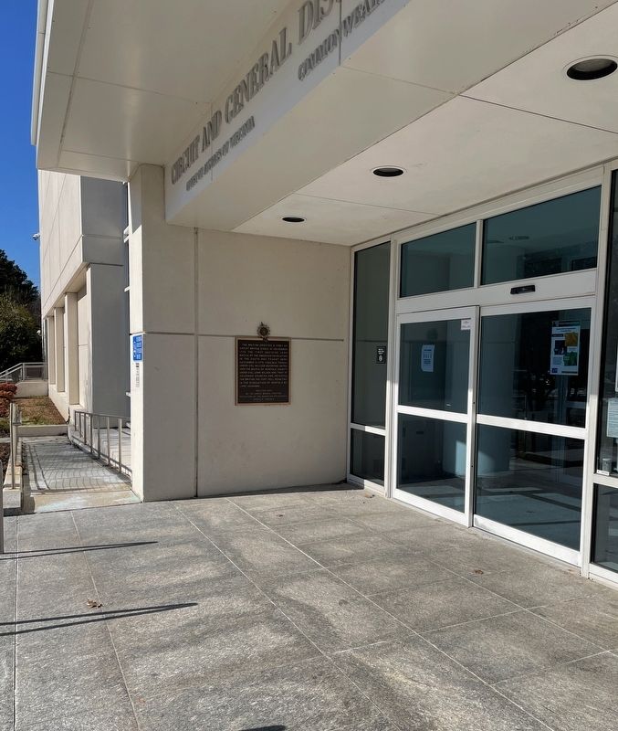
Location. 36° 43.02′ N, 76° 15.018′ W. Marker is in Chesapeake, Virginia. It is in Great Bridge. Marker can be reached from the intersection of Albemarle Drive and Holt Drive, on the left when traveling west. Marker attached to the wall of the entrance to to the Chesapeake Municipal Building. Touch for map. Marker is at or near this postal address: 304 Albemarle Drive, Chesapeake VA 23322, United States of America. Touch for directions.
Other nearby markers. At least 8 other markers are within walking distance of this marker. History of Norfolk County (a few steps from this marker); Never Forget (within shouting distance of this marker); SSG Jonathan Kilian Dozier, USA (about 500 feet away, measured in a direct line); Chesapeake Veterans Memorial (about 500 feet away); Battle of Great Bridge Monument (about 600 feet away); Norfolk County Almshouse (approx. 0.2 miles away); The Iron Titans Tame the Marsh (approx. half a mile away); What is a Lock? (approx. half a mile away). Touch for a list and map of all markers in Chesapeake.
Also see . . . The Battle of Great Bridge. (Submitted on February 10, 2022, by Brandon D Cross of Flagler Beach, Florida.)
Credits. This page was last revised on February 29, 2024. It was originally submitted on February 10, 2022, by Brandon D Cross of Flagler Beach, Florida. This page has been viewed 198 times since then and 36 times this year. Last updated on February 26, 2024, by Carolyn Sanders of Plano, Texas. Photos: 1, 2. submitted on February 10, 2022, by Brandon D Cross of Flagler Beach, Florida. • Bernard Fisher was the editor who published this page.

