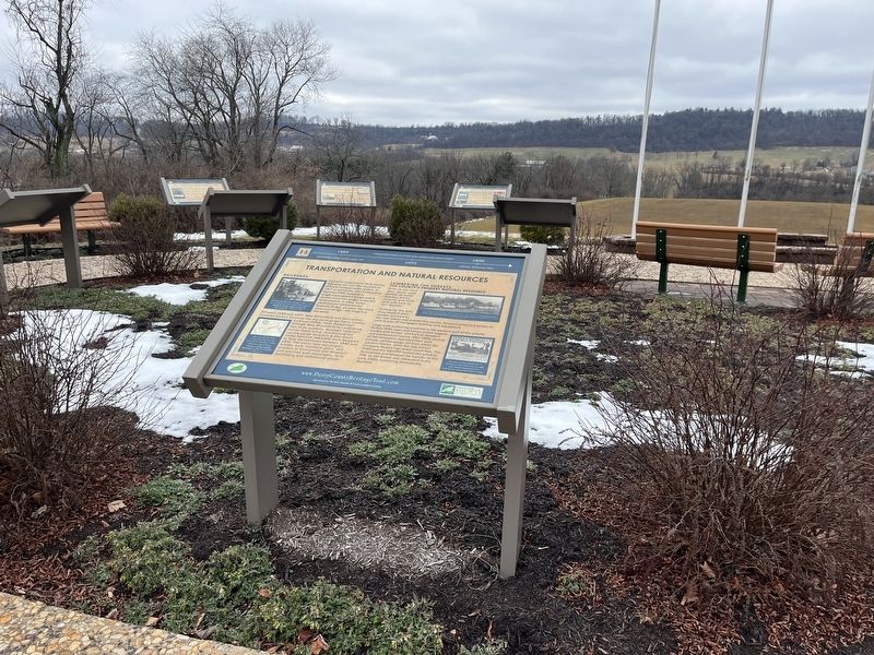
Spring Township in Elliottsburg in Perry County, Pennsylvania — The American Northeast (Mid-Atlantic)
Transportation and Natural Resources
Perry County Bicentennial
— 1820 - 2020 —

Photographed By Devry Becker Jones (CC0), February 23, 2024
1. Transportation and Natural Resources Marker
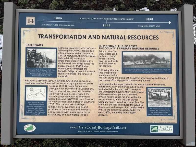
1889: Johnstown flood ended canal era.
1892: Homestead Strike in Pittsburgh symbolized labor unrest.
1898: Spanish American War.
Railroads
Economic expansion in Perry County following the Civil War required an efficient transportation system. In 1877 at Marysville, the Pennsylvania Railroad (PRR) replaced its single-track wooden bridge with a double-track iron bridge across the Susquehanna. In 1902, Italian stonemasons completed the Rockville Bridge, an iconic four-track stone arch bridge — the longest in the world.
Between 1889 and 1983, New Bloomfield and Duncannon business leaders financed the standard-gauge Perry County Railroad (PCRR), from Duncannon through New Bloomfield to Landisburg. Not to be outdone, Newport investors, led by David Gring, constructed the narrow-gauge Newport & Sherman's Valley Railroad (N&SVRR) from Newport to New Germantown between 1890 and 1892. The trains took passengers, lumber, bark, livestock, grain, and produce to Duncannon and Newport and returned with passengers, farm machinery, and commercial goods.
Lumbering the Forests
The County's Primary Natural Resource
Prior to the Civil War, locals used timber to build houses, barns, taverns and mills and oak bark to tan leather.
Following the war, they shipped their lumber and bark to the river towns and outside the county. Farmers converted timber to cash to pay off mortgages and buy new equipment.
Large scale lumbering occurred in the western part of the county. Before 1890, oxen and horses pulled wagons loaded with lumber and bark to Newport and Cumberland County. After 1890, several of the companies operated their own, private, narrow-gauge rail lines within the western forests, while the Oak Extract Company floated logs down Laurel Run. The PCRR and the N&SVRR hauled the wood to Duncannon and Newport for transfer to the PRR. As the timber was exhausted in the early 1900s, lumbering dramatically declined.
[Captions:]
Building the Rockville Bridge, 1902. Used by permission of the author Dan Cupper, Rockville Bridge: Rails across the Susquehanna, (2002), p. 46.
Map showing the Perry County Railroad and the Newport & Sherman's Valley Railroad, taken from A History of Perry County Railroads by Roy F. Chandler (1970), p. 67.
East Waterford and Kansas Valley Railroad, ca. 1895, taken from Pitch Pine and Prop Timber: The Logging Railroad of South-Central Pennsylvania by Benjamin F. G. Kline, Jr. (1971), p. 172.
The Perry County Democrat, 11 December 1893 advertised sawmills and engines manufactured in York by two cousins from

Photographed By Devry Becker Jones (CC0), February 23, 2024
2. Transportation and Natural Resources Marker
Erected 2020 by Historical Society of Perry County. (Marker Number 14.)
Topics and series. This historical marker is listed in these topic lists: Bridges & Viaducts • Industry & Commerce • Natural Resources • Railroads & Streetcars. In addition, it is included in the Pennsylvania Railroad (PRR), and the Perry County Heritage Trail in Pennsylvania. series lists. A significant historical year for this entry is 1889.
Location. 40° 23.081′ N, 77° 17.856′ W. Marker is in Elliottsburg, Pennsylvania, in Perry County. It is in Spring Township. Marker can be reached from Shermans Valley Road (Pennsylvania Route 274) 0.4 miles east of Veterans Way (Pennsylvania Route 74), on the right when traveling west. Touch for map. Marker is at or near this postal address: 2471 Shermans Valley Rd, Elliottsburg PA 17024, United States of America. Touch for directions.
Other nearby markers. At least 8 other markers are within walking distance of this marker. The Gring Lions (here, next to this marker); The First Inhabitants of Perry County (here, next to this marker); A New Century (here, next to this marker); Contact Between Widely Different Cultures (here, next to this marker); Post-Civil War Transformation (here, next to this marker); The Perry County Bicentennial Plaza (here, next to this marker); Life in the Great Depression (here, next to this marker); WW I and Its Aftermath (here, next to this marker). Touch for a list and map of all markers in Elliottsburg.
Credits. This page was last revised on February 29, 2024. It was originally submitted on February 29, 2024, by Devry Becker Jones of Washington, District of Columbia. This page has been viewed 46 times since then. Photos: 1, 2. submitted on February 29, 2024, by Devry Becker Jones of Washington, District of Columbia.