Natchez in Natchitoches Parish, Louisiana — The American South (West South Central)
The Helaire Family of Oakland
⎯⎯⎯
The Shields Family of Oakland
Photographed by Cajun Scrambler, July 2, 2023
1. The Helaire Family of Oakland / The Shields Family of Oakland Marker
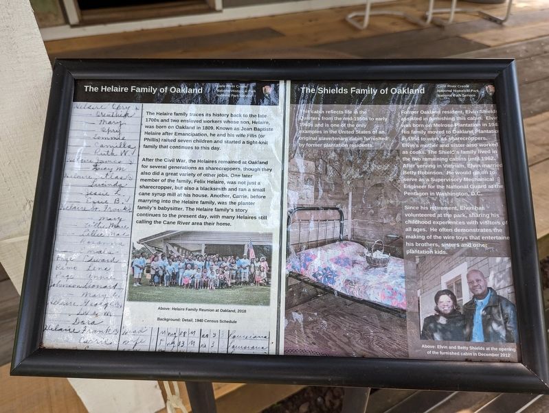
The Helaire family traces its history back to the late 1700s and two enslaved workers whose son, Helaire, was born on Oakland in 1809. Known as Jean Baptiste Helaire after Emancipation, he and his wife Filis (or Phillis) raised seven children and started a tight-knit family that continues to this day.
After the Civil War, the Helaires remained at Oakland for several generations as sharecroppers, though they also did a great variety of other jobs. One later member of the family, Felix Helaire, was not just a sharecropper, but also a blacksmith and ran a small family cane syrup mill at his house. Another, Carrie, before marrying into the Helaire family, was the planter family's babysitter. The Helaire family's story continues to the present day, with many Helaires still calling the Cane River area their home.
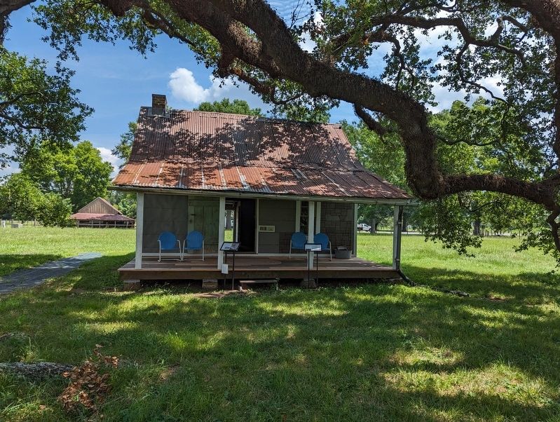
This cabin reflects life in the Quarters from the mid-1950s to early 1960s and is one of the only examples in the United States of an original slave/tenant cabin furnished by former plantation residents.
Former Oakland resident, Elvin Shield assisted in furnishing
this page online
Since his retirement, Elvin has volunteered at the park, sharing his childhood experiences with visitors of all ages. He often demonstrates the making of the wire toys that entertained his brothers, sinters and other plantation kids.
Erected by National Park Service, U.S. Department of the Interior.
Topics. This historical marker is listed in these topic lists: African Americans • Settlements & Settlers. A significant historical year for this entry is 1809.
Location. 31° 39.846′ N, 93° 0.186′ W. Marker is in Natchez, Louisiana, in Natchitoches Parish. It can be reached from Louisiana 494 (Louisiana Route 494) near Highway 119. Touch for map. Marker is at or near this postal address: 4285 LA-494,
Photographed by Cajun Scrambler, July 2, 2023
2. The Helaire Family of Oakland / The Shields Family of Oakland Marker

Regionally, this marker is in Central Louisiana. It is also in the American South, specifically in the Deep South, and in the Piney Woods. Globally, it is in North America, a Gulf of Mexico state, the Western Hemisphere, the Western World, and the Anglosphere. Historically, it finds itself in what was once New Spain, the Viceroyalty of New France, the territory of the Mississippian Culture, the Louisiana Purchase, one of the Confederate States of America, and the Antebellum South.
Other nearby markers. At least 8 other markers are within walking distance of this marker: Escaped! Freedom Seekers in 1863-1864 (here, next to this marker); Middleman to Yardman (within shouting distance of this marker); Quarters Community (within shouting distance of this marker); Cotton Ginning Time (about 300 feet away, measured in a direct line); Corn Crib (about 300 feet away); Oakland Grist Mill (about 300 feet away); A French Connection (about 400 feet away); Maker of Most Things Wood (about 400 feet away). Touch for a list and map of all markers in Natchez.
More about this marker. Located on the grounds of the Oakland Plantation, part of the Cane River Creole National Historic Park.
Credits. This page was last revised on November 14, 2024. It was originally submitted on March 1, 2024, by Cajun Scrambler of Assumption, Louisiana. This page has been viewed 945 times since then and 76 times this year. Photos: 1, 2. submitted on March 1, 2024, by Cajun Scrambler of Assumption, Louisiana.
