Valley City in Barnes County, North Dakota — The American Midwest (Upper Plains)
Bridging Time
Mill Dam Bridge
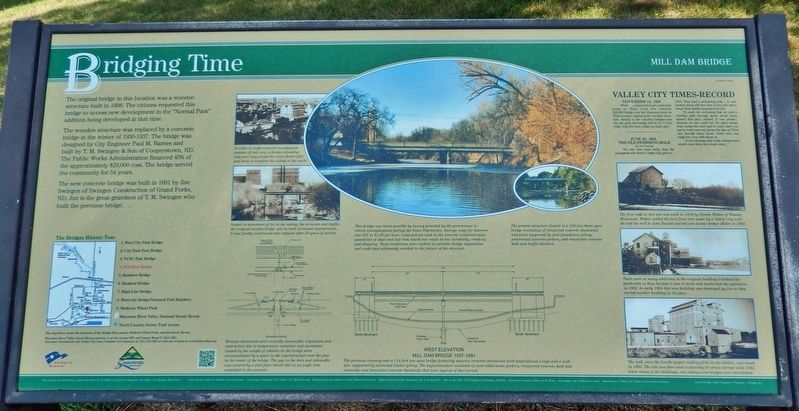
The original bridge in this location was a wooden structure built in 1898. The citizens requested this bridge to access new development in the "Normal Park" addition being developed at that time.
The wooden structure was replaced by a concrete bridge in the winter of 1936-1937. The bridge was designed by City Engineer Paul M. Barnes and built by T. M. Swingen & Son of Cooperstown, ND. The Public Works Administration financed 45% of the approximately $29,000 cost. The bridge served the community for 54 years.
The new concrete bridge was built in 1991 by Jim Swingen of Swingen Construction of Grand Forks, ND. Jim is the great-grandson of T. M. Swingen who built the previous bridge.
[photo & illustration captions]
• In order to make room for an adequate number of rail cars, a bridge extending only part way across the river (lower left) was built to complete the siding to the south.
• Subject to movement of ice in the spring, the elements and traffic, the original wooden bridge was in need of annual maintenance. It was finally condemned and replaced after 38 years of service.
• Mill Dam Bridge 1937-1991 The previous crossing was a 114 foot two span bridge featuring massive concrete abutments with longitudinal wings and a wall pier supported by untreated timber piling. The superstructure consisted of steel rolled beam girders, reinforced concrete deck and sidewalks and decorative concrete handrails that were typical of that period.
• Expansion Device Because abutments were virtually immovable, expansion and contraction due to temperature variation and movement caused by the weight of vehicles on the bridge were accommodated by a space in the superstructure over the pier in the center of the bridge. The gap in the deck and sidewalks was covered by a steel plate which slid on, an angle iron embedded in the concrete.
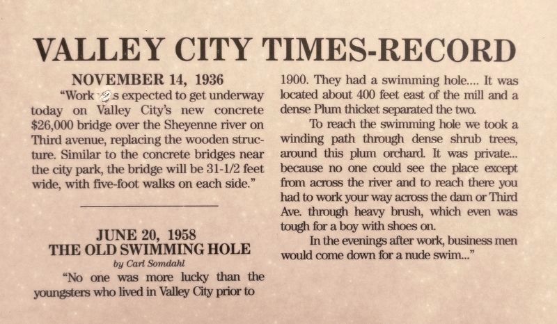
• This bridge [the 1936-1937 bridge] was made possible by money provided by the government to relieve unemployment during the Great Depression. Average wage for laborers was 55¢ to $1.20 per hour. Local gravels used in the concrete contained large quantities of shale and soft rock which can result in low durability, cracking and chipping. These conditions were evident in periodic bridge inspections and could have ultimately resulted in the failure of the structure.
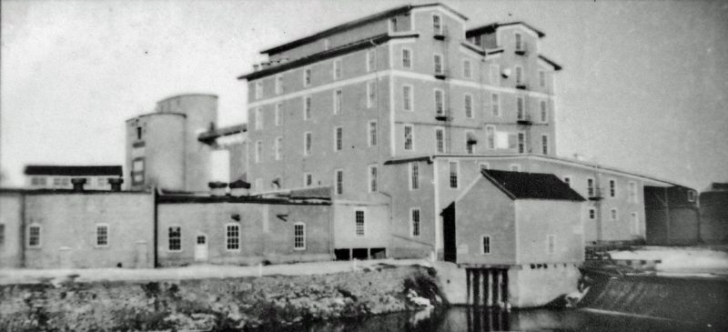
• The first mill on this site was built in 1878 by Hiram Walker of Whalen, Minnesota. Walker milled the first flour ever made by a Valley City mill. He sold the mill to John Russell and his son-in-law Arthur Miller in 1882.
• There were so many additions to the original building it looked like patchwork so they decided to tear it down and modernize the operation in 1902. In early 1904 this new building was destroyed by fire so they erected another building in its place.
Erected by The City of Valley City and Valley City Bridges Task Force.
Topics and series. This historical marker is listed in these topic lists: Bridges & Viaducts • Charity & Public Work • Industry & Commerce • Settlements & Settlers. In addition, it is included in the Works Progress Administration (WPA) projects series list. A significant historical year for this entry is 1991.
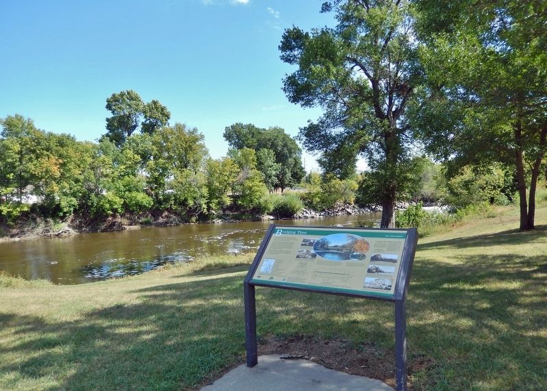
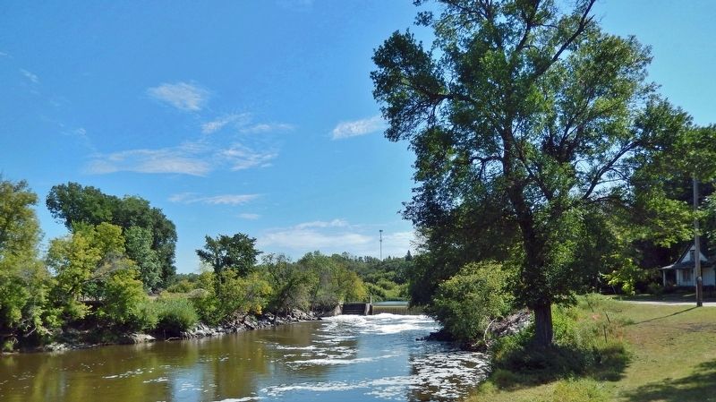
Location. 46° 55.183′ N, 97° 59.984′ W. Marker is in Valley City, North Dakota, in Barnes County. Marker is at the intersection of 3rd Avenue Southeast and College Street Southeast, on the left when traveling south on 3rd Avenue Southeast. The marker is located near the northeast corner of the intersection, overlooking the Sheyenne River and the Mill Dam to the east. Touch for map. Marker is in this post office area: Valley City ND 58072, United States of America. Touch for directions.
Other nearby markers. At least 8 other markers are within walking distance of this marker. Bridging the Community (approx. 0.2 miles away); Herman Stern (approx. ¼ mile away); Footbridge to Fun (approx. 0.3 miles away); Soothing Sounds of Splashing Water (approx. 0.4 miles away); Valley City Park Memorial Bandshell (approx. 0.4 miles away); Caboose
(approx. 0.4 miles away); Historic Neighborhood (approx. 0.4 miles away); Rosebud Visitor Center Along the Byway (approx. 0.4 miles away). Touch for a list and map of all markers in Valley City.
Related markers. Click here for a list of markers that are related to this marker. Valley City Historic Bridges Tour
Also see . . . Sheyenne River Valley Scenic Byway - Mill Dam Bridge. Excerpt:
The simple span of the Mill Dam Bridge, which once ran to a millwork dam on the Sheyenne River in Valley City, can be seen to the east of the Valley City State University Footbridge.(Submitted on March 7, 2024, by Cosmos Mariner of Cape Canaveral, Florida.)
Photographed By Cosmos Mariner, August 27, 2022
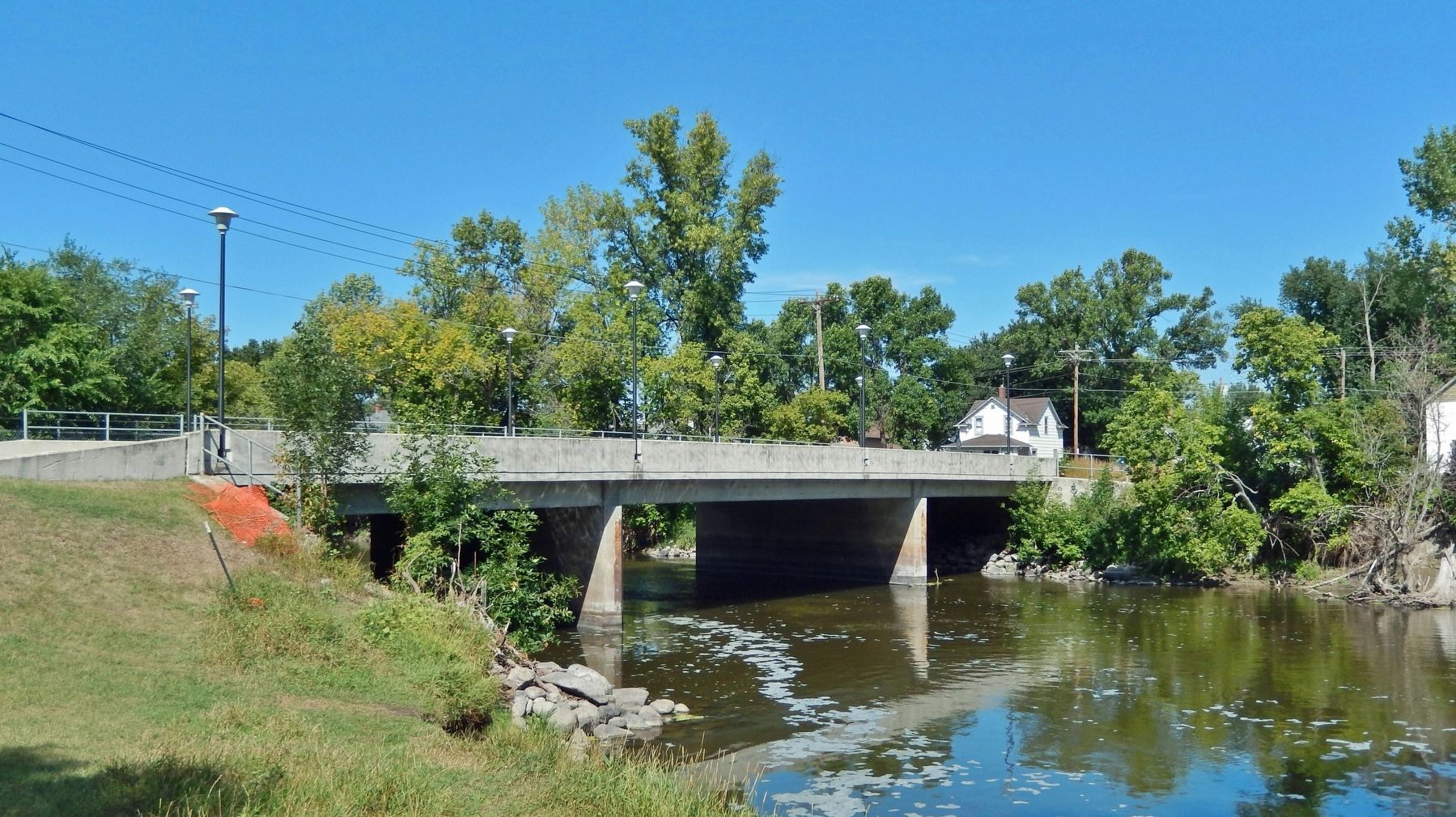
6. Mill Dam Bridge (looking north from marker)
The present structure is a 140-foot three span bridge consisting of reinforced concrete abutments and piers supported by steel foundation piling, pre-stressed concrete girders, and reinforced concrete deck and traffic barriers.
Credits. This page was last revised on April 28, 2024. It was originally submitted on March 5, 2024, by Cosmos Mariner of Cape Canaveral, Florida. This page has been viewed 41 times since then. Photos: 1, 2, 3, 4, 5, 6. submitted on March 7, 2024, by Cosmos Mariner of Cape Canaveral, Florida.
