Stuyvesant Falls in Columbia County, New York — The American Northeast (Mid-Atlantic)
Stuyvesant Falls
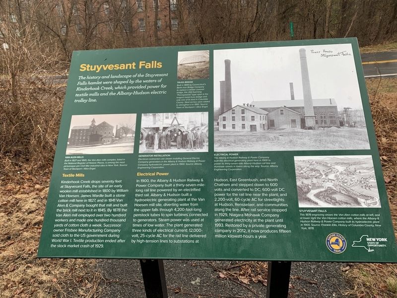
The history and landscape of the Stuyvesant Falls hamlet were shaped by the waters of Kinderhook Creek, which provided power for textile mills and the Albany-Hudson electric trolley line.
Textile Mills
Kinderhook Creek drops seventy feet at Stuyvesant Falls, the site of an early woolen mill established in 1800 by William Van Hoesen. James Wardle built a stone cotton mill here in 1827, and in 1841 Van Alen & Company bought that mill and built the brick mill next to it in 1845. By 1878 the Van Alen mill employed over two hundred workers and made one hundred thousand yards of cotton cloth a week. Successor owner Frisbee Manufacturing Company sold cloth to the US government during World War I. Textile production ended after the stock market crash of 1929.
Electrical Power
In 1900, the Albany & Hudson Railway & Power Company built a thirty-seven-mile-long rail line powered by an electrified third rail. Albany & Hudson built a hydroelectric generating plant at the Van Hoesen mill site, diverting water from the upper falls through 4,200-foot-long penstock tubes to spin turbines connected to generators. Steam power was used at times of low water. The plant generated three kinds of electrical current: 12,000-volt, 25-cycle AC for the rail line delivered by high-tension lines to substations at Hudson, East Greenbush, and North Chatham and stepped down to 600 volts and converted to DC; 600-volt DC power for the rail line near the plant, and 2,200-volt, 60-cycle AC for streetlights at Hudson, Rensselaer, and communities along the line. After rail service stopped in 1929, Niagara Mohawk Company generated electricity at the plant until 1993. Restored by a private generating company in 2012, it now produces fifteen million kilowatt-hours a year.
ELECTRICAL POWER
The Albany & Hudson Railway & Power Company built this electrical generating plant here in 1900 to power its thirty-seven-mile Albany-Hudson rail line and illuminate streets in towns along the way. Source: Albany Engineering Corporation.
STUYVESANT FALLS
This 1878 engraving shows the Von Alen cotton mills at left, and at lower right the Van Hoesen cotton mills, where the Albany & Hudson Railway & Power Company built its hydroelectric plant in 1900. Source: Franklin Ellis, History of Columbia County New York, 1878.
GENERATOR INSTALLATION
Electrical contractors are shown installing General Electrica Company generators in the Albany & Hudson Railway & Power Company hydroelectric power plant in 1900. Source: Albany Engineering Corporation.
Van Alen Mills
Built in 1827 and 1845, the Van Alen mills complex, listed in
the National Register of Historic Places, is among the most picturesque pre-Civil War industrial sites in New York. Source: Town of Stockport/ Alice Engel.
TRUSS BRIDGE
Built in 1899 by Connecticut's Berlin Iron Bridge Company to replace a timber covered bridge, this 202-foot-long "Pennsylvania"-type span is the longest metal bridge truss bridge and only one of its kind in Columbia County. Steel Arches were added to strengthen it in 1993. Source: Town of Stockport/ Alice Engel.
Erected by New York State, Empire State Trail.
Topics. This historical marker is listed in these topic lists: Industry & Commerce • Railroads & Streetcars • Settlements & Settlers. A significant historical year for this entry is 1800.
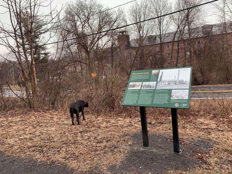
Location. 42° 21.452′ N, 73° 44.154′ W. Marker is in Stuyvesant Falls, New York, in Columbia County. Marker is at the intersection of New Street and Woods Lane, on the left when traveling east on New Street. Touch for map. Marker is in this post office area: Stuyvesant NY 12173, United States of America. Touch for directions.
Other nearby markers. At least 8 other markers are within 2 miles of this marker, measured as the crow flies. Stuyvesant Falls Overlook Park (about 700 feet away, measured in a direct line); Kinderhook Creek (about 700 feet away); The Empire State Trail (about 700 feet away); Passenger and Freight Depots (approx. ¼ mile away); Stockport-Stuyvesant Line (approx. ¼ mile away); Farmhands and Fishing (approx. 1.8 miles away); An Agrarian Lifestyle… (approx. 1.8 miles away); Farm Operations (approx. 1.8 miles away). Touch for a list and map of all markers in Stuyvesant Falls.
Credits. This page was last revised on March 7, 2024. It was originally submitted on March 5, 2024, by Steve Stoessel of Niskayuna, New York. This page has been viewed 37 times since then. Photos: 1, 2. submitted on March 5, 2024, by Steve Stoessel of Niskayuna, New York. • Andrew Ruppenstein was the editor who published this page.

