Nuttallburg in Fayette County, West Virginia — The American South (Appalachia)
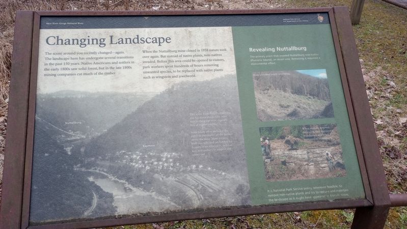
Changing Landscape
New River Gorge National River
When the Nuttallburg mine closed in 1958 nature took over again. But instead of native plants, non-natives invaded. Before this area could be opened to visitors, park workers spent hundreds of hours removing unwanted species, to be replaced with native plants such as wingstem and jewelweed.
Revealing Nuttallburg
The primary plant that invaded Nuttallburg was kudzu (Pueraria lobata), an Asian vine. Removing it required a monumental effort.
This scene from early Nuttallburg and Kaymoor shows how mine sites in the gorge were typically free of vegetation.
Mine leases often included the rights to the timber on the surface above the mine. Mine owners built sawmills and cut lumber for houses, mine structures, railroad ties, and timbers to support the mine roof.
When workers removed the kudzu, they discovered foundations and other remnants of Nuttallburg.
It is National Park Service policy, wherever feasible, to remove non-native plants and try to restore and maintain the landscape as it might have appeared in historic times.
Erected by National Park Service US. Department of the Interior.
Topics. This historical marker is listed in these topic lists: Industry & Commerce • Settlements & Settlers. A significant historical year for this entry is 1958.
Location. 38° 3.003′ N, 81° 2.394′ W. Marker is in Nuttallburg, West Virginia, in Fayette County. Marker is on Keeneys Creek Road, on the right when traveling west. Touch for map. Marker is at or near this postal address: County Rte 85/2, Fayetteville WV 25840, United States of America. Touch for directions.
Other nearby markers. At least 8 other markers are within walking distance of this marker. A Building Evolves (here, next to this marker); Exploring Nuttallburg (a few steps from this marker); Home Sweet Home (within shouting distance of this marker); Railroads and Coal (about 800 feet away, measured in a direct line); John Nuttall And Nuttallburg (about 800 feet away); Henry Ford's Nuttallburg (about 800 feet away); Nuttallburg and Short Creek (approx. 0.2 miles away); Moving Coal Downhill (approx. 0.2 miles away). Touch for a list and map of all markers in Nuttallburg.
Credits. This page was last revised on March 12, 2024. It was originally submitted on March 6, 2024, by Craig Doda of Napoleon, Ohio. This page has been viewed 32 times since then. Photos: 1, 2. submitted on March 6, 2024, by Craig Doda of Napoleon, Ohio. • Bill Pfingsten was the editor who published this page.

