Roy in Weber County, Utah — The American Mountains (Southwest)
First Settlers of Roy
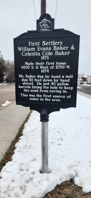
Photographed by Randy Higley, March 5, 2024
1. First Settlers of Roy Marker
William Evans Baker & Celestia Cole Baker
1873
Made their first home on
6000 S. & West of 2700 W.
1874
Mr. Baker dug by hand a well dug 50 feet down
by hand shovel. He put 40 gallon barrels lining the hole
to keep the sand from caving in.
This was the first source of water in the area.
Erected by Roy City.
Topics. This historical marker is listed in this topic list: Settlements & Settlers. A significant historical year for this entry is 1873.
Location. 41° 9.27′ N, 112° 2.779′ W. Marker is in Roy, Utah, in Weber County. It is on 6000 South west of South 2700 West Street, on the right when traveling west. The marker is near the trailhead for the Denver and Rio Grande Western Rail Trail. Touch for map. Marker is in this post office area: Roy UT 84067, United States of America. Touch for directions.

Regionally, this marker is in the Wasatch Front and in Greater Salt Lake. It is also in the American Mountain West and on the Colorado Plateau. Globally, it is in North America, the Rocky Mountains, the Western Hemisphere, the Western World, and the Anglosphere. Historically, it finds itself in what was once New Spain and also Mexico’s Alta California.
Other nearby markers. At least 8 other markers are within 4 miles of this marker, measured as the crow flies: First Post Office in Roy (about 300 feet away, measured in a direct line); a different marker also named The First Post Office in Roy (about 300 feet away); Clinton (approx. ¾ mile away); Settlement of Clearfield (approx. 3.1 miles away); Hensley/Salt Lake Cutoff Ruts (approx. 3.3 miles away); Muskrat Springs-Hooper (approx. 3.6 miles away); Hensley / Salt Lake Cutoff-Bluff Road (approx. 4 miles away); The Kington Fort-Morrisite War Site (approx. 4.1 miles away). Touch for a list and map of all markers in Roy.
Also see . . . Roy City (Utah History Encyclopedia).
this page online
Excerpt: Roy is six miles southwest of Ogden, abutting Hill Air Force on the east and the town of Hooper on the west. Roy was settled in 1873, twenty-five years after Ogden, and most of the surrounding communities had been settled prior to that time. No one really wanted this dry, sandy land. Yet, eventually a trickling of settlers came and endured harsh conditions to tear a living from the resistant soil….(Submitted on March 6, 2024.)
A well was dug fifty feet deep by installing open barrels in the ground as it was dug to keep the loose sand from caving in. The meager water available was colored and brackish. The settlers trudged each day to Muskrat Springs in Hooper for acceptable water to satisfy their personal needs and to provide for the animals they owned. This procedure continued until 1882 when the settlers realized that if this place were to grow, they needed to find better water sources. An idea was born. Walking up to sixteen miles up Weber Canyon, the settlers--men, women, and children--dug a canal by hand to bring water from the nearby mountains. The canal was lined with rocks that the women and children amassed as the route was cleared.
The canal was surveyed and leveled by simple but effective means, and, when it was finished, the water scuttled through the rows the settlers had made. Prospects for the town were at once improved.
Credits. This page was last revised on March 7, 2024. It was originally submitted on March 6, 2024, by Randy Higley of Hooper, Utah. This page has been viewed 907 times since then and 123 times this year. Photo 1. submitted on March 6, 2024, by Randy Higley of Hooper, Utah. • Andrew Ruppenstein was the editor who published this page.
Editor’s want-list for this marker. Distance photo showing marker and surroundings • Can you help?
