Kaymoor in Fayette County, West Virginia — The American South (Appalachia)
From Top to Bottom
New River Gorge National Park and Preserve
— National Park Service, U.S. Department of the Interior —
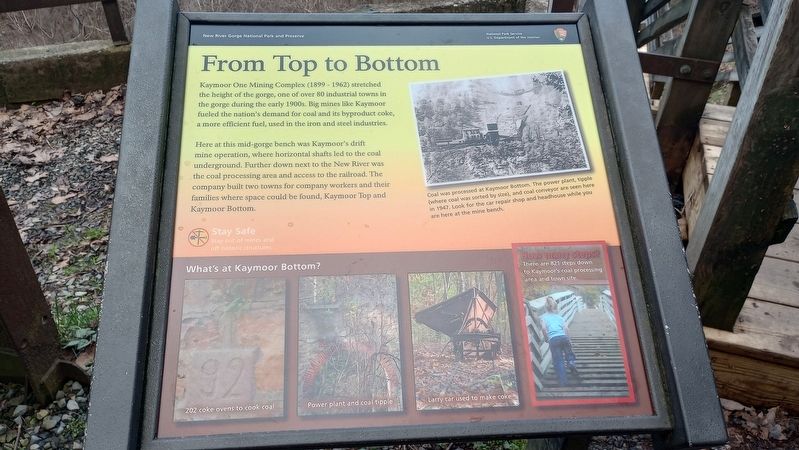
Kaymoor One Mining Complex (1899 - 1962) stretched the height of the gorge, one of over 80 industrial towns in the gorge during the early 1900s. Big mines like Kaymoor fueled the nation's demand for coal and its byproduct coke, a more efficient fuel, used in the iron and steel industries.
Here at this mid-gorge bench was Kaymoor's drift mine operation, where horizontal shafts led to the coal underground. Further down next to the New River was the coal processing area and access to the railroad. The company built two towns for company workers and their families where space could be found, Kaymoor Top and Kaymoor Bottom.
[Caption:]
Coal was processed at Kaymoor Bottom. The power plant, tipple (where coal was sorted by size), and coal conveyor are seen here in 1947. Look for the car repair shop and headhouse while you are here at the mine bench.
Erected by National Park Service, U.S. Department of the Interior.
Topics. This historical marker is listed in these topic lists: Architecture • Industry & Commerce • Natural Resources. A significant historical year for this entry is 1947.
Location. 38° 2.832′ N, 81° 3.971′ W. Marker is in Kaymoor, West Virginia, in Fayette County. Marker is at the intersection of Kaymoor Miners Trail and Kaymoor Trail, on the right when traveling west on Kaymoor Miners Trail. Touch for map. Marker is at or near this postal address: 881 Kaymoor Miners Trail, Fayetteville WV 25840, United States of America. Touch for directions.
Other nearby markers. At least 8 other markers are within walking distance of this marker. Protecting Bats (here, next to this marker); Getting Coal Down (here, next to this marker); A Busy Bench (within shouting distance of this marker); Valuable Air (about 300 feet away, measured in a direct line); Going Up? (about 500 feet away); Mountain Haulage (approx. 0.2 miles away); Kaymoor One Mine (approx. 0.2 miles away); Kaymoor Bottom (approx. ¼ mile away). Touch for a list and map of all markers in Kaymoor.
Credits. This page was last revised on March 14, 2024. It was originally submitted on March 7, 2024, by Craig Doda of Napoleon, Ohio. This page has been viewed 40 times since then. Photos: 1, 2. submitted on March 7, 2024, by Craig Doda of Napoleon, Ohio. • Devry Becker Jones was the editor who published this page.

