Rothenburg ob der Tauber in Ansbach, Bavaria, Germany — Central Europe
Türme der Nordflanke / Towers of the north flank
Rothenburg ob der Tauber
Inscription.
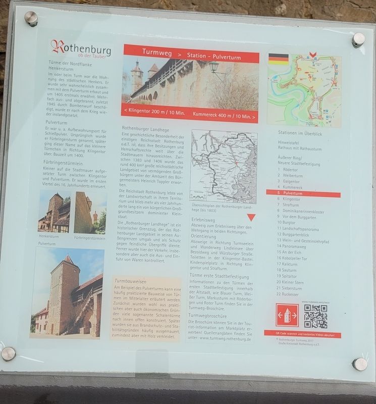
Türme der Nordflanke
Henkersturm
Im oder beim Turm war die Wohnung des städtischen Henkers. Er wurde sehr wahrscheinlich zusammen mit dem Pulverturm erbaut und um 1405 erstmals erwähnt. Mehrfach aus- und abgebrannt, zuletzt 1945 durch Bombenwurf beschädigt, wurde er nach dem Krieg wieder instandgesetzt.
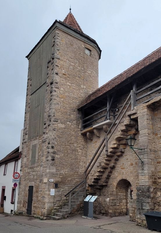
Pulverturm
Er war u. a. Aufbewahrungsort für Schießpulver. Ursprünglich wurde er Fürbringersturm genannt, später ging dieser Name auf das kleinere Türmchen in Richtung Klingentor über. Bauzeit um 1400.
Fürbringerstürmlein
Kleiner auf die Stadtmauer aufgesetzter Turm zwischen Klingentor und Pulverturm. Er wurde im ersten Viertel des 16. Jahrhunderts erneuert.
Rothenburger Landhege
Eine geschichtliche Besonderheit der einstigen Reichsstadt Rothenburg o.d.T. ist, dass ihre Besitzungen und Herrschaftsrechte weit über die Stadtmauern hinausreichten. Zwischen 1383 und 1406 wurde das rund 400 km² große reichsstädtische Landgebiet von vermögenden Großbürgern unter der Amtszeit des Bürgermeisters Heinrich Toppler erworben.
Die Reichstadt Rothenburg lebte von der Landwirtschaft in ihrem Territorium und blieb mehr als vier Jahrhunderte lang ein von bürgerlichen Großgrundbesitzern dominierter Kleinstaat.
Die „Rothenburger Landhege" ist ein historischer Grenzzug, der das Rothenburger Landgebiet in seinen Außengrenzen umgab und als Schutz gegen feindliche Übergriffe diente. Ferner wurde hier der Verkehr, insbesondere aber auch die Aus- und Einfuhr von Waren kontrolliert.
Turmbauweisen
Am Beispiel des Pulverturms kann eine häufig praktizierte Bauweise von Türmen im Mittelalter erläutert werden. Zunächst wurden wohl aus praktischen aber auch ökonomischen Gründen viele sogenannte Schalentürme nach innen offen konstruiert. Später wurden sie aus Brandschutz- und Stabilitätsgründen häufig ausgemauert, zumindest aber mit Holz verkleidet.
Bildunterschriften
Henkersturm
Pulverturm
Fürbringerstürmlein
Übersichtsplan der Rothenburger Landhege (bis 1803)
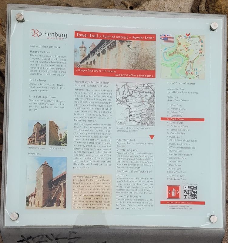
Towers of the north flank
Hangman's Tower
This was the residence of the town hangman. Originally built along with the Pulverturm (Powder Tower) around 1405, the tower has been damaged or burned on several occasions (including twice during WWII). It was rebuilt after the war.
Powder Tower
Among
other uses, this tower - which was built around 1400
- stored gunpowder.
Little Fürbringer Tower
This small tower, between Klingentor and Pulverturm, was rebuilt in the first quarter of the 16th century.
Rothenburg's Territorial Boundary and Its Fortified Border
Remember that because Rothenburg was an imperial town, it owned and ruled land far beyond its town walls. Between 1383 and 1406, the city-state of Rothenburg - with its wealthy citizens and effective Mayor Heinrich Toppler - grew to an area of about 400 square kilometers. That's a chunk of land about 12 miles by 12 miles. The overview map shows the extent of Rothenburg's territory.
This territory produced much-needed food for the townspeople. And its 57-kilometer-long (35-mile) guarded border provided the town in the event of enemy attacks. The eastern border of the territory, along the "Frankenhöhe" (Franconian Heights), was mostly unfortified. The most important access points were secured by nine towers, which also collected tolls from passing merchants. The Lichteler Landturm (Lichteler Land Tower) and the Großharbacher Turm (Great Harbach Tower) are still in good condition.
How the Towers Were Built
By studying the Pulverturm (Powder Tower) as an example, we can learn something about how these towers were built in the Middle Ages.
For practical and economic reasons, many of the towers were originally constructed open to the inside of town. Over the centuries, for reasons of stability, these were often walled up or at least fortified with wood.
Captions
Hangman's Tower
Fürbringer Tower
Powder Tower
Overview of Rothenburg's territorial defenses (up to 1803)
Erected by Rothenburg Tourism Service.
Topics. This historical marker is listed in this topic list: Forts and Castles. A significant historical year for this entry is 1405.
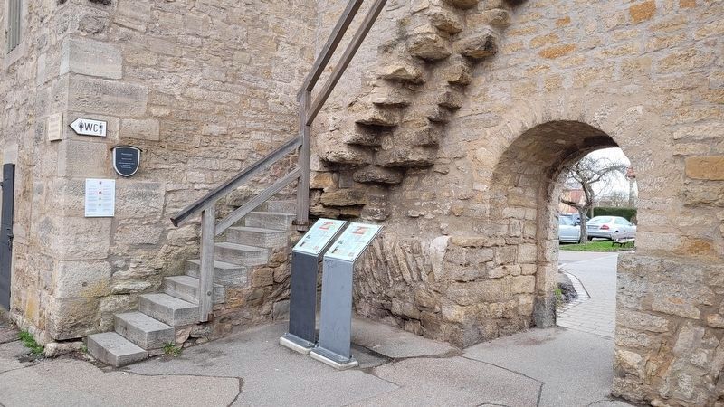
Location. 49° 22.806′ N, 10° 10.736′ E. Marker is in Rothenburg ob der Tauber, Bayern (Bavaria), in Ansbach. Marker is at the intersection of Klingenschütt and Schrannenpl, on the right when traveling west on Klingenschütt. The markers are located next to the tower gate. Touch for map. Marker is at or near this postal address: Klingenschütt 3, Rothenburg ob der Tauber BY 91541, Germany. Touch for directions.
Other nearby markers. At least 8 other markers are within walking distance of this marker. Pulverturm / Powder Tower (here, next to this marker); Fürbringertürmlein / Provider Tower (about 90 meters away, measured in a direct line); Granary / Jewish Cemetery (about 90 meters away); Schrannenscheune / Grain Storage Barn (about 90 meters away); Jews's Alley and Jewish Quarter (about 150 meters away); Henkersturm / Executioner's Storm (about 150 meters away); Klingentorturm / Bladegate Tower (about 180 meters away); Klingentor / Klingen Gate (about 180 meters away). Touch for a list and map of all markers in Rothenburg ob der Tauber.
Also see . . . Town wall and town gates. Rothenburg ob der Tauber (Submitted on March 8, 2024, by James Hulse of Medina, Texas.)
Credits. This page was last revised on March 8, 2024. It was originally submitted on March 7, 2024, by James Hulse of Medina, Texas. This page has been viewed 44 times since then. Photos: 1, 2, 3, 4. submitted on March 8, 2024, by James Hulse of Medina, Texas.


