Mount Hope in Fayette County, West Virginia — The American South (Appalachia)
Mine Safety
Mt. Hope
— Coal Heritage Trail —
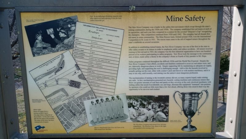
The New River Company was a leader in the safety-first movement which swept through the state's mining communities during the 1920s and 1930s. The company established first aid teams at each of its operations, and each year they competed in a contest for the coveted "Director's Cup" recognizing the champion. This competition continued from 1920 until 1942. The company had all-female first aid teams in some communities. The Mine Rescue team, formed around 1920, won the International Competition in St. Louis in 1921. The rescue team came to the aid of trapped miners throughout the state's coalfields on several occasions.
In addition to establishing trained teams, the New River Company was one of the first in the state to offer safety awards to its miners in order to emphasize safety and reduce accidents. All miners received training in first aid and in 1925, the company was the first industrial organization to have one hundred percent of its workers participating in safety programs. New River took the message to the community and, at times, made safety a theme in the company's floats in Fourth of July parades in Mt. Hope.
Safety programs continued throughout the difficult 1930s until the World War II period. Despite the New River Company's best efforts, accidents and fatalities continued to occur as coal mines were, and are, inherently dangerous places to work. Simply supporting life by maintaining an adequate air supply, providing light, and supporting the roof is challenging enough. Add to this the hazards involved in actually getting out the coal, either with a miner's pick and shovel or with modern machinery, and it is easy to see why, until recently, coal mining was the nation's most dangerous profession.
The mechanization of mining in the twentieth century did not, as many experts hoped, make mining any safer. In fact, mechanization presented new hazards: cutting machines and continuous miners that threw out greater amounts of coal dust and sparks as they cut away at the coal; electrical machinery with trailing cables that arced if accidentally cut; and large, dinosaur-like equipment "trammed" into position by operators who could see little more than a few feet ahead, offering those who stood in their way the opportunity to be run-over and crushed.
Topics. This historical marker is listed in these topic lists: Industry & Commerce • Natural Resources. A significant historical year for this entry is 1920.
Location. 37° 53.442′ N, 81° 10.307′ W. Marker is in Mount Hope, West Virginia, in Fayette County. Marker is on Main Street (West Virginia Route 211) 0.1 miles north of North Michigan Avenue, on the right when traveling north. Touch for map. Marker is at or near this postal address: 267 Main Street, Mount Hope WV 25880, United States of America. Touch for directions.
Other nearby markers. At least 8 other markers are within walking distance of this marker. Phoenix City of the New River (here, next to this marker); New River Coalfield (here, next to this marker); The Coming of the Railroads (here, next to this marker); The Coal Companies (here, next to this marker); The Dunloup Creek Watershed (approx. 0.2 miles away); a different marker also named The Dunloup Creek Watershed (approx. 0.2 miles away); a different marker also named The Dunloup Creek Watershed (approx. 0.2 miles away); Siltix Mine Disaster (approx. ¼ mile away). Touch for a list and map of all markers in Mount Hope.
Credits. This page was last revised on March 15, 2024. It was originally submitted on March 8, 2024, by Craig Doda of Napoleon, Ohio. This page has been viewed 33 times since then. Photos: 1, 2. submitted on March 8, 2024, by Craig Doda of Napoleon, Ohio. • Devry Becker Jones was the editor who published this page.

