Rothenburg ob der Tauber in Ansbach, Bavaria, Germany — Central Europe
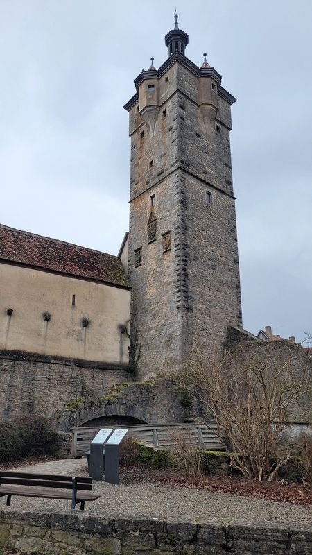
Klingentor / Klingen Gate
Rothenburg ob der Tauber
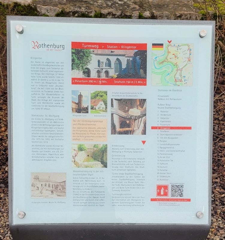
Klingentor
Der Name ist abgeleitet von den landschaftlichen Gegebenheiten am Ende der engen, zum Taubertał abfallenden Schlucht, einer sogenannten Klinge. Der mächtige, 37 Meter hohe Turm wurde bereits 1360 erwähnt. Er diente u. a. bis in das 19. Jh. hinein als Wasserturm. Damit war er Endpunkt einer „Druckleitung", die seit 1594 von der Bronnenmühle im Taubertal direkt heraufführte. Der Wasserbehälter im Turm versorgte die Brunnen der Stadt. Die Antage mit imposantem Turm und Wehrkirche wurde als nördliches Tor der Stadtbefestigung um 1594/97 erbaut.
Wehrkirche St. Wolfgang
Die Kirche St.-Wolfgang mit Schäfertanzkabinett ist als Wehrkirche direkt in die Befestigungsanlage am Klingentor eingebunden und besitzt mehrstöckige Kasematten, Schießscharten und einen Geschützboden. Erbaut wurde die spätgotische Kirche 1475 bis 1493, der Hochaltar starimt von 1514.
Ats Wehrkirche werden Kirchen bezeichnet, die mit Vorrichtungen zur Abwehr von Feinden, wie z.B. Zinnen, Wehrerkern, Maschikulis oder Schießscharten versehen bzw. von Wehrbauten umgeben sind.
Teil der Verteidigungsanlage und Pferdeschwemme
Das sogenannte Wässele, unterhalb des Klingentores diente früher auch als Waschplatz für Pferde. Hier wurden die Hufe gewaschen und das Fell gepflegt.
Wasserversorgung in der mittelalterlichen Stadt
Schon frühzeitig ab dem 15. Jh. bemühte sich Rothenburg o.d.T. im Hinblick auf die Versorgung unabhängig und im Angriffsfalle überlebensfähig zu bleiben.
Bis zur Errichtung des Pumpwerks (1594) an der Bronnenmühle erhielt die Bevölkerung das Wasser durch Ziehbrunnen und durch eine unterirdisch verlegte Leitung aus einem Wasserreservoir nördlich der Stadt.
Bildunterschriften
Historische Ansicht: Kirche St. Wolfgang
Klingentor-Turm
Bronnenmühle
Erhalten Wasserfördertechnik im Nebengebäude der Bronnenmühle
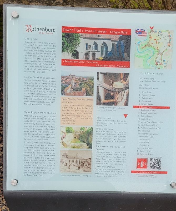
Klingen Gate
This gate sits above a narrow gorge, or "Klinge," that leads down into the Tauber Valley. The robust 37-meter-high tower was already mentioned in 1360 and used as a water tower until the 19th century. The tower was at the end of a "pressure pipe," which led up from the Bronnenmühle (Bronnen Mill) in the valley below. The Gateway with imposing tower and fortified church was probably built between 1594 and 1597.
Fortified Church of St. Wolfgang
The fortified church, with its Schäfertanz (or Shepherds' Dance) cabinet, is an integral part of the fortifications of the Klingen Tower. Although it's an active house of worship, it also has multi-storey subterranean defense tunnels (called casemates), arrow slits, and an artillery room. The late-Gothic church was built around 1490; the high altar dates from 1514.
Water Supply in the Middle Ages
Medieval towns struggled to supply enough water for their thirsty residents. Ideally, water could be taken from nearby bodies of water. But more aften, the town had to build wells, which required subterranean water feeds. During droughts or sieges, the natural water supply could run out, so towns would supplement by using pipelines or cisterns.
A town's growth was limited by how much water it had. And so, Rothenburg made efforts quite early on (in the 15th century) to ensure its independence by improving its water supply. At first, townspeople could get water at public and private drawing wells, and a source to the north of the town. But starting in 1594, a pumping station was used to pipe in water from the Bronnen Mill via the narrow gorge, or "Klinge," into a „pressure equalization tank" here in the Klingen Tower Gate.
Horse Watering Place and Defense Constructions
The moat below the Klingen Gate survives from the old defensive fortifications. But this pond was used not only for defense; earlier, it was called Horse Watering Place, where horses would be groomed at the end of a long working day.
Captions
Historic views: Church of St. Wolfgang
Surviving water transport technology next to the Bronnen Mill
Topics. This historical marker is listed in these topic lists: Animals • Forts and Castles • Industry & Commerce. A significant historical year for this entry is 1360.
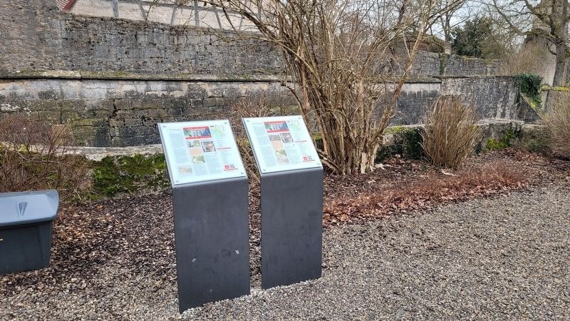
Location. 49° 22.822′ N, 10° 10.577′ E. Marker is in Rothenburg ob der Tauber, Bayern (Bavaria), in Ansbach. Marker is at the intersection of Klingengasse and Klosterweth, on the right when traveling south on Klingengasse. The markers are located outside the city wall on the northwest side of the tower. Touch for map. Marker is at or near this postal address: Klingengasse 15, Rothenburg ob der Tauber BY 91541, Germany. Touch for directions.
Other nearby markers. At least 8 other markers are within walking distance of this marker. Klingentorturm / Bladegate Tower (a few steps from this marker); Fürbringertürmlein / Provider Tower (about 90 meters away, measured in a direct line); Pulverturm / Powder Tower (about 180 meters away); Türme der Nordflanke / Towers of the north flank (about 180 meters away); Granary / Jewish Cemetery (about 210 meters away); Schrannenscheune / Grain Storage Barn
(about 240 meters away); Jews's Alley and Jewish Quarter (approx. 0.3 kilometers away); St. Jakob's Church World War I Memorial (approx. 0.3 kilometers away). Touch for a list and map of all markers in Rothenburg ob der Tauber.
Also see . . . Town wall and town gates. Rothenburg ob der Tauber (Submitted on March 10, 2024, by James Hulse of Medina, Texas.)
Credits. This page was last revised on March 10, 2024. It was originally submitted on March 9, 2024, by James Hulse of Medina, Texas. This page has been viewed 40 times since then. Photos: 1, 2, 3, 4. submitted on March 10, 2024, by James Hulse of Medina, Texas.


