Urbandale Nations in Nashville in Davidson County, Tennessee — The American South (East South Central)
England Park
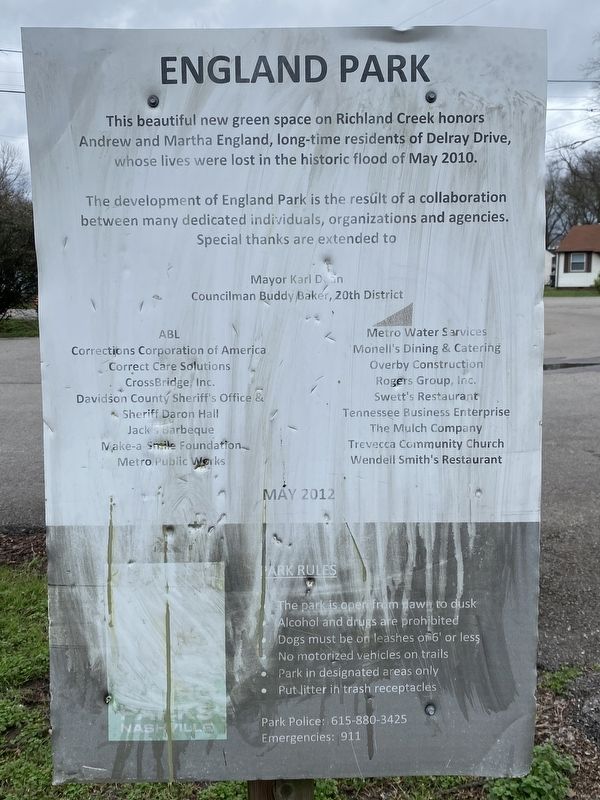
This beautiful new green space on Richland Creek honors Andrew and Martha England, long-time residents of Delray Drive, whose lives were lost in the historic flood of May 2010.
The development of England Park is the result of a collaboration between many dedicated individuals, organizations and agencies. Special thanks are extended to
Mayor Karl Dan Councilman Buddy Baker, 20th District • ABL • Corrections Corporation of America • Correct Care Solutions • CrossBridge, Inc. Davidson County Sheriff's Office & Sheriff Daron Hall • Jack's Barbeque • Make-a Smile Foundation • Metro Public Works • Metro Water Services • Monell's Dining & Catering • Overby Construction • Rogers Group, Inc. • Swett's Restaurant • Tennessee Business Enterprise • The Mulch Company • Trevecca Community Church • Wendell Smith's Restaurant
Erected 2012 by City of Nashville, Tennessee.
Topics. This historical marker is listed in this topic list: Disasters. A significant historical month for this entry is May 2010.
Location. 36° 9.396′ N, 86° 51.3′ W. Marker is in Nashville, Tennessee, in Davidson County. It is in Urbandale Nations. Marker is at the intersection of Delray Drive and Illinois Avenue, on the left when traveling north on Delray Drive. Touch for map. Marker is at or near this postal address: 809 Delray Dr, Nashville TN 37209, United States of America. Touch for directions.
Other nearby markers. At least 8 other markers are within walking distance of this marker. Robertson Avenue (approx. 0.4 miles away); Battle of Nashville (approx. 0.4 miles away); St. Ann Catholic Church and School (approx. half a mile away); Cockrill School (approx. half a mile away); “Travelers' Rest” (approx. 0.6 miles away); Cohen Building (approx. 0.6 miles away); Richland Hall (approx. 0.6 miles away); Sykes Field (approx. 0.6 miles away). Touch for a list and map of all markers in Nashville.
Credits. This page was last revised on March 21, 2024. It was originally submitted on March 10, 2024, by Darren Jefferson Clay of Duluth, Georgia. This page has been viewed 72 times since then. Photos: 1, 2. submitted on March 10, 2024, by Darren Jefferson Clay of Duluth, Georgia. • Devry Becker Jones was the editor who published this page.

