Birmingham Township in West Chester in Chester County, Pennsylvania — The American Northeast (Mid-Atlantic)
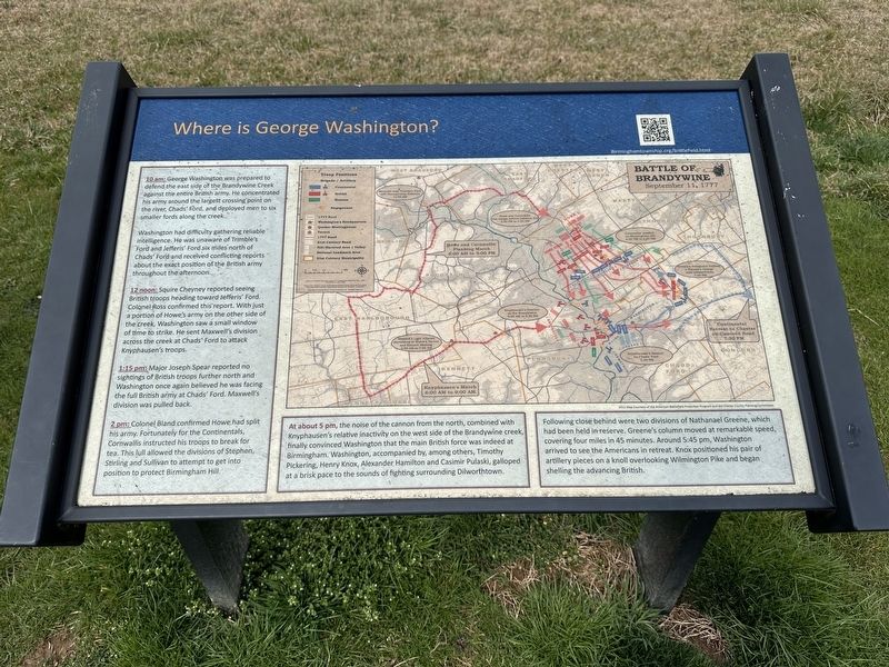
Where is George Washington?
Washington had difficulty gathering reliable intelligence. He was unaware of Trimble's Ford and Jefferis' Ford six miles north of Chads' Ford and received conflicting reports about the exact position of the British army throughout the afternoon.
12 noon: Squire Cheyney reported seeing British troops heading toward Jefferis' Ford. Colonel Ross confirmed this report. With just a portion of Howe's army on the other side of the creek, Washington saw a small window of time to strike. He sent Maxwell's division across the creek at Chads' Ford to attack Knyphausen's troops.
1:15 pm: Major Joseph Spear reported no sightings of British troops further north and Washington once again believed he was facing the full British army at Chads' Ford. Maxwell's division was pulled back.
2 pm: Colonel Bland confirmed Howe had split his army. Fortunately for the Continentals, Cornwallis instructed his troops to break for tea. This lull allowed the divisions of Stephen, Stirling and Sullivan to attempt to get into position to protect Birmingham Hill.
At about 5 pm, the noise of the cannon from the north, combined with Knyphausen's relative inactivity on the west side of the Brandywine creek, finally convinced Washington that the main British force was indeed at Birmingham. Washington, accompanied by, among others, Timothy Pickering, Henry Knox, Alexander Hamilton and Casimir Pulaski, galloped at a brisk pace to the sounds of fighting surrounding Dilworthtown.
Following close behind were two divisions of Nathanael Greene, which had been held in reserve. Greene's column moved at remarkable speed, covering four miles in 45 minutes. Around 5:45 pm, Washington arrived to see the Americans in retreat. Knox positioned his pair of artillery pieces on a knoll overlooking Wilmington Pike and began shelling the advancing British.
Erected by Birmingham Township.
Topics and series. This historical marker is listed in these topic lists: Patriots & Patriotism • War, US Revolutionary. In addition, it is included in the Former U.S. Presidents: #01 George Washington series list. A significant historical date for this entry is September 11, 1777.
Location. 39° 54.209′ N, 75° 34.743′ W. Marker is in West Chester, Pennsylvania, in Chester County. It is in Birmingham Township. Marker can be reached from South New Street. Touch for map. Marker is at or near this postal address: 1325 S New St, West Chester PA 19382, United States of America. Touch for directions.
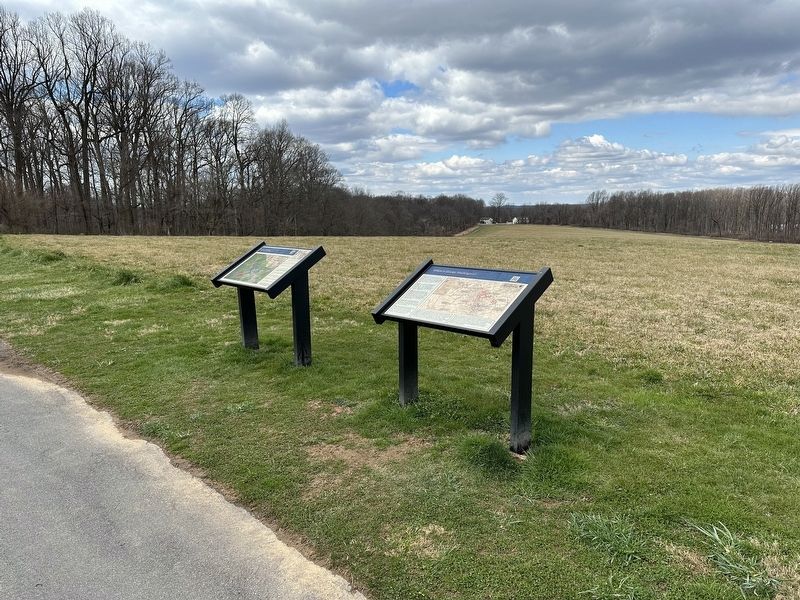
Other nearby markers. At least 8 other markers are within walking distance of this marker. Sandy Hollow (here, next to this marker); Sandy Hollow Heritage Park (within shouting distance of this marker); a different marker also named Sandy Hollow Heritage Park (within shouting distance of this marker); Brandywine Battlefield A Commonwealth Treasure (about 400 feet away, measured in a direct line); a different marker also named Sandy Hollow Heritage Park (approx. 0.2 miles away); Brandywine (approx. 0.4 miles away); Lafayette Memorial (approx. 0.4 miles away); a different marker also named Brandywine (approx. half a mile away). Touch for a list and map of all markers in West Chester.
Credits. This page was last revised on March 11, 2024. It was originally submitted on March 10, 2024, by Pete Skillman of Townsend, Delaware. This page has been viewed 61 times since then. Photos: 1, 2. submitted on March 10, 2024, by Pete Skillman of Townsend, Delaware. • Bill Pfingsten was the editor who published this page.

