East Bradford Township in West Chester in Chester County, Pennsylvania — The American Northeast (Mid-Atlantic)
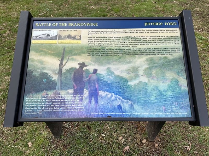
Battle of the Brandywine
Jefferis' Ford
During the Battle of Brandywine on September 11, 1777, British Generals Howe and Cornwallis marched 11,000 Crown Force soldiers through the farm and across the east branch of the Brandywine at Jefferis' Ford in the 14-mile flanking effort against General George Washington's American forces stationed at Chadd's Ford. Emmor Jefferis was forcefully coerced into serving the British as a guide beyond the east side of the ford, while the invading troops purportedly plundered his house and barn. General Howe began to realize that his tactical flanking maneuver had worked once he emerged on the east side of Jefferis' Ford and, much to his surprise, was not met by Washington's troops.
Emmor Jefferis survived the war and his family later operated the farmhouse (ca. 1714) as a tavern for travelers moving along the route of today's Allerton Road. The tavern became known as the "Sign of the Eel's Foot Tavern" and closed around 1845. The truss bridge that you see today was constructed in 1905 and was originally located over the Doe Run in nearby West Marlborough Township. It was relocated to its current site in 1953 to replace a wooden covered bridge that had burned down.
"...our eyes were caught on a sudden by the appearance of the army coming out of the woods into the fields belonging to Emmor Jefferis, on the west side of the creek, above the fording-place. In a few minutes the fields were literally covered over with them, and they were hastening towards us. Their arms and bayonets, being raised, shone as bright as silver, the sky being clear and the day exceedingly warm..." -- Joseph Townsend's firsthand account of the British Army arriving at Jefferis' Ford
Captions
Jefferis' Ford Covered Bridge
Photograph taken in 1932, by Frank R. Zabley, of the Jefferis' Ford covered bridge, built in 1833 and destroyed by fire in 1953. Courtesy of Delaware Public Archives
Sign of the Eel's Foot Tavern
Photograph of the Sign of the Eel's Foot Tavern, known today as Blue Rock Farm, former home of Emmor Jefferis, taken in 1899 by Douglas E. Brinton. Courtesy of Chester County History Center
"The Trap is Sprung" Painting by Barclay Rubincam, West Chester, Pennsylvania, United States, 1970, Oil on canvas, Courtesy of Lydia Willits Bartholomew
Topics. This historical marker is listed in these topic lists: Settlements & Settlers • War, US Revolutionary. A significant historical date for this entry is September 11, 1777.
Location. 39° 56.374′ N, 75° 38.092′ W. Marker is in West Chester, Pennsylvania, in Chester County. It is in East Bradford Township. Marker is on Allerton Road, on the right when traveling west. Touch for map. Marker is at or near this postal address: 1000 W Miner St, West Chester PA 19382, United States of America. Touch for directions.
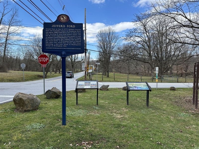
Other nearby markers. At least 8 other markers are within 2 miles of this marker, measured as the crow flies. The Worth / Jefferis Rural Historic District (a few steps from this marker); Jefferis Ford (a few steps from this marker); a different marker also named Jefferis Ford (about 400 feet away, measured in a direct line); Sconnelltown. (approx. 0.6 miles away); Jean Kane Foulke (approx. ¾ mile away); Down by the Water’s Edge (approx. 1.1 miles away); Stroud Preserve (approx. 1.1 miles away); Gilbert Cope (approx. 1.4 miles away). Touch for a list and map of all markers in West Chester.
Credits. This page was last revised on March 11, 2024. It was originally submitted on March 10, 2024, by Pete Skillman of Townsend, Delaware. This page has been viewed 84 times since then. Photos: 1, 2. submitted on March 10, 2024, by Pete Skillman of Townsend, Delaware. • Bill Pfingsten was the editor who published this page.

