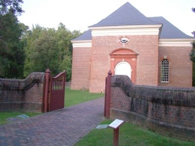
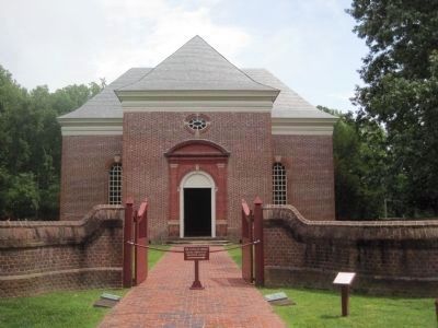
Near Weems in Lancaster County, Virginia — The American South (Mid-Atlantic)
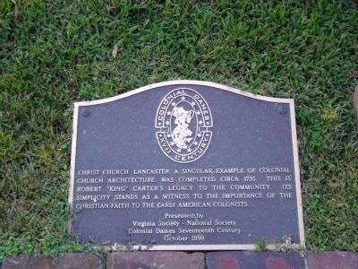
Christ Church Lancaster
Erected 1999 by Virginia Society – National Society Colonial Dames Seventeenth Century, in October.
Topics and series. This historical marker is listed in this topic list: Churches & Religion. In addition, it is included in the National Historic Landmarks, and the The Colonial Dames of America series lists. A significant historical year for this entry is 1735.
Location. 37° 40.838′ N, 76° 25.415′ W. Marker is near Weems, Virginia, in Lancaster County. Marker can be reached from the intersection of Gaskin Road (County Route 709) and Christ Church Road (County Route 646). It is flush with the ground beside the walkway to the main entrance to the church. Touch for map. Marker is in this post office area: Weems VA 22576, United States of America. Touch for directions.
Other nearby markers. At least 8 other markers are within 3 miles of this marker, measured as the crow flies. Foundation for Historic Christ Church, Inc. (here, next to this marker); Virginia Founders, Revolutionary War Patriots and War of 1812 Veterans (here, next to this marker); Site of Robert Carter's Brick Kiln (within shouting distance of this marker); Corotoman (about 300 feet away, measured in a direct line); Christ Church (about 300 feet away); Irvington World War I Memorial (approx. 1.3 miles away); A. T. Wright High School (approx. 2.8 miles away); Albert Terry Wright (approx. 2.8 miles away). Touch for a list and map of all markers in Weems.
Also see . . . David Miles’ Marker. The Christ Church website contains many pages on the history and architecture of Christ Church with many photographs. One of the photographs shows the stone set into the floor at the crossing of the east-west and north-south axis of the church. It reads “Here lyeth the body of Mr David Miles who died the 29 of Decembr 1674 and in ye 46 yeare of his age. Hodie mihi cras tibi” The latin translates to “Today for me, tomorrow for you.” (Submitted on November 8, 2009, by J. J. Prats of Powell, Ohio.)
Photographed By J. J. Prats, September 5, 2009
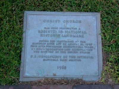
2. Christ Church, Registered National Historic Landmark
“Christ Church has been designated a Registered National Historic Landmark under the provisions of the Historic Sites Act of August 21, 1935. This site possesses exceptional value in commemorating and illustrating the history of the United States. U.S. Department of the Interior, National Park Service, 1962.”
Photographed By Kevin W., August 12, 2010
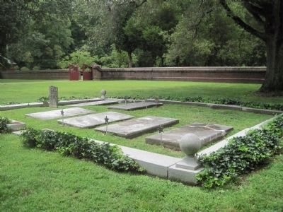
5. The Kelley Plot at Christ Church Lancaster
As mentioned on the Founders, Patriots, and Veterans Marker above, the Kelley's are buried in a prominent spot on the church grounds. There was once a wall with an iron gate erected around the Kelley Plot, but that has not yet been restored. The gate and its key are on display in the visitor's center.
Credits. This page was last revised on July 5, 2021. It was originally submitted on November 8, 2009, by J. J. Prats of Powell, Ohio. This page has been viewed 1,684 times since then and 47 times this year. Photos: 1, 2, 3. submitted on November 8, 2009, by J. J. Prats of Powell, Ohio. 4, 5. submitted on August 17, 2010, by Kevin W. of Stafford, Virginia.
