Dryden in Kenora District, Ontario — Central Canada (North America)
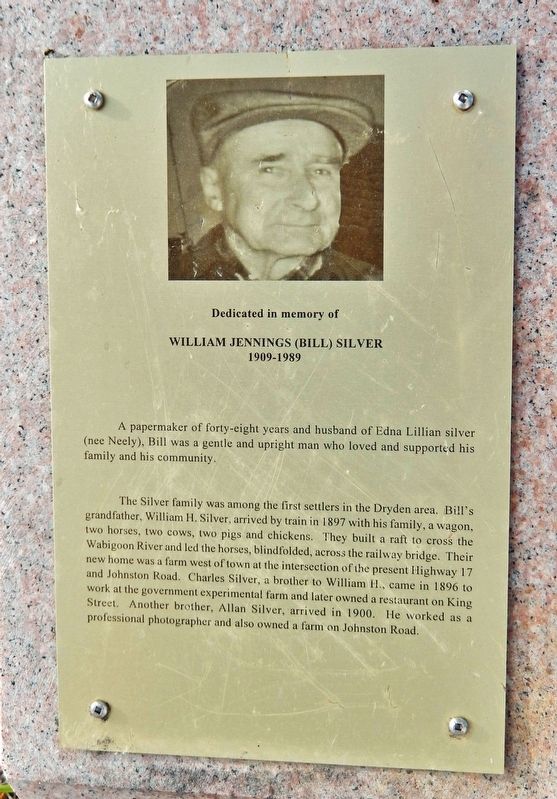
William Jennings (Bill) Silver
William Jennings (Bill) Silver
A papermaker of forty-eight years and husband of Edna Lillian Silver (nee Neely), Bill was a gentle and upright man who loved and supported his family and his community.
The Silver family was among the first settlers in the Dryden area. Bill's grandfather, William H. Silver, arrived by train in 1897 with his family, a wagon, two horses, two cows, two pigs and chickens. They built a raft to cross the Wabigoon River and led the horses, blindfolded, across the railway bridge. Their new home was a farm west of town at the intersection of the present Highway 17 and Johnston Road. Charles Silver, a brother to William H., came in 1896 to work at the government experimental farm and later owned a restaurant on King Street. Another brother, Allan Silver, arrived in 1900. He worked as a professional photographer and also owned a farm on Johnston Road.
Topics. This historical marker is listed in these topic lists: Industry & Commerce • Settlements & Settlers. A significant historical year for this entry is 1897.
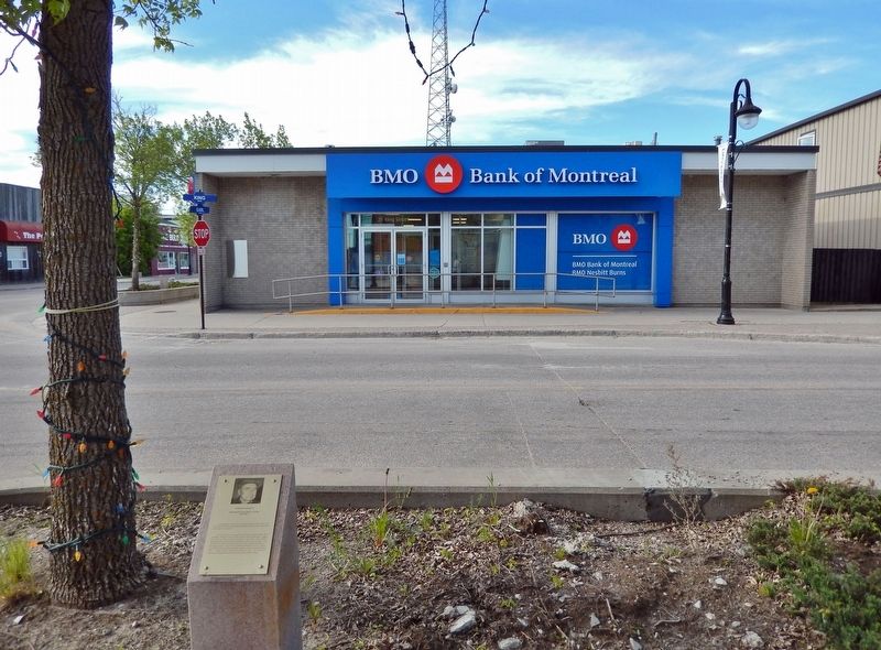
Location. 49° 47.05′ N, 92° 50.435′ W. Marker is in Dryden, Ontario, in Kenora District. Marker is at the intersection of King Street and Earl Avenue, on the left when traveling west on King Street. The marker is located beside the sidewalk, near the southeast corner of the intersection. Touch for map. Marker is at or near this postal address: 20 King Street, Dryden ON P8N 1B3, Canada. Touch for directions.
Other nearby markers. At least 8 other markers are within walking distance of this marker. Frederick Russell Hawke (here, next to this marker); 25 King Street (within shouting distance of this marker); The Smith Building (within shouting distance of this marker); A. Grant Fumerton (about 90 meters away, measured in a direct line); Norman F. McAuley (about 120 meters away); Alexander Mackenzie Wilson (about 120 meters away); Alan Durance (about 210 meters away); George Kenneth Rowat (about 210 meters away). Touch for a list and map of all markers in Dryden.
Also see . . .
1. There's No Place Like Home: Log houses for the Early Settlers.
(By Bethany Waite, Museum and Heritage Coordinator, Dryden & District Museum.) Includes a photo from 1901/02 of William Silver Sr's Farm. House built in the Fall of 1897, 4 miles west of Dryden.(Submitted on March 19, 2024, by Cosmos Mariner of Cape Canaveral, Florida.)
Excerpt: When early settlers began farming in the area, they first needed to clear their land. They used the logs they cut to construct houses, schools, shops, and barns. Settlers built log houses of at least 16 feet x 20 feet, which were quick to build and could house a family temporarily while they established their farm. Once the farm was operational, a larger permanent home would be built to accommodate the growing family.
2. William Jennings Silver (1909-1989) (Find A Grave).
(Dryden Cemetery, Dryden, Kenora District, Ontario, Canada)(Submitted on March 19, 2024, by Cosmos Mariner of Cape Canaveral, Florida.)
Credits. This page was last revised on March 19, 2024. It was originally submitted on March 19, 2024, by Cosmos Mariner of Cape Canaveral, Florida. This page has been viewed 51 times since then. Photos: 1, 2. submitted on March 19, 2024, by Cosmos Mariner of Cape Canaveral, Florida.

