Delhi in Norfolk County, Ontario — Central Canada (North America)
Main Street
(Between King St. and Church St.)
Frederick Sovereign is credited to the founding of the hamlet of “Sovereign’s Corners” changed later to Fredericksburg in around 1828. The railway in 1880 referred to the first station as Delhi.
[photo captions]
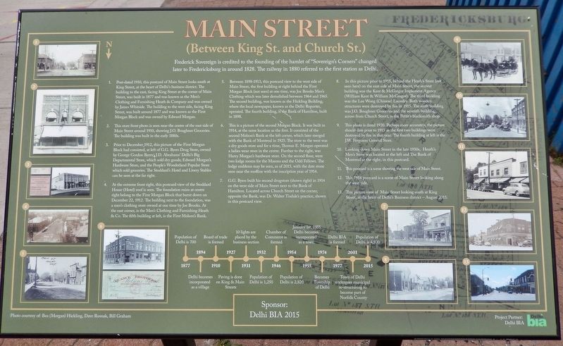
1. Post-dated 1910, this postcard of Main Street looks south at King Street, at the heart of Delhi's business district. The building to the east, facing King Street at the corner of Main Street, was built in 1877 and was known as the Men's Clothing and Furnishing Heath & Company and was owned by James Whitside. The building to the west side, facing King Street, was built around 1877 and was known as the First Morgan Block and was owned by Edward Morgan.
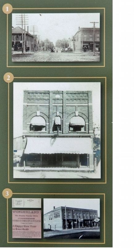
2. This store front photo is seen near the centre of the east side of Main Street around 1910, showing J.O. Boughner Groceries. The building was built in the early 1880s.
3. Prior to December, 1912, this picture of the First Morgan Block had consisted, at left of G.G. Byers Drug Store, owned by George Gordon Byers; J.D. Abrahams' Delhi's Big Departmental Store, which sold dry goods; Edward Morgan's Hardware Store, and the People's Wonderland Popular Store which sold groceries. The Stoddard's Hotel and Livery Stables can be seen at the far right.
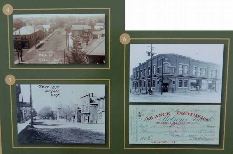
4. At the extreme front right, this postcard view of the Stoddard House (Hotel) roof is seen. The foundation ruins at centre right belong to the First Morgan Block that burnt down on December 22, 1912. The building next to the foundation was a men's clothing store owned at one time by Joe Brooks. At the east corner, is the Men's Clothing and Furnishing Heath & Co. The fifth building at left is the First Molson's Bank.
5. Between 1898-1913, this postcard view to the west side of Main Street, the first building at right behind the First Morgan Block (not seen) at one time, was Joe Brooks Men's Clothing which was later demolished between 1964 and 1965. The second building was known as the Hickling Building, where the local newspaper, known as the Delhi Reporter, operated. The fourth building, is the Bank of Hamilton, built in 1898.
6. This is a picture of the second Morgan Block. It was built in 1914, at the same location as the first. It consisted of the second Molson's Bank at the left corner, which later merged with the Bank of Montreal in 1925. The store to the west was a dry goods store and for a time, Thomas E. Morgan operated a ladies wear store in the centre. Further to the right, was Harry Morgan's hardware store. On the second floor, were two lodge rooms for the Masons and the Odd Fellows. The lodge emblems may be seen, as of 2015, with the date stone seen near the roofline with the inscription year of 1914.
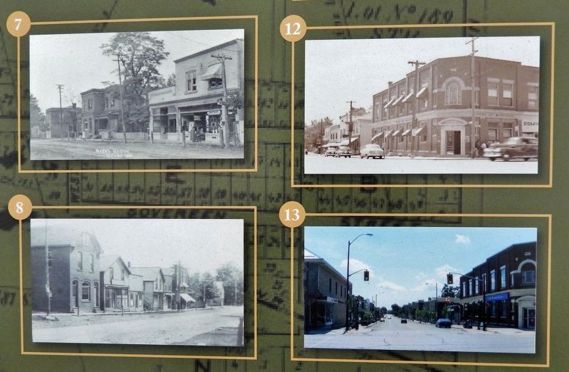
7. G.G. Byers built his second drugstore (shown right) in 1914 on the west side of Main Street next to the Bank of Hamilton. Located across Church Street on the corner, opposite the Bank, was Dr. Walter Tisdale's practice, shown in this postcard view.
8. In this picture prior to 1915, behind the Heath's Store (not seen here) on the east side of Main Street, the second building was the Kent &, McGregor Implement Agency (William Kent &, William McGregor). The third building was the Lee Wong (Chinese) Laundry. Both wooden structures were destroyed by fire in 1915. The sixth building was J.O. Boughner Groceries and the seventh building, across from Church Street, is the Pettit's blacksmith shop.
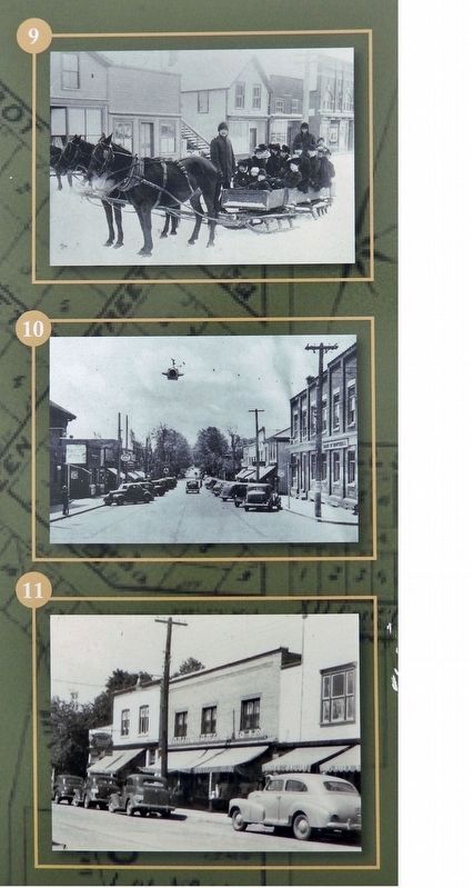
9. This photo is dated 1920. Perhaps more accurately, the picture should date prior to 1915 as the first two buildings were destroyed by fire in that year. The fourth building at left is the J.W. Ferguson General Store.
10. Looking down Main Street in the late 1930s, Heath's Men's Store was located at the left and The Bank of Montreal at the right, in this postcard.
11. This postcard is a scene showing the west side of Main Street.
12. This 1954 postcard is a scene of Main Street looking along the west side.
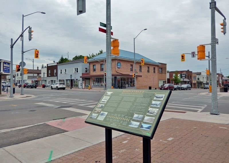
13. This picture view of Main Street looking south at King Street, at the heart of Delhi's Business district — August 2015.
Timeline
1877 • Population of Delhi is 700
1894 • Delhi becomes incorporated as a village
1910 • Board of trade is formed
1927 • Paving is done on King & Main Streets
1931 • 10 lights are placed by the business section
1932 • Population of Delhi is 1,250
1946 • Chamber of Commerce is formed
1954 • Population of Delhi is 2,8201955 • January 1st, 1955 Delhi becomes incorporated as a town
1974 • Becomes Township of Delhi
1977 • Delhi BIA is formed
2001 • Town of Delhi undergoes municipal re-structuring to become part of Norfolk County
2015 • Population of Delhi is 4,100
Photos courtesy of: Bea (Morgan) Hickling, Dave Rusnak, Bill Graham
Erected 2015 by Norfolk County and Delhi BIA.
Topics. This historical marker is listed in these topic lists: Architecture • Industry & Commerce • Railroads & Streetcars • Settlements & Settlers. A significant historical year for this entry is 1880.
Location. 42° 51.349′ N, 80° 29.871′ W. Marker is in Delhi, Ontario, in Norfolk County. Marker is at the intersection of Main Street of Delhi and King Street (Provincial Highway 3), on the right when traveling south on Main Street of Delhi. The marker is located beside the sidewalk at the northwest corner of the intersection. Touch for map. Marker is at or near this postal address: 121 King Street, Delhi ON N4B 1X9, Canada. Touch for directions.
Other nearby markers. At least 8 other markers are within 16 kilometers of this marker, measured as the crow flies. Church Street Fire Hall (about 150 meters away, measured in a direct line); a different marker also named Main Street (about 150 meters away); Multicultural Heritage Association of Norfolk (about 210 meters away); a different marker also named Main Street (approx. 0.3 kilometers away); Delhi District German Home (approx. 0.9 kilometers away); Sergeant Frederick Hobson, V.C. (approx. 15.7 kilometers away); Norfolk County Court-House and Gaol (approx. 15.8 kilometers away); Simcoe (approx. 15.9 kilometers away). Touch for a list and map of all markers in Delhi.
Also see . . .
1. Delhi, Ontario (Wikipedia). Excerpt:
Delhi is known as the "Heart of Tobacco Country." Prior to 1880, this community was known for its lumber industry. Frederick Sovereign settled here in about 1812. According to some genealogy records, his father, originally from Germany, was called Frederick Zavering, Zafrin, or Safrein. The records suggest that the family initially emigrated to New Jersey but moved to Norfolk County in Upper Canada because of the Revolutionary War in the U.S.(Submitted on March 24, 2024, by Cosmos Mariner of Cape Canaveral, Florida.)
2. Delhi, Ontario (Small Town Canada). Excerpt:
Originally called Sovereign’s Corners, the community was renamed Fredericksburg before, in 1856, changing its name to Delhi. A railway was built through the town in the 1870s and was crucial to the town’s growth. Businesses could now start shipping their products all across Canada without having to travel far. Prior to the 1880s, Delhi was a lumber-rich community. They had their very own lumber mill, thanks to the large amount of water running through the town.(Submitted on March 24, 2024, by Cosmos Mariner of Cape Canaveral, Florida.)
Credits. This page was last revised on March 24, 2024. It was originally submitted on March 24, 2024, by Cosmos Mariner of Cape Canaveral, Florida. This page has been viewed 52 times since then. Photos: 1, 2, 3, 4, 5, 6. submitted on March 24, 2024, by Cosmos Mariner of Cape Canaveral, Florida.
