Fourth Ward in Houston in Harris County, Texas — The American South (West South Central)
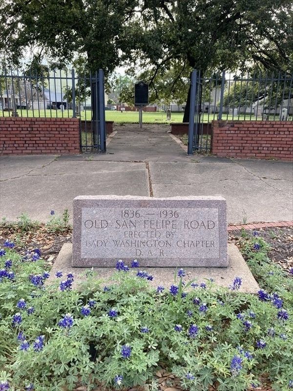
Old San Felipe Road
Old San Felipe Road
Erected by
Lady Washington Chapter
D. A. R.
Erected 1936 by Lady Washington Daughters of the American of the Revolution.
Series. This historical marker is included in the Daughters of the American Revolution series list. A significant historical year for this entry is 1836.
Location. 29° 45.465′ N, 95° 22.73′ W. Marker is in Houston, Texas, in Harris County. It is in the Fourth Ward. Marker is at the intersection of West Dallas Street and Valentine Street, on the right when traveling east on West Dallas Street. Touch for map. Marker is at or near this postal address: 1102 W Dallas St, Houston TX 77019, United States of America. Touch for directions.
Other nearby markers. At least 8 other markers are within walking distance of this marker. In Memory of Mrs. Rebecca Lamar (a few steps from this marker); Amos B. Edson (a few steps from this marker); Gravesite of John Kirby Allen (1810-1838) (a few steps from this marker); Augustus Chapman Allen (a few steps from this marker); David Porter Richardson (within shouting distance of this marker); Major Isaac N. Moreland (within shouting distance of this marker); James Collinsworth (within shouting distance of this marker); Archibald S. Lewis (within shouting distance of this marker). Touch for a list and map of all markers in Houston.
Click on the ad for more information.
Please report objectionable advertising to the Editor.
sectionhead>More about this marker. Old San Felipe Road - Austin's colony hacked out the trail in 1830, when "built" meant chopping down trees and prying out stumps. Their wagon road was the first public thoroughfare in Harris County. Six years after its completion, the trail would be the primary escape route for Texian families fleeing Santa Anna's army during the Runaway Scrape.Please report objectionable advertising to the Editor.
It also acted as a trade route between the cotton plantations along the Brazos and Colorado rivers near the Austin colony and the improvised ports along Buffalo Bayou at Houston and Harrisburg. Riverboats would then take cotton and other materials to the port of Galveston for shipping nationally and internationally.
Credits. This page was last revised on March 25, 2024. It was originally submitted on March 25, 2024, by Carolyn Sanders of Plano, Texas. This page has been viewed 55 times since then. Photo 1. submitted on March 25, 2024, by Carolyn Sanders of Plano, Texas. • James Hulse was the editor who published this page.
Editor’s want-list for this marker. A photo of the marker and the surrounding area in context. • Can you help?
