Thunder Bay in Thunder Bay District, Ontario — Central Canada (North America)
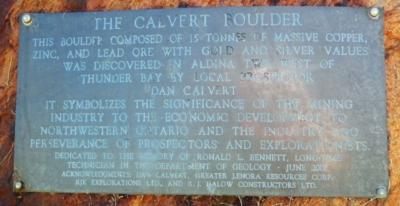
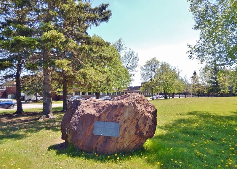
The Calvert Boulder
It symbolizes the significance of the mining industry to the economic development to northwestern Ontario and the industry and perseverance of prospectors and explorationists.
Dedicated to the memory of Ronald L. Bennett, long-time technician in the Department of Geology — June 2001. Acknowledgments: Dan Calvert, Greater Lenora Resources Corp., RJK Explorations Ltd., and B. J. Halow Constructors Ltd.
Topics. This historical marker is listed in these topic lists: Exploration • Industry & Commerce.
Location. 48° 25.341′ N, 89° 15.68′ W. Marker is in Thunder Bay, Ontario, in Thunder Bay District. Marker is on Agora Circle, 0.1 kilometers south of Oliver Road, on the left when traveling south. The marker and Calvert Boulder are located on the Lakehead University campus, just west of the Lakehead University School of Nursing Building. Touch for map. Marker is at or near this postal address: 955 Oliver Road, Thunder Bay ON P7B 5E1, Canada. Touch for directions.
Other nearby markers. At least 8 other markers are within 3 kilometers of this marker, measured as the crow flies. Lakehead University (within shouting distance of this marker); Original Paper Machine Steam Engine Drive (approx. 2.2 kilometers away); Cummins Site (approx. 2.4 kilometers away); Simon James Dawson (approx. 2.5 kilometers away); Historic Church (approx. 3 kilometers away); Port Arthur Collegiate Institute (approx. 3 kilometers away); The Major Christopher Patrick John O'Kelly, VC Armoury (approx. 3 kilometers away); Col. Elizabeth Smellie 1884-1968 (approx. 3 kilometers away). Touch for a list and map of all markers in Thunder Bay.
Also see . . . Calvert Property (pdf). Excerpt:
The Calvert Property is located approximately 55 kilometres west of the city of Thunder Bay, Ontario. Access is by travelling 12 kilometers on a well-maintained all-weather road from Highway 590. Recorded previous work in the area dates back to the 1950’s, however exploration at the time was for iron ore. The current claim block and surrounding properties only started to receive attention after the discovery of high-grade massive sulfide boulders in the area by the OGS, the Stares Brothers and Dan Calvert. Gold-rich VMS boulders discovered in 1996 led to the discovery of a glacial dispersal train of boulders that seemed to emanate from a 1200 metre long conductive zone shown on the OGS 1991 Shebandowan geophysical survey. One boulder in particular assayed 0.6% Cu, 12.0% Zn, 4.44% Pb, 359 g/t Ag, 5.54 g/t Au.(Submitted on April 2, 2024, by Cosmos Mariner of Cape Canaveral, Florida.)
Credits. This page was last revised on April 2, 2024. It was originally submitted on March 30, 2024, by Cosmos Mariner of Cape Canaveral, Florida. This page has been viewed 46 times since then. Photos: 1, 2. submitted on April 2, 2024, by Cosmos Mariner of Cape Canaveral, Florida.

