Theodore Roosevelt Island in Northwest Washington in Washington, District of Columbia — The American Northeast (Mid-Atlantic)
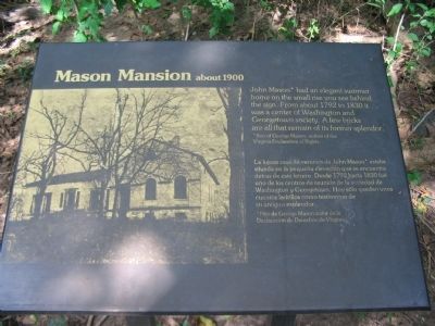
Mason Mansion
about 1900
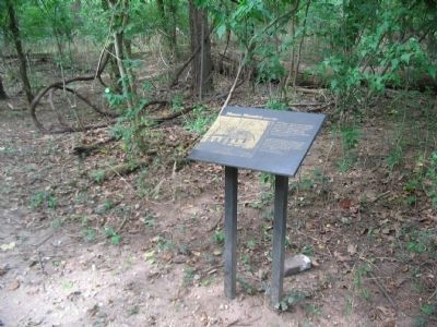
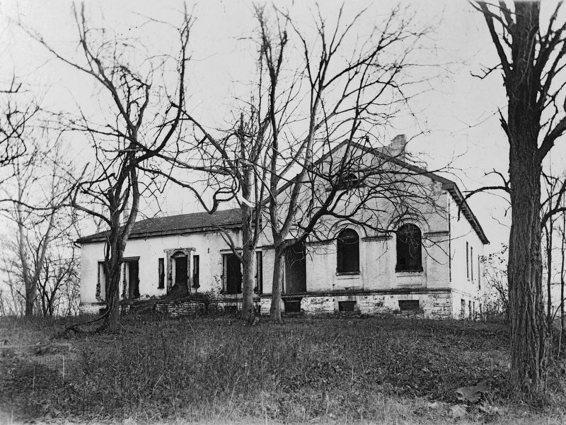
John Mason* had an elegant summer home on the small rise you see behind the sign. From about 1792 to 1830 it was a center of Washington and Georgetown society. A few bricks are all that remain of its former splendor.
*Son of George Mason, author of the Virginia Declaration of Rights.
*Hijo de George Mason, autor de la Declaración de Derechos de Virginia.
Erected by National Park Service, U.S. Department of the Interior.
Topics. This historical marker is listed in this topic list: Notable Buildings. A significant historical year for this entry is 1792.
Location. 38° 53.658′ N, 77° 3.747′ W. Marker is in Northwest Washington in Washington, District of Columbia. It is on Theodore Roosevelt Island. Marker can be reached from Upland Trail, on the left when traveling north. Located along a foot trail in Theodore Roosevelt Island National Memorial. Touch for map. Marker is in this post office area: Washington DC 20007, United States of America. Touch for directions.
Other nearby markers. At least 8 other markers are within walking distance of this marker. Urban Wilderness (about 300 feet away, measured in a direct line); Natural by Design (about 500 feet away); Naturalist (about 600 feet away); The Mason Estate (about 600 feet away); Making the Memorial (approx. 0.2 miles away); Theodore Roosevelt (approx. ¼ mile away); American Indian Villages and Captain John Smith (approx. ¼ mile away in Virginia); Mount Vernon Trail (approx. ¼ mile away in Virginia). Touch for a list and map of all markers in Northwest Washington.
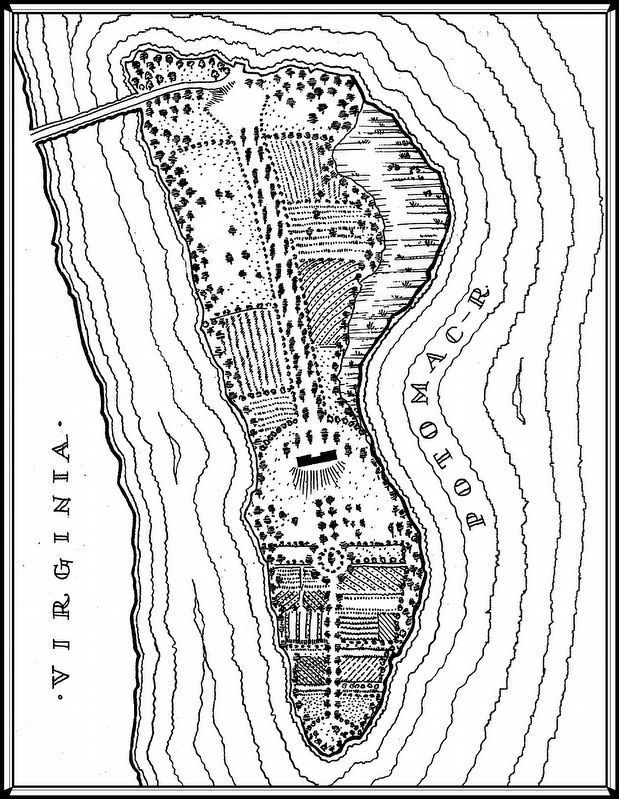
Library of Congress - HABS
5. The Mason Family on Mason's Island
“From 1717-1833 the prominent Mason family of Virginia owned Theodore Roosevelt Island, and during this period it began to be referred to as Mason's Island. Upon his father's death in 1735, George Mason IV inherited the property and later became a wealthy planter and revolutionary statesman, best remembered as the author of the 1776 Virginia Constitution and Declaration of Rights. He did not settle on the Island, but in 1748 established a ferry between Georgetown on the Maryland side of the Potomac and a ferry house on the island's north shore. After George Mason IV died in 1792, the island passed to his fourth son, John Mason, who built a large classical revival-style mansion there ca. 1800. The house, set atop the island's highest point, was the centerpiece of the functioning plantations and pleasure gardens John Mason developed on the site. The northern section of the island held the commercial plantations, and visitors approached the house via a wide alee. The Mason family's personal gardens were located to the south, where they grew food consumed on the property and entertained prominent guests. John Mason also authorized construction of Mason's causeway, which by ca. 1807 connected the island's northwest corner with the Virginia shore. Following a series of financial setbacks, Mason sold the island in 1833, ending his family's tenure.” — HABS (map based on Robert King, "A Map of the City of Washington," 1818)
Credits. This page was last revised on April 4, 2024. It was originally submitted on June 15, 2009, by Craig Swain of Leesburg, Virginia. This page has been viewed 1,272 times since then and 115 times this year. Last updated on April 4, 2024, by Laura Edwards of Bethesda, Maryland. Photos: 1, 2, 3. submitted on June 15, 2009, by Craig Swain of Leesburg, Virginia. 4. submitted on April 7, 2017, by Allen C. Browne of Silver Spring, Maryland. 5. submitted on April 9, 2017, by Allen C. Browne of Silver Spring, Maryland. • Devry Becker Jones was the editor who published this page.
