Mount Vernon in Rockcastle County, Kentucky — The American South (East South Central)
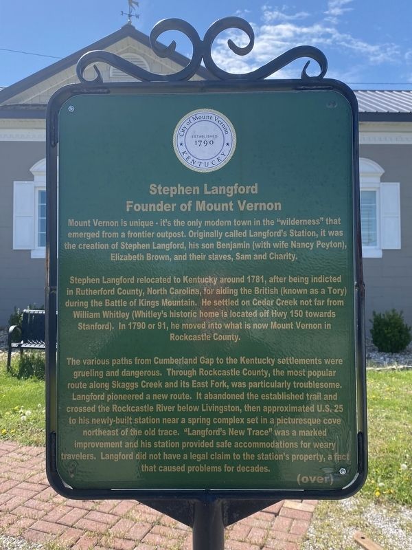
Stephen Langford
Founder of Mount Vernon
Stephen Langford relocated to Kentucky around 1781, after being indicted in Rutherford County, North Carolina, for aiding the British (known as a Tory) during the Battle of Kings Mountain. He settled on Cedar Creek not far from William Whitley (Whitley's historic home is located off Hwy 150 towards Stanford). In 1790 or 91, he moved into what is now Mount Vernon in Rockcastle County.
The various paths from Cumberland Gap to the Kentucky settlements were grueling and dangerous. Through Rockcastle County, the most popular route along Skaggs Creek and its East Fork, was particularly troublesome. Langford pioneered a new route. It abandoned the established trail and crossed the Rockcastle River below Livingston, then approximated U.S. 25 to his newly-built station near a spring complex set in a picturesque cove northeast of the old trace. "Langford's New Trace" was a marked improvement and his station provided safe accommodations for weary travelers. Langford did not have a legal claim to the station's property, a fact that caused problems for decades.
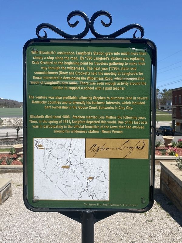
With Elizabeth's assistance, Langford's Station grew into much more than simply a stop along the road. By 1795 Langford's Station was replacing Crab Orchard as the beginning point for travelers gathering to make their way through the wilderness. The next year (1796), state road commissioners (Knox and Crockett) held the meeting at Langford's for those interested in developing the Wilderness Road, which incorporated much of Langford's new route. There was even enough activity around the station to support a school with a paid teacher.
The venture was also profitable, allowing Stephen to purchase land in several Kentucky counties and to diversify his business interests, which included part ownership in the Goose Creek Saltworks in Clay City.
Elizabeth died about 1806. Stephen married Lois Mullins the following year. Then, in the spring of 1811, Langford departed this world. One of his last acts was in participating in the official formation of the town that had evolved around his wilderness station - Mount Vernon.
Written by: Jeff Renner, Historian
Erected by City of Mount Vernon.
Topics. This historical marker is listed in this topic list: Notable Places.
Location. 37° 21.202′ N, 84° 20.43′ W. Marker is in Mount Vernon, Kentucky, in Rockcastle County. Marker is at the intersection of Richmond Street and West Main Street, on the left when traveling north on Richmond Street. Touch for map. Marker is at or near this postal address: 100 Richmond St, Mount Vernon KY 40456, United States of America. Touch for directions.
Other nearby markers. At least 8 other markers are within walking distance of this marker. City of Mount Vernon - 1800's (here, next to this marker); How the City of Mount Vernon was named (a few steps from this marker); Pioneer Routes In Rockcastle County (a few steps from this marker); Longhunters / George Washington's Deer Park (a few steps from this marker); C.C. Williams Home (a few steps from this marker); Fritz Krueger Building (within shouting distance of this marker); Triangle Park (within shouting distance of this marker); a different marker also named Triangle Park (within shouting distance of this marker). Touch for a list and map of all markers in Mount Vernon.
Credits. This page was last revised on April 14, 2024. It was originally submitted on April 8, 2024, by Darren Jefferson Clay of Duluth, Georgia. This page has been viewed 45 times since then. Photos: 1, 2, 3. submitted on April 11, 2024, by Darren Jefferson Clay of Duluth, Georgia. • James Hulse was the editor who published this page.


