Emory in Rains County, Texas — The American South (West South Central)
Emory United Methodist Church
Photographed by Jeff Leichsenring, April 7, 2024
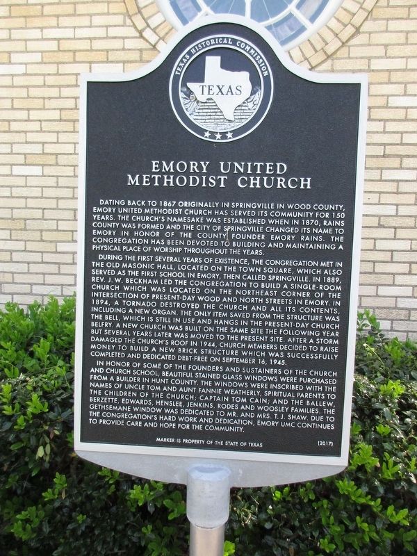
1. Emory United Methodist Church Marker
During the first several years of existence, the congregation met in the old Masonic hall, located on the town square, which also served as the first school in Emory, then called Springville. In 1889, Rev. J.W. Beckham led the congregation to build a single-room church which was located on the northeast corner of the intersection of present-day Wood and North Streets in Emory. In 1894, a tornado destroyed the church and all its contents, including a new organ. The only item saved from the structure was the bell, which is still in use and hangs in the present-day church belfry. A new church was built on the same site the following year but several years later was moved to the present site. After a storm damaged
this page online
In honor of some of the founders and sustainers of the church and church school, beautiful stained glass windows were purchased from a builder in Hunt County. The windows were inscribed with the names of Uncle Tom and Aunt Fannie Weatherly, spiritual parents to the children of the church; Captain Tom Cain, and the Ballew, Berzette, Edwards, Henslee, Jenkis, Rodes and Woosley families. The Gethsemane window was dedicated to Mr. and Mrs. T.J. Shaw. Due to the congregation’s hard work and dedication, Emory UMC continues to provide care and hope for the community.
Erected 2017 by Texas Historical Commission. (Marker Number 18815.)
Topics. This historical marker is listed in this topic list: Religion & Religious Structures. A significant historical date for this entry is September 16, 1945.
Location. 32° 52.551′ N, 95° 45.859′ W. Marker is in Emory, Texas, in Rains County. It is at the intersection of North Texas Street and College Street, on the right when traveling north
Photographed by Jeff Leichsenring, April 7, 2024
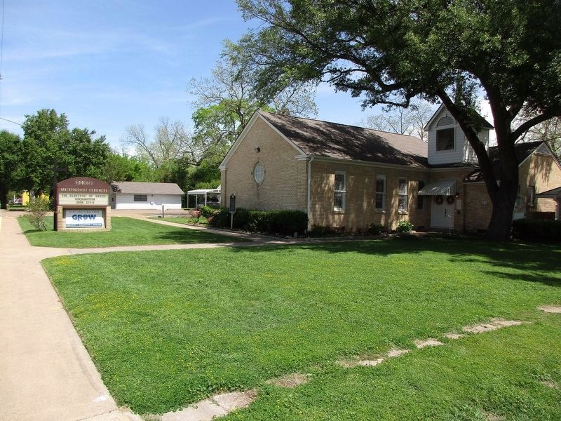
2. Emory United Methodist Church and Marker

Regionally, this marker is in the American South and in the Piney Woods. Globally, it is in North America, a Gulf of Mexico state, the Western Hemisphere, the Western World, and the Anglosphere. Historically, it finds itself in what was once New Spain, the Republic of Texas, and one of the Confederate States of America.
Other nearby markers. At least 8 other markers are within 3 miles of this marker, measured as the crow flies: Rains County (about 500 feet away, measured in a direct line); Rains County Courthouse (about 500 feet away); Near Offices of "Rains County Leader" (about 500 feet away); The Amis House (approx. 0.2 miles away); a different marker also named Rains County (approx. ¼ mile away); Emory Rains (approx. ¼ mile away); Ambrose Fitzgerald (approx. 0.4 miles away); Site of Fraser Brick Company (approx. 2.8 miles away). Touch for a list and map of all markers in Emory.
Credits. This page was last revised on May 5, 2024. It was originally submitted on April 8, 2024, by Jeff Leichsenring of Garland, Texas. This page has been viewed 375 times since then and 33 times this year. Photos: 1, 2. submitted on April 8, 2024, by Jeff Leichsenring of Garland, Texas. • James Hulse was the editor who published this page.
