Bloomington in Monroe County, Indiana — The American Midwest (Great Lakes)
The Railroad: Bringing Life to Bloomington
— Switchyard Park —
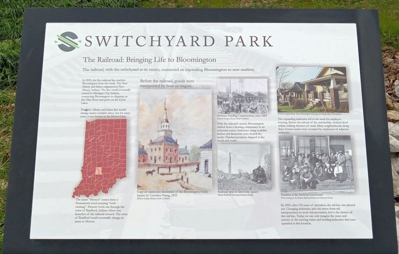
The railroad, with the switchyard at its center, connected an expanding Bloomington to new markets.
In 1853, the first railroad line reached Bloomington from the south. The New Albany and Salem originated in New Albany, Indiana. The line would eventually extend to Michigan City, Indiana, connecting Bloomington to shipping on the Ohio River and ports on the Great Lakes.
The New Albany and Salem line would change names multiple times, but for many years, it was known as the Monon Line.
The name "Monon" comes from a Potawatomi word meaning "swift running". Monon Creek ran through the town of Bradford, Indiana where two branches of the railroad crossed. The town of Bradford would eventually change its name to Monon.
Before the railroad, goods were transported by boat or wagon.
Copy of watercolor illustration of the Bloomington Public Square by Cornelius Pering, 1833
Monroe County History Center Collection
Showers Building Construction, circa 1884
Monroe County History Center Collection
With the railroad's arrival, Bloomington shifted from a farming community to an industrial center. Industries using available timber and limestone soon dotted the tracks. Finished products shipped to the north and south.
Railroad spur to limestone quarry
Monon Railroad Historical-Technical Society
McDoel Neighborhood. Photo: Bloomington Housing and Neighborhood Development
The expanding industries led to the need for employee housing. Before the advent of the automobile, workers lived within walking distance of work. Many neighborhoods along these former tracks were occupied by employees of adjacent industries.
Workers at the McDoel Switchyard
Photo courtesy of the Monon Railroad Historical-Technical Society
By 2000, after 150 years of operation, the rail line was phased out. Changing industries, plus to move from rail transportation to truck transportation, led to the demise of this rail line. Today, we can only imagine the noise and activity of the moving trains and bustling industries that once operated at this location.
Topics. This historical marker is listed in these topic lists: Industry & Commerce • Railroads & Streetcars. A significant historical year for this entry is 1853.
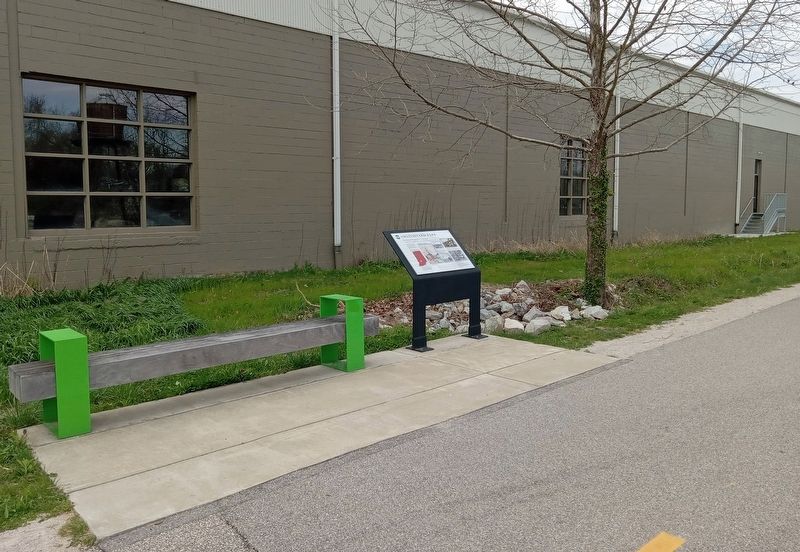
Location. 39° 9.058′ N, 86° 32.181′ W. Marker is in Bloomington, Indiana, in Monroe County. Marker is on the B-Line Trail north of W. Hillside Drive, on the left when traveling north. The marker is in Switchyard Park along the rail trail, near the reconstructed
locomotive water tower. Touch for map. Marker is at or near this postal address: 300 W Hillside Drive, Bloomington IN 47403, United States of America. Touch for directions.
Other nearby markers. At least 8 other markers are within one mile of this marker, measured as the crow flies. From Cabinets to Radios to Televisions (about 800 feet away, measured in a direct line); Industry and Environment (approx. ¼ mile away); Bringing Light to a Stream (approx. ¼ mile away); State Seminary of Indiana (approx. ¾ mile away); Captain Kathryn Janeway (approx. one mile away); The Monon Railroad (approx. one mile away); Inns and Taverns Cater to New Travelers (approx. 1.1 miles away); The Mobley-Buskirk-Hill Building (approx. 1.1 miles away). Touch for a list and map of all markers in Bloomington.
Credits. This page was last revised on April 12, 2024. It was originally submitted on April 12, 2024, by McGhiever of Minneapolis, Minnesota. This page has been viewed 48 times since then. Photos: 1, 2. submitted on April 12, 2024, by McGhiever of Minneapolis, Minnesota.

