Norwich in Norfolk, England, United Kingdom — Northwestern Europe (the British Isles)
Elm Hill
Photographed by Ray Gurganus
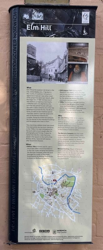
1. Elm Hill Marker
What
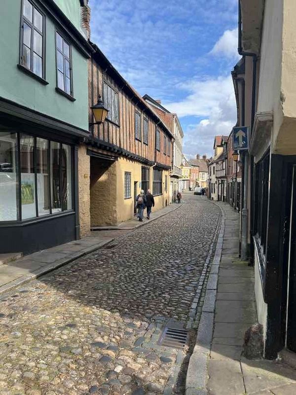
Elm Hill is the loveliest old street in the City, and probably one of the best in the country. It is almost the same in appearance now as it was when most of the properties were last rebuilt, after the major fire of 1507. At that time it was home to prosperous merchants, craftsmen and civic dignitaries who built the fine jettied houses with pan-tile roofs. It also contains one of the few buildings to survive the fire, the Briton's Arms, as well as two medieval parish churches, historic riverside quays and part of the Norwich Blackfriars' complex. Along the street blue plaques tell the stories of the individual buildings and the people who lived in them.
This charming cobbled street was saved from demolition during slum clearance in the 1920s. It is now a showpiece for Norwich and is much sought after for photography and filming. It takes its name from the Elm trees that once stood in the square to the north of the Britons Arms, replaced with planes after Dutch Elm Disease.
When
• Before 1066: St Simon and St Jude is one of the oldest church foundations in the City. It was certainly here before the Norman Conquest, when the land belonged to a sister of the Anglo-Scandinavian Archbishop Stigand who is shown on the Bayeux tapestry.
• 24th August 1549: During Kett's Rebellion the rebels, using Elm Hill and its two churches as bases, fought the Earl of Warwick's troops here for the whole day before they were eventually overwhelmed.
• 1850s: The factory of Wright and Son, at what is now Wrights Court, made "plain and fancy fabrics" and were said to have employed 1,500 handloom weavers. This was one of several textile and shoe factories in Elm Hill.
Who
Sir John Pettus (1550-1614) Lived on Elm Hill and is buried in a magnificent tomb at St Simon and St Jude parish church. He was involved in the
this page online
The Mercers Company was the trade organisation for dealers in fine cloths, in which Norwich specialised. The mark of the company appears on several nearby buildings, and the Pettus family, Augustine Steward, and other Elm Hill residents were Mercers.
William Bostling. Mayor of Norwich at the outbreak of the Civil War lived at what is now No 32. He was imprisoned for his loyalty to the Crown whilst Norwich elected a Parliamentarian city government.
Erected by Norwich Heart.
Topics. This historical marker is listed in this topic list: Industry & Commerce. A significant historical date for this entry is August 24, 1549.
Location. 52° 37.941′ N, 1° 17.863′ E. Marker is in Norwich, England, in Norfolk. It is at the intersection of Elm Hill and Wensum Street, on the left when traveling east on Elm Hill. Touch for map. Touch for directions.

Regionally, this marker is in East Anglia. Globally, it is on the Atlantic Ocean, in the North Atlantic Region, in Europe, in Atlantic Europe, on one of the British Isles, in the Western World,
Photographed by Ray Gurganus
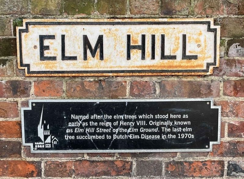
2. Elm Hill Marker
Named after the elm trees which stood here as early as the reign of Henry VIII. Originally known as Elm Hill Street or the Elm Ground. The last elm tree succumbed to Dutch Elm Disease in the 1970s.
Other nearby markers. At least 8 other markers are within walking distance of this marker: Wrights Court (within shouting distance of this marker); Paston House (about 90 meters away, measured in a direct line); Augustine Steward House (about 120 meters away); Edith Cavell (about 120 meters away); St Peter Hungate (about 150 meters away); United Reformed Church (about 150 meters away); a different marker also named Elm Hill (about 180 meters away); St Christopher's Church (about 180 meters away). Touch for a list and map of all markers in Norwich.
Photographed by Ray Gurganus
3. Elm Hill
Credits. This page was last revised on April 25, 2024. It was originally submitted on April 23, 2024, by Ray Gurganus of Washington, District of Columbia. This page has been viewed 349 times since then and 93 times this year. Photos: 1, 2, 3. submitted on April 23, 2024, by Ray Gurganus of Washington, District of Columbia. • Andrew Ruppenstein was the editor who published this page.
