Orinda in Contra Costa County, California — The American West (Pacific Coastal)
Bryant Station Site
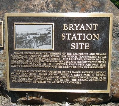
The Bryant Station was named to honor Mayor Andrew J. Bryant of San Francisco. Mayor Bryant owned a large farm in Orinda Park, where his beautiful gardens and large outdoor dance floor were the train's main attraction. After 1893, the Orinda Crossroads was popularly referred to as Bryant's Corners.
Topics. This historical marker is listed in this topic list: Railroads & Streetcars. A significant historical year for this entry is 1881.
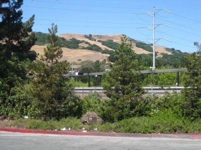
Location. 37° 52.749′ N, 122° 10.955′ W. Marker is in Orinda, California, in Contra Costa County. Marker is at the intersection of Moraga Way and Vashell Way, on the right when traveling south on Moraga Way. Touch for map. Marker is in this post office area: Orinda CA 94563, United States of America. Touch for directions.
Other nearby markers. At least 8 other markers are within walking distance of this marker. The Orinda Theatre, 1941 (within shouting distance of this marker); Pony Express (about 300 feet away, measured in a direct line); The Crossroads (about 400 feet away); The deLaveaga Station (about 400 feet away); a different marker also named The Pony Express (about 500 feet away); Orinda Mural (about 500 feet away); The de Laveaga Station (about 500 feet away); The First Downtown (about 700 feet away). Touch for a list and map of all markers in Orinda.
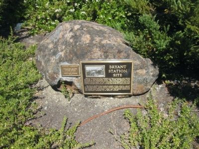
More about this marker. The marker is mounted on a low rock between two pine trees about 4 feet in from the curb. The rock is located approximately where Moraga Way dead-ends, with Vashell Way splitting off to the right, and a turn-around/alleyway splitting off to the left.
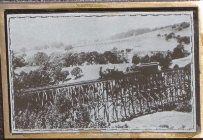
Also see . . . Orinda Historical Society Newsletter of January, 2007. Kent and Teresa Long's Trains in Orinda? provides a history of the California and Nevada Line in Orinda, "...Incorporated in 1881, the “C&N” was led by Captain “Denver” Smith, who had built several successful railroads in Colorado. The line was planned to run from Emeryville, through Berkeley, San Pablo, and present-day Orinda, then extend through the Central Valley, over the Sierra Nevada near Sonora Pass, and terminate in Nevada, where it would connect with the Carson and Colorado Railroad. Trains began running between Emeryville and San
Pablo in 1885, and the track was extended to the Orinda Crossroads (then
called Bryant) by 1891. Impressive trestles were built in Orinda to cross the local creeks, and three stations were established, Orinda Park (at Wagner
Ranch), de Laveaga (on the deLaveaga family’s property at Miner Rd.), and Bryant. Picnickers from Oakland would take the train out to enjoy the Orinda countryside, and hay grown in Lafayette and other local produce would be transported by the train back into market. As it turned out, the Bryant station at the Crossroads was as far as the railroad would ever reach, its finances hampered by competition and frequent washouts of the tracks. The train stopped running in late 1900." (Submitted on November 18, 2009.)

Photographed By Andrew Ruppenstein, July 12, 2009
3. Bryant Station Site Marker and Landmark Designation Plaque
Mounted next to the Bryant Station marker is a landmark designation plaque indicating that the site was designated an historic landmark by the City of Orinda on July 12, 1997 by Ordinance 97-06.
Credits. This page was last revised on June 16, 2016. It was originally submitted on November 18, 2009, by Andrew Ruppenstein of Lamorinda, California. This page has been viewed 2,120 times since then and 37 times this year. Photos: 1, 2, 3, 4. submitted on November 18, 2009, by Andrew Ruppenstein of Lamorinda, California. • Syd Whittle was the editor who published this page.


