Thurston in Fairfield County, Ohio — The American Midwest (Great Lakes)
The History of Thurston
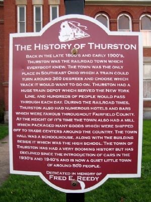
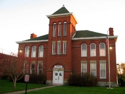
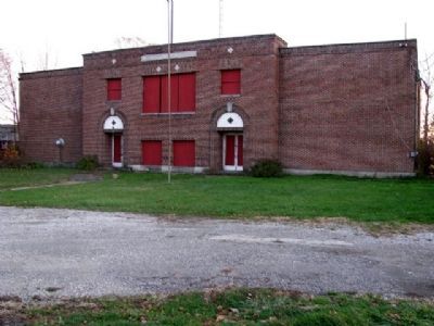
Back in the late 1800's and early 1900's, Thurston was the railroad town which everybody knew. The town was the only place in southeast Ohio which a train could turn around 360 degrees and choose which track it would want to go on. Thurston had a huge train depot which served the New York Line, and hundreds of people would pass through each day. During the railroad times, Thurston also had numerous hotels and bars which were famous throughout Fairfield County. At the height of it's time the town also had a mill which packaged many goods which were shipped off to trade centers around the country. The town hall was a schoolhouse, along with the building beside it which was the high school. The town of Thurston has had a very booming history but has declined since the introduction of cars in the 1930's and 1940's and is now a quiet little town of around 500 people.
Dedicated in memory of Fred E. Reedy
Topics. This historical marker is listed in these topic lists: Education • Industry & Commerce • Railroads & Streetcars • Settlements & Settlers.
Location. 39° 50.391′ N, 82° 32.713′ W. Marker is in Thurston, Ohio, in Fairfield County. Marker is on Baltimore-Somerset Road (Ohio Route 256) 0.1 miles west of the railroad tracks, on the left when traveling west. Touch for map. Marker is at or near this postal address: 2215 Baltimore-Somerset Road, Thurston OH 43157, United States of America. Touch for directions.
Other nearby markers. At least 8 other markers are within 7 miles of this marker, measured as the crow flies. The Ohio & Erie Canal and the "Twin Cities" / The Ohio & Erie Canal and the Dry Dock Lock (approx. 3.3 miles away); Liberty Union VFW Post 3761 Veterans Memorial (approx. 3.6 miles away); Deep Cut at the Licking Summit / Millersport and the Ohio-Erie Canal (approx. 4.2 miles away); Millersport World War II Memorial (approx. 4.2 miles away); VFW Post 3761 (approx. 4.6 miles away); Neptune P2V-5F (Sp-2E) 131522 (approx. 4.6 miles away); Floral Hills All American Veterans Memorial (approx. 5.6 miles away); Buckeye Lake (approx. 6.8 miles away).
Also see . . . A History of Thurston. Town website entry (Submitted on November 25, 2009, by William Fischer, Jr. of Scranton, Pennsylvania.)
Credits. This page was last revised on November 21, 2023. It was originally submitted on November 25, 2009, by William Fischer, Jr. of Scranton, Pennsylvania. This page has been viewed 1,343 times since then and 82 times this year. Photos: 1, 2, 3. submitted on November 25, 2009, by William Fischer, Jr. of Scranton, Pennsylvania.


