Patterson in Putnam County, New York — The American Northeast (Mid-Atlantic)
Historic District
Patterson 200 Years
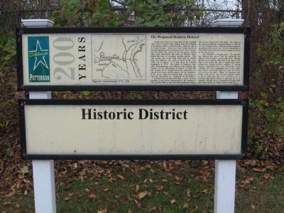
The Proposed Historic District
People have lived for a long time in this beautiful valley where a natural trail, running from New England to the Hudson, makes a gentle bend here along the edge of the Great Swamp. Traces have been found nearby of campsites dating back three thousand years. More recently, but still before the arrival of the Europeans, Indian tribes from Connecticut and from the Hudson Valley shared this area as a summer hunting ground. This trail became one of the main roads used by settlers from New England who began to arrive in the early 1730s and it appears on a map made for General Washington in 1778. The center of Patterson, then called Fredericksburg, was located at the Triangle Inn Corner, now the intersection of Routes 311 and 292. The remains of the original three-way intersection (so typical of that time and this place), and the foundation of the tavern which was located there were destroyed when the intersection was “improved” by N.Y.S.D.O.T.
Patterson was an important town, a center of local government and culture, unconnected to the markets of NYC and the West as were the towns along the Hudson River in the western part of the county. The coming of the railroad in 1840 and its expansion during and after the Civil War changed all that. Patterson became a prosperous agricultural center and the center of Town shifted from one end of Main Street to the other, from the Triangle Inn Corner to the railroad line.
Now Patterson is changing again. The interstate has replaced the railroad and the automobile has taken us from the land to jobs in other areas. Through all this change however, this bend in the road on the edge of the swamp has been a special place where people have shared hunting campfires or church suppers, celebrated births and buried their dead, worshipped their God, remembered their heroes, taught their children and shared with each other the lessons learned from the land. While the structures and groups which are here now all have wonderful stories to tell of more than 200 years of growing up in Patterson, this Historic District is proposed, not as a museum of the past, but as a celebration of the place itself and concern for its continuing existence in the future.
Topics and series. This historical marker is listed in this topic list: Settlements & Settlers. In addition, it is included in the Former U.S. Presidents: #01 George Washington series list. A significant historical year for this entry is 1778.
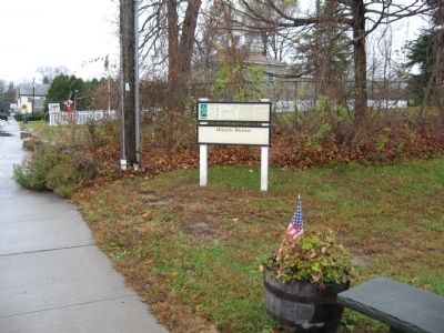
Location. 41° 30.816′ N, 73° 36.294′ W. Marker is in Patterson, New York, in Putnam County. Marker is at the intersection of New York State Route 311 and Front Street, on the right when traveling west on State Route 311. Located next to Patterson Town Hall. Touch for map. Marker is at or near this postal address: 1142 Route 311, Patterson NY 12563, United States of America. Touch for directions.
Other nearby markers. At least 8 other markers are within walking distance of this marker. Patterson 9/11 Memorial (a few steps from this marker); The Presbyterian Church (approx. 0.4 miles away); The Fellowship Hall (approx. 0.4 miles away); Patterson Grange No. 939 (approx. 0.4 miles away); District School No. 1 (approx. 0.4 miles away); Maple Avenue Cemetery (approx. 0.4 miles away); Ludington Graves (approx. 0.4 miles away); Christ Church (approx. 0.4 miles away). Touch for a list and map of all markers in Patterson.
Also see . . . Historic Patterson, New York. (Submitted on November 28, 2009, by Michael Herrick of Southbury, Connecticut.)
Credits. This page was last revised on June 16, 2016. It was originally submitted on November 28, 2009, by Michael Herrick of Southbury, Connecticut. This page has been viewed 704 times since then and 14 times this year. Photos: 1, 2. submitted on November 28, 2009, by Michael Herrick of Southbury, Connecticut. • Kevin W. was the editor who published this page.

