Pawling in Dutchess County, New York — The American Northeast (Mid-Atlantic)
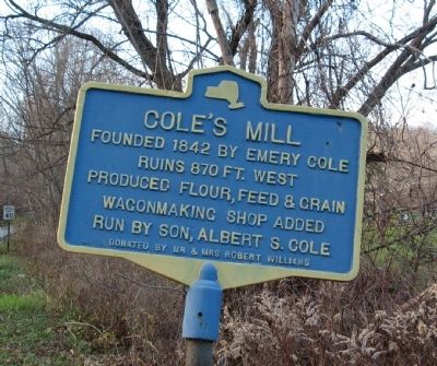
Cole’s Mill
Ruins 870 ft. west
Produced flour, feed & grain
Wagonmaking shop added
run by son, Albert S. Cole
Erected by Mr & Mrs Robert Williams.
Topics. This historical marker is listed in these topic lists: Industry & Commerce • Settlements & Settlers. A significant historical year for this entry is 1842.
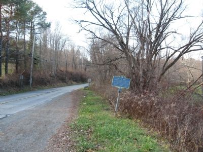
Location. 41° 34.038′ N, 73° 36.873′ W. Marker is in Pawling, New York, in Dutchess County. Marker is at the intersection of West Main Street (Old Route 55) and Lakeside Drive, on the right when traveling west on West Main Street. Located next to Edward R. Murrow Memorial Park. Touch for map. Marker is in this post office area: Pawling NY 12564, United States of America. Touch for directions.
Other nearby markers. At least 8 other markers are within 2 miles of this marker, measured as the crow flies. Murrow Park (within shouting distance of this marker); Methodist Church (approx. ¾ mile away); Pawling Veterans Memorial (approx. ¾ mile away); Pawling World War I and Civil War Memorial (approx. ¾ mile away); Memorial Trees (approx. ¾ mile away); Grange Hall (approx. 0.9 miles away); Lakeside Park (approx. 0.9 miles away); Pawling School 1907 (approx. 1.1 miles away). Touch for a list and map of all markers in Pawling.
Regarding Cole’s Mill. The ruins are up the road, past the bend. A small broken-up stone dam, almost completely overgrown, can just be seen astride the small stream next to the road.
Credits. This page was last revised on May 14, 2020. It was originally submitted on November 29, 2009, by Michael Herrick of Southbury, Connecticut. This page has been viewed 1,285 times since then and 93 times this year. Photos: 1, 2. submitted on November 29, 2009, by Michael Herrick of Southbury, Connecticut. • Kevin W. was the editor who published this page.
Editor’s want-list for this marker. Picture of the ruins. • Can you help?

