Bakersfield in Kern County, California — The American West (Pacific Coastal)
Fairhaven Pump House
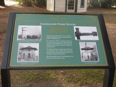
Access to adequate water supplies was crucial to the settlement of Kern County.
Water from the Kern River was diverted to irrigate farmlands, but most towns relied on wells for drinking water.
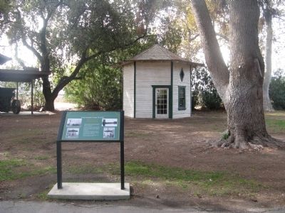
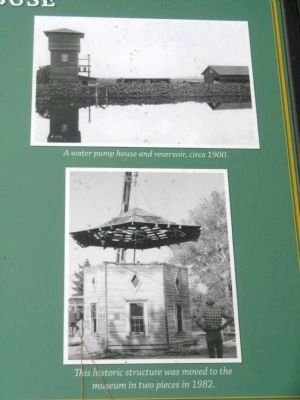
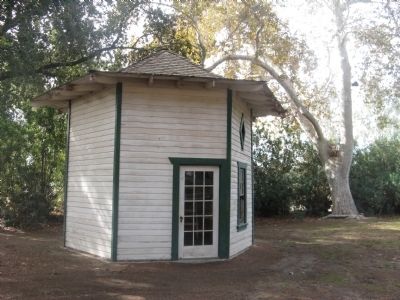
The Fairhaven Water Company built this structure in 1921 to house a well and pump located in the middle of the intersection of Fairhaven Drive and East Drive northwest of Bakersfield.
The Fairhaven Water Company provided water to residential and commercial customers until 1981 when the California Water Service Company acquired this district.
Chuck Mandell donated this building to the Kern County Museum in 1982.
Erected by Kern County Museum.
Topics. This historical marker is listed in these topic lists: Natural Resources • Notable Buildings. A significant historical year for this entry is 1921.
Location. 35° 23.546′ N, 119° 1.311′ W. Marker is in Bakersfield, California, in Kern County. Marker can be reached from Chester Avenue. Marker is located at the Chapel Green section of Pioneer Village at the Kern County Museum. Touch for map. Marker is at or near this postal address: 3801 Chester Avenue, Bakersfield CA 93301, United States of America. Touch for directions.
Other nearby markers. At least 8 other markers are within walking distance of this marker. Weill House (a few steps from this marker); Norris School (within shouting distance of this marker); Railroad Flagman’s Building (within shouting distance of this marker); Gazebo (within shouting distance of this marker); Haggard House (within shouting distance of this marker); Saint John's Episcopal Mission (within shouting distance of this marker); Bena Depot (within shouting distance of this marker); Blacksmith Shop (within shouting distance of this marker). Touch for a list and map of all markers in Bakersfield.
Photographed By Syd Whittle, November 27, 2009
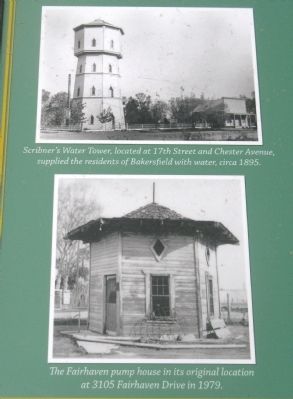
3. Photos Displayed on Marker
Upper Photo:
Scribner’s Water Tower, located at 17th Street and Chester Avenue, supplied the residents of Bakersfield with water, circa 1895.
Lower Photo:
The Fairhaven Pump House is its original location at 3105 Fairhaven Drive in 1979.
Scribner’s Water Tower, located at 17th Street and Chester Avenue, supplied the residents of Bakersfield with water, circa 1895.
Lower Photo:
The Fairhaven Pump House is its original location at 3105 Fairhaven Drive in 1979.
Credits. This page was last revised on August 1, 2018. It was originally submitted on December 13, 2009, by Syd Whittle of Mesa, Arizona. This page has been viewed 1,002 times since then and 15 times this year. Photos: 1, 2, 3, 4, 5. submitted on December 13, 2009, by Syd Whittle of Mesa, Arizona.
