Trussville in Jefferson County, Alabama — The American South (East South Central)
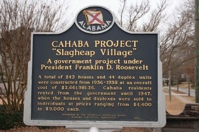
Cahaba Project
"Slagheap Village"
— A government project under President Franklin D. Roosevelt —
Erected 1999 by Alabama Historical Association / Trussville Historical Board.
Topics and series. This historical marker is listed in this topic list: Settlements & Settlers. In addition, it is included in the Alabama Historical Association, and the Former U.S. Presidents: #32 Franklin D. Roosevelt series lists. A significant historical year for this entry is 1936.
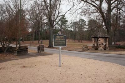
Location. 33° 37.314′ N, 86° 36.096′ W. Marker is in Trussville, Alabama, in Jefferson County. Marker is at the intersection of Main Street (U. S. Highway 11) and Parkway Drive, on the left when traveling east on Main Street (U. S. Highway 11). Touch for map. Marker is in this post office area: Trussville AL 35173, United States of America. Touch for directions.
Other nearby markers. At least 8 other markers are within 5 miles of this marker, measured as the crow flies. Trussville (about 600 feet away, measured in a direct line); First Baptist Church of Trussville (about 600 feet away); Trussville, Alabama (approx. 0.4 miles away); Confederate Storehouse Burned By Federal Troops (approx. 0.4 miles away); Trussville Furnace (approx. 0.6 miles away); Mt. Nebo Cemetery (approx. 1.3 miles away); Pioneer Massey Cemetery (approx. 4.6 miles away); Center Point, Alabama (approx. 4.9 miles away). Touch for a list and map of all markers in Trussville.
Additional keywords. New Towns, New Deal
Credits. This page was last revised on November 2, 2019. It was originally submitted on January 5, 2010, by Timothy Carr of Birmingham, Alabama. This page has been viewed 1,581 times since then and 59 times this year. Photos: 1, 2, 3, 4. submitted on January 5, 2010, by Timothy Carr of Birmingham, Alabama. • Bill Pfingsten was the editor who published this page.


