Kettering in Montgomery County, Ohio — The American Midwest (Great Lakes)
Watervliet Shaker Community
Inscription.
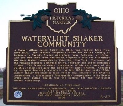
Side A:
A Shaker village called Watervliet, Ohio, was located here from 1806-1900. The Shakers, originally called the United Society of Believers in Christ's Second Appearing, were followers of Mother Ann Lee who came from Manchester, England in 1774 and established the first Shaker community in Watervliet, New York. The tenets of the religion included communal living, celibacy, and public confession of sins. The frenzied dance movements, which were part of the worship of their sect, gave the members the name "Shakers." Attracted by the great Kentucky revivals in the late 1700s and early 1800s, Eastern Shaker missionaries came west to find converts and establish communities. A discontented Presbyterian congregation in the Beaver Creek area called Beulah was the nucleus for the Watervliet Shaker community.
(Continued on other side)
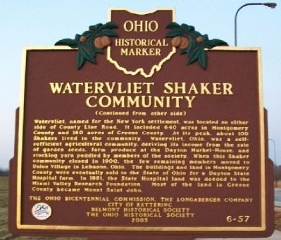
Side B:
(Continued from other side)
Watervliet, named for the New York settlement, was located on either side of County Line Road. It included 640 acres in Montgomery County and 160 acres of Greene County. At its peak, about 100 Shakers lived in the community. Watervliet, Ohio, was a self-sufficient agricultural community, deriving its income from the sale of garden seeds, farm produce at the Dayton Market-House, and stocking yarn peddled by members of the society. When this Shaker community closed in 1900, the few remaining members moved to Union Village in Lebanon, Ohio. The buildings and land in Montgomery County were eventually sold to the State of Ohio for a Dayton State Hospital farm. In 1981, the State Hospital land was deeded to the Miami Valley Research Foundation. Most of the land in Greene County became Mount Saint John.
Erected 2003 by Ohio Bicentennial Commission, The Longaberger Company, City of Kettering, Belmont Historical Society, and The Ohio Historical Society. (Marker Number 6-57.)
Topics and series. This historical marker is listed in these topic lists: Churches & Religion • Settlements & Settlers. In addition, it is included in the Communal and Utopian Societies, and the Ohio Historical Society / The Ohio History Connection series lists. A significant historical year for this entry is 1774.
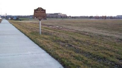
Location. 39° 43.097′ N, 84° 6.272′ W. Marker is in Kettering, Ohio, in Montgomery County. Marker is on Research Boulevard/County Line Road (Ohio Route 835) 0.1 miles north of Shakertown Road, on the left when traveling north. Touch for map. Marker is in this post office area: Dayton OH 45430, United States of America. Touch for directions.
Other nearby markers. At least 8 other markers are within 4 miles of this marker, measured as the crow flies. Cassano’s Pizza King® (approx. 2.7 miles away); Lewis & Elizabeth Kemp Homestead
(approx. 3.1 miles away); Beavercreek Veterans Memorial #1 (approx. 3.1 miles away); Beavercreek Veterans Memorial #2 (approx. 3.1 miles away); Beavercreek Veterans Memorial #3 (approx. 3.1 miles away); Beavercreek Veterans Memorial #4 (approx. 3.1 miles away); Burkhardt Hill (approx. 3.6 miles away); Col. Robert Patterson (approx. 4 miles away).
Also see . . . History of Montgomery County, Ohio. (Submitted on January 10, 2010, by William Fischer, Jr. of Scranton, Pennsylvania.)
Credits. This page was last revised on June 16, 2016. It was originally submitted on January 10, 2010, by William Fischer, Jr. of Scranton, Pennsylvania. This page has been viewed 3,611 times since then and 103 times this year. Photos: 1, 2, 3. submitted on January 10, 2010, by William Fischer, Jr. of Scranton, Pennsylvania.


