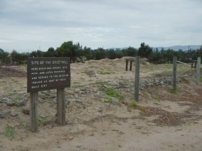
Soledad in Monterey County, California — The American West (Pacific Coastal)
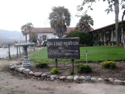
Mission Nuestra Señora Dolorosísima de la Soledad
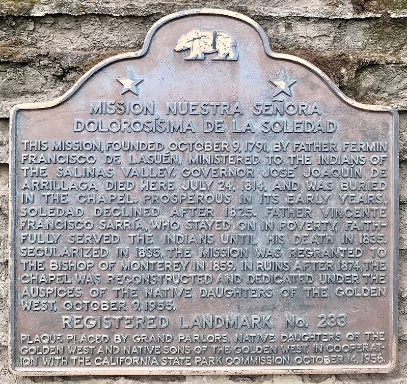
This mission, founded October 9, 1791 by Father Fermín Francisco de Lasuén, ministered to the Indians of the Salinas Valley. Governor José Joaquín de Arrillaga died here July 24, 1814 and was buried in the chapel. Prosperous in its early years, Soledad declined after 1825, but Father Vicente Francisco Sarría stayed on in poverty to serve the Indians until his death in 1835, when the mission was secularized. It was regranted to the Bishop of Monterey in 1859. In ruins after 1874, the chapel was reconstructed and dedicated under the auspices of the Native Daughters of the Golden West, October 9th, 1955.
Registered Landmark No. 233.
Plaque placed by Grand Parlors, Native Daughters of the Golden West and Native Sons of the Golden West, in cooperation with the California State Park Commission, October 14, 1956.
Erected 1956 by Grand Parlors of the Native Daughters of the Golden West and the Native Sons of the Golden West. (Marker Number 233.)
Topics and series. This historical marker is listed in these topic lists: Churches & Religion • Notable Places • Settlements & Settlers. In addition, it is included in the California Historical Landmarks, and the Native Sons/Daughters of the Golden West series lists. A significant historical month for this entry is July 1812.
Location. 36° 24.375′ N, 121° 21.285′ W. Marker is in Soledad, California, in Monterey County. Marker is at the intersection of Fort Romie Road and Mission Road, on the left when traveling west on Fort Romie Road. Touch for map. Marker is at or near this postal address: 36641 Fort Romie Road, Soledad CA 93960, United States of America. Touch for directions.
Other nearby markers. At least 8 other markers are within 2 miles of this marker, measured as the crow flies. Padre Florencio Ibanez (about 500 feet away, measured in a direct line); The De Anza Expedition in Soledad (about 500 feet away); Jose Joaquin de Arrillaga (about 500 feet away); Site of Original Church (about 600 feet away); El Camino Real Bell (about 700 feet away); Railroad Station Site (approx. 2 miles away); Cesar Chavez Park (approx. 2 miles away); One Voice Murals Project (approx. 2 miles away). Touch for a list and map of all markers in Soledad.
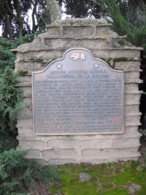
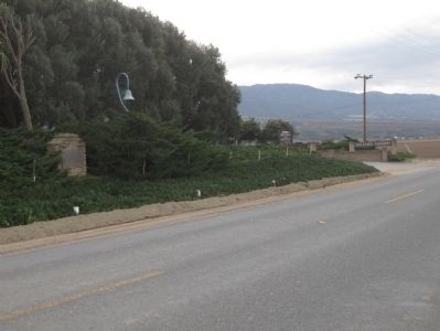
More about this marker. The mission marker is mounted on a cement monument amongst some bushes and trees on the south side of the road, just to the east of the entrance to the mission.
Also see . . . Mission Soledad. Monterey County Historical Society website entry (Submitted on July 24, 2021, by Larry Gertner of New York, New York.)
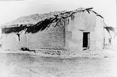
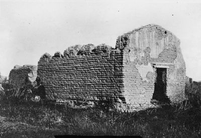
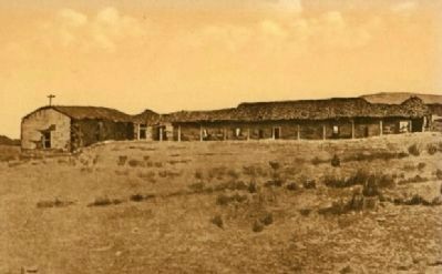
Freethy Collection, courtesy Historic American Buildings Survey, circa 1884
4. Chapel (1884), from Southwest
After the secularization of the Franciscan missions in 1834, the Mission went into decline, with most of the resident population leaving. The picture above, taken a half century, shows how far the decline had gone.
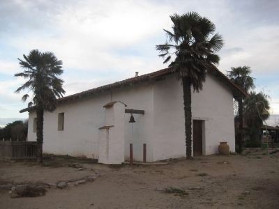
Photographed By Andrew Ruppenstein, January 16, 2010
6. Chapel (2010)
The chapel, rebuilt in 1954-55, was constructed of handmade adobe bricks made, at least in part, from the dust of the original adobe. Services are held in the chapel several times a year. The church bell, visible in the picture, is a replica of the churches original bell, which was cast in Mexico City in 1794.
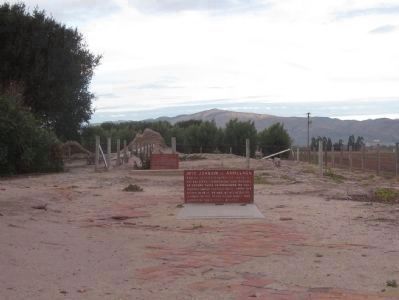
Photographed By Andrew Ruppenstein, January 16, 2010
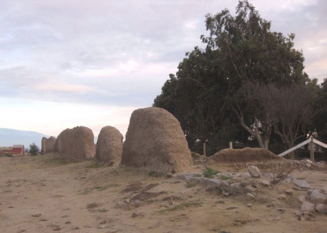
10. Former church floor, with graves of Arillaga and Ibanez
On the east side of the mission grounds is the remains of the original church. It was dedicated in 1791 and destroyed by floods in 1828, never to be rebuilt. Buried in the floor of the church were Jose Joaquin de Arillaga, the first governor of Alta California, and Padre Florencio Ibanez, the resident priest at the mission, who served from 1803 until his death in 1818. Both have interpretive signs next to their graves:
Jose Joaquin de Arillaga - known affectionately as Papa by his soldiers, companions and friends, he served twice as Governor of California under Spanish rule. Upon his death in 1814, he was, at his request, garbed in the Franciscan habit and buried in the mission church.
Padre Florencio Ibanez - as the only resident padre he devotedly served at Mission Soledad for 15 years until his death November 26, 1818. He is the only priest buried at this mission.
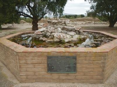
Photographed By Barry Swackhamer, March 20, 2013
12. Mission Fountain
The plaque reads:
This fountain is reverently dedicated as a tribute to our pioneer founders, the departed advisers and members of this committee to our devoted Native Daughters, their families and friends throughout the State of California, for valued support in the preservation and restoration of Historic Landmark No. 233, Mission Nuestra Senora Dolorosisima de la Soledad and in respect and loving memory to Abel, Nicola and Flora Bianchi and the pioneers of the Soledad community.
“Let no good by thee be marred,
Let no duty seem too hard,
In all things bravely do you best,
And then to god well, leave the rest”
Mission Soledad Restoration Committee
Grand Parlor, N.D.G.W.
September 27, 1975
This fountain is reverently dedicated as a tribute to our pioneer founders, the departed advisers and members of this committee to our devoted Native Daughters, their families and friends throughout the State of California, for valued support in the preservation and restoration of Historic Landmark No. 233, Mission Nuestra Senora Dolorosisima de la Soledad and in respect and loving memory to Abel, Nicola and Flora Bianchi and the pioneers of the Soledad community.
Let no duty seem too hard,
In all things bravely do you best,
And then to god well, leave the rest”
Mission Soledad Restoration Committee
Grand Parlor, N.D.G.W.
September 27, 1975
Credits. This page was last revised on January 28, 2024. It was originally submitted on February 6, 2010, by Andrew Ruppenstein of Lamorinda, California. This page has been viewed 3,708 times since then and 54 times this year. Photos: 1. submitted on January 28, 2024, by Craig Baker of Sylmar, California. 2, 3, 4, 5, 6, 7, 8, 9, 10. submitted on February 6, 2010, by Andrew Ruppenstein of Lamorinda, California. 11. submitted on February 6, 2010. 12, 13. submitted on April 11, 2013, by Barry Swackhamer of Brentwood, California. • Syd Whittle was the editor who published this page.
