East Sumter in Sumter County, South Carolina — The American South (South Atlantic)
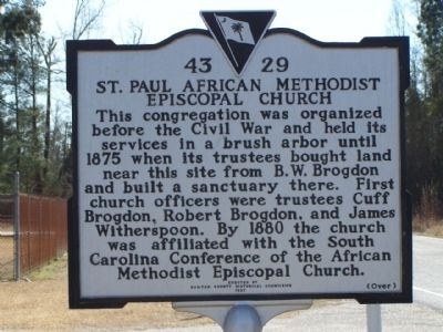
St. Paul African American Methodist Episcopal Church
This congregation was organized before the Civil War and held its services in a brush arbor until 1875 when its trustees bought land near this site from B. W. Brogdon and built a sanctuary there. First church officers were trustees Cuff Brogden, Robert Brogden, and James Witherspoon. By 1880 the church was affiliated with the South Carolina Conference of the African Methodist Episcopal Church.
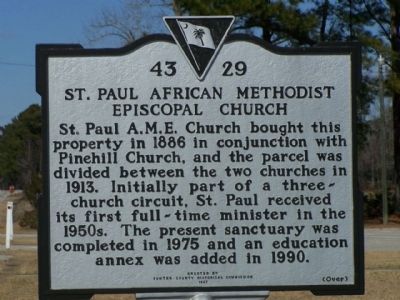
Marker Reverse:
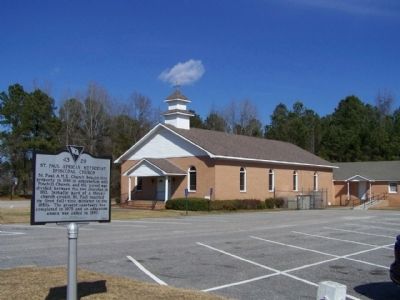
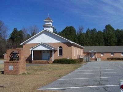
St. Paul A. M. E. Church bought this property in 1886 in conjunction with Pinehill Church, and the parcel was divided between the two churches in 1913. Initially part of a three-church circuit, St. Paul received its first full-time minister in the 1950s. The present sanctuary was completed in 1975 and an education annex was added in 1990.
Erected 1997 by The Sumter County Historical Commission. (Marker Number 43-29.)
Topics and series. This historical marker is listed in these topic lists: African Americans • Churches & Religion. In addition, it is included in the African Methodist Episcopal (AME) Church series list. A significant historical year for this entry is 1875.
Location. 33° 53.936′ N, 80° 15.077′ W. Marker is in East Sumter, South Carolina, in Sumter County. Marker is on Plowden Mill Road, on the left when traveling south. Located approx. 500 yards south of Myrtle Beach Highway (US 378) on the left. Touch for map. Marker is at or near this postal address: 835 Plowden Mill Road, Sumter SC 29153, United States of America. Touch for directions.
Other nearby markers. At least 8 other markers are within 6 miles of this marker, measured as the crow flies. Concord Presbyterian Church (approx. 1.8 miles away); Beulah School (approx. 4.4 miles away); The Britton Community / Britton Siding (approx. 4.7 miles away); Battle of Dingle's Mill (approx. 5.1 miles away); Site of The Battle of Dingle's Mill (approx. 5.1 miles away); St. Anne Catholic Church (approx. 5.1 miles away); a different marker also named Battle of Dingles Mill (approx. 5.1 miles away); Kendall Institute (approx. 5.2 miles away).
Credits. This page was last revised on June 16, 2016. It was originally submitted on February 13, 2010, by Mike Stroud of Bluffton, South Carolina. This page has been viewed 1,211 times since then and 39 times this year. Photos: 1, 2, 3, 4. submitted on February 13, 2010, by Mike Stroud of Bluffton, South Carolina. • Kevin W. was the editor who published this page.


