Mesa in Maricopa County, Arizona — The American Mountains (Southwest)
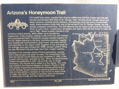
Arizona's Honeymoon Trail
Photographed by Bill Kirchner, February 13, 2010
1. Arizona's Honeymoon Trail Marker
Because of the romantic nature of these adventures, reporter Will C.
this page online
Erected 2001 by Daughters of Utah Pioneers Maricopa East Company. (Marker Number 532.)
Topics and series. This historical marker is listed in this topic list: Settlements & Settlers. In addition, it is included in the Daughters of Utah Pioneers series list. A significant historical year for this entry is 1881.
Location. 33° 24.949′ N, 111° 49.178′ W. Marker is in Mesa, Arizona, in Maricopa County. It can be reached from East Main Street. Marker is located in Pioneer Park between
Photographed by Bill Kirchner, February 13, 2010
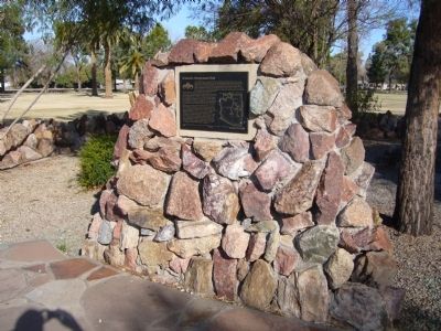
2. Arizona's Honeymoon Trail Marker

Regionally, this marker is in the Sonoran Desert, in the Phoenix Metropolitan Area, and in the Tohono O’odham Nation. It is also in the American Southwest. Globally, it is in North America, the Western Hemisphere, the Western World, and the Anglosphere. Historically, it finds itself in what was once New Spain, the Gadsden Purchase, and Mexico’s Alta California.
Other nearby markers. At least 8 other markers are within walking distance of this marker: Mesa (a few steps from this marker); Mesa Pioneer Monument (within shouting distance of this marker); Sirrine House (approx. ¾ mile away); The Alhambra Hotel (approx. 0.8 miles away); Zenos Co-Op (approx. 0.9 miles away); Mesa Woman's Club House (approx. 0.9 miles away); Pomeroy Building (approx. 0.9 miles away); Wayne C. Pomeroy (approx. 0.9 miles away). Touch for a list and map of all markers in Mesa.
Also see . . . Washington County Historical Society. Route Map, History
Photographed by Bill Kirchner, February 13, 2010
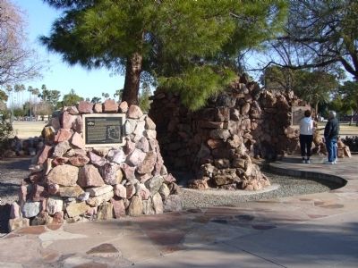
3. Arizona's Honeymoon Trail Marker
Arizona's Honeymoon Trail Marker is on the left and the Mesa Marker is on the right, being viewed by a couple.
Credits. This page was last revised on June 17, 2020. It was originally submitted on February 15, 2010, by Bill Kirchner of Tucson, Arizona. This page has been viewed 4,926 times since then and 92 times this year. Photos: 1, 2, 3. submitted on February 15, 2010, by Bill Kirchner of Tucson, Arizona. • Syd Whittle was the editor who published this page.
Editor’s want-list for this marker. Photos of remnants of the trail located in Northern Arizona. • Can you help?
