Marker Logo HMdb.org THE HISTORICAL
MARKER DATABASE
“Bite-Size Bits of Local, National, and Global History”
Midtown - Downtown in Columbia in Richland County, South Carolina — The American South (South Atlantic)
 

Columbia Bible College


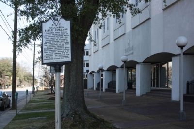
Columbia Bible College Marker image. Click for full size.
Photographed By Mike Stroud, 2010
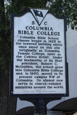
1. Columbia Bible College Marker
Inscription. Columbia Bible School classes began in 1923 in the towered building which once stood on this site (originally as Columbia Female College, later as the Colonia Hotel). Under the leadership of its first president, Robert C. McQuilkin, the school grew into Columbia Bible College and, in 1960, moved to its present campus NW of Columbia. Its alumni now serve in church-related ministries around the world.
 
Erected 1979 by The Columbia Bible College Alumni Association. (Marker Number 40-86.)
 
Topics. This historical marker is listed in this topic list: Churches & Religion. A significant historical year for this entry is 1923.
 
Location. 34° 0.443′ N, 81° 1.708′ W. Marker is in Columbia, South Carolina, in Richland County. It is in Midtown - Downtown. Marker is on Hampton Street, on the right when traveling east. Located between Pickens Street and Henderson Street. Touch for map. Marker is in this post office area: Columbia SC 29201, United States of America. Touch for directions.
 
Other nearby markers. At least 8 other markers are within walking distance of this marker. Original Site of Columbia College (a few steps from this marker); A Fortunate Survivor (about 400 feet away, measured in a direct line); Tommy Wilson's Neighborhood (about 500 feet away); Wilson House (about 500 feet away); Wilson Boyhood House
Paid Advertisement
Click on the ad for more information.
Please report objectionable advertising to the Editor.
Click or scan to see
this page online
(about 500 feet away); Woodrow Wilson Family Home & Gardens (about 500 feet away); Columbia Civil Rights Sit-Ins/Barr v. City of Columbia (1964) (about 500 feet away); Victorian By Design (about 500 feet away). Touch for a list and map of all markers in Columbia.
 
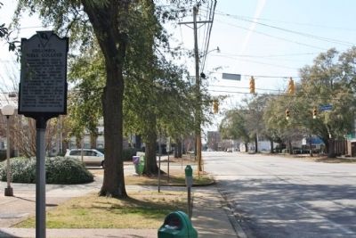
Columbia Bible College Marker seen along Hampton Street image. Click for full size.
Photographed By Mike Stroud, 12
2. Columbia Bible College Marker seen along Hampton Street
Columbia Bible College Marker, looking west near the intersection with Pickens Street image. Click for full size.
Photographed By Mike Stroud, February 21, 2010
3. Columbia Bible College Marker, looking west near the intersection with Pickens Street
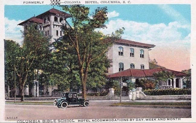
<i> Formerly Colonia Hotel, Columbia, S.C.</i> image. Click for full size.
circa 1930
4. Formerly Colonia Hotel, Columbia, S.C.
Here's an oddity: a postcard that was overprinted to reflect the change in ownership and repurposing of the building.
 
 
Credits. This page was last revised on February 16, 2023. It was originally submitted on March 7, 2010, by Mike Stroud of Bluffton, South Carolina. This page has been viewed 878 times since then and 59 times this year. Photos:   1, 2, 3. submitted on March 7, 2010, by Mike Stroud of Bluffton, South Carolina.   4. submitted on October 2, 2015. • Craig Swain was the editor who published this page.
Share this page.  
Share on Tumblr
m=28303

CeraNet Cloud Computing sponsors the Historical Marker Database.
This website earns income from purchases you make after using our links to Amazon.com. We appreciate your support.
Paid Advertisement
Apr. 25, 2024