East Sumter in Sumter County, South Carolina — The American South (South Atlantic)
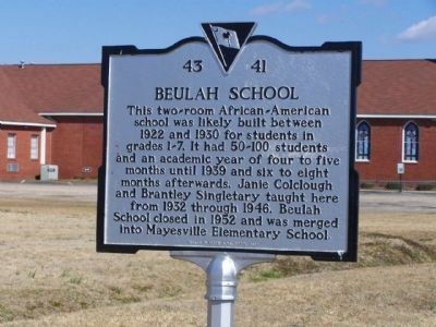
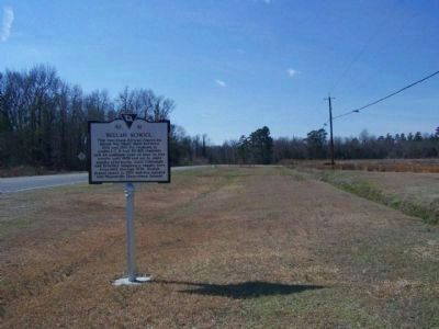
Beulah School
Erected 2008 by Beulah A.M.E. Church. (Marker Number 43-41.)
Topics and series. This historical marker is listed in these topic lists: African Americans • Education. In addition, it is included in the African Methodist Episcopal (AME) Church series list. A significant historical year for this entry is 1922.
Location. 33° 57.729′ N, 80° 14.941′ W. Marker is in East Sumter, South Carolina, in Sumter County. Marker is on 3175 Florence Highway (US 76), on the right when traveling west. Located just north of Goza Road. Touch for map. Marker is in this post office area: Sumter SC 29153, United States of America. Touch for directions.
Other nearby markers. At least 8 other markers are within 6 miles of this marker, measured as the crow flies. Birthplace of Mary McLeod Bethune (approx. 2.6 miles away); The Mayesville Story (approx. 2.9 miles away); Concord Presbyterian Church (approx. 3.9 miles away); St. Paul African American Methodist Episcopal Church (approx. 4.4 miles away); Salem (Black River) Presbyterian Church (approx. 5˝ miles away); Bethel United Methodist Church (approx. 5˝ miles away); Sumter Vietnam Memorial (approx. 5.8 miles away); Henry L. Scarborough House (approx. 5.8 miles away).
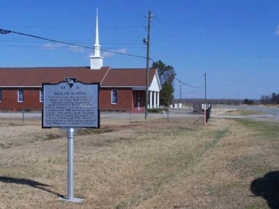
Regarding Beulah School. Today, only the Bethel A.M.E. Church sits at the school site
Also see . . . Google Street View. The school building can clearly be seen in the Google street view from December 2007. Notice that this is before the marker is placed. Presumably the building was still on the site when the marker was placed since it references the structure. It disappears sometime before the next street view images are taken in October 2012. (Submitted on October 30, 2014, by David Taylor of Darlington, South Carolina.)
Additional commentary.
1. The building was razed.
After inquiring with the SC Dept of Archives and History about the building, I received this response from Ehren Foley, Ph.D. the Historical Marker Coordinator.
I spoke with the current pastor at Beulah and he says that some time before 2009, when he came to Beulah, the congregation made the decision to raze the building. They had tried to explore some funding options for restoration (I know there aren’t many, certainly not from our office), but decided that the school was beyond repair. They did the marker in order to interpret the site before they took down the structure.
— Submitted November 13, 2014, by David Taylor of Darlington, South Carolina.
Credits. This page was last revised on June 16, 2016. It was originally submitted on March 17, 2010, by Mike Stroud of Bluffton, South Carolina. This page has been viewed 1,166 times since then and 42 times this year. Photos: 1, 2, 3. submitted on March 17, 2010, by Mike Stroud of Bluffton, South Carolina. • Bill Pfingsten was the editor who published this page.


