Hayward in Alameda County, California — The American West (Pacific Coastal)
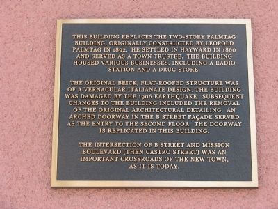
The Palmtag Building
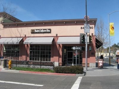
The original brick, flat-roofed structure was a vernacular Italianate design. He building was damaged by the 1906 Earthquake. Subsequent changes to the building included the removal of the original architectural detailing. An arched doorway in the B Street façade served as the entry to the second floor. The doorway is replicated in this building.
The intersection of B Street and Mission Boulevard (then Castro Street) was an important crossroads of the new town, as it is today.
Topics. This historical marker is listed in this topic list: Notable Buildings. A significant historical year for this entry is 1892.
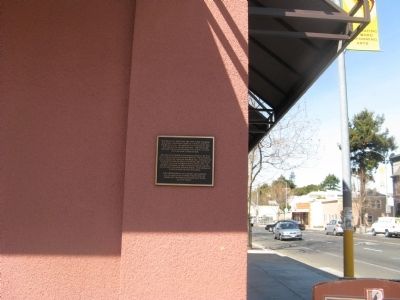
Location. 37° 40.326′ N, 122° 5.037′ W. Marker is in Hayward, California, in Alameda County. Marker is at the intersection of B Street and Mission Boulevard, on the right when traveling west on B Street. Touch for map. Marker is at or near this postal address: 880 B Street, Hayward CA 94541, United States of America. Touch for directions.
Other nearby markers. At least 8 other markers are within walking distance of this marker. Rancho San Lorenzo (about 700 feet away, measured in a direct line); Hayward Public Library (about 700 feet away); Allen F. Strutz Veterans Memorial Building (about 800 feet away); NSGW Hall - Eden Parlor No. 113 (about 800 feet away); Hayward 9/11 Memorial (approx. 0.2 miles away); Hayward War Memorial (approx. 0.2 miles away); I.D.E.S. Council Hayward #14 (approx. ¼ mile away); Juan Bautista de Anza Expedition Campsite #98 (approx. 0.4 miles away). Touch for a list and map of all markers in Hayward.
Credits. This page was last revised on August 5, 2018. It was originally submitted on March 21, 2010, by Syd Whittle of Mesa, Arizona. This page has been viewed 1,098 times since then and 16 times this year. Photos: 1, 2, 3. submitted on March 21, 2010, by Syd Whittle of Mesa, Arizona.


