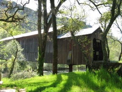
Near Chico in Butte County, California — The American West (Pacific Coastal)
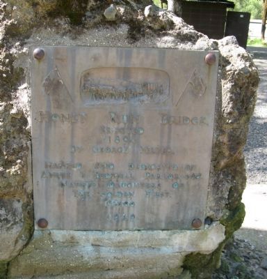
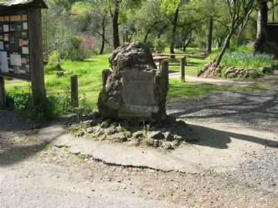
Honey Run Covered Bridge / Gold Dredge
Erected
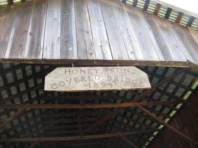
1894
By George Miller
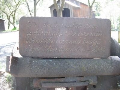
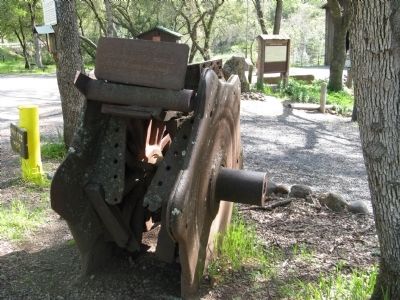
Gold Dredge
Erected 1949 by Annie K. Bidwell Parlor 168, Native Daughters of the Golden West.
Topics and series. This historical marker is listed in these topic lists: Bridges & Viaducts • Notable Places. In addition, it is included in the Covered Bridges, and the Native Sons/Daughters of the Golden West series lists. A significant historical year for this entry is 1894.
Location. Marker has been permanently removed. It was located near 39° 43.718′ N, 121° 42.233′ W. Marker was near Chico, California, in Butte County. Marker was at the intersection of Honey Run Road and Centerville Road, on the right when traveling north on Honey Run Road. Touch for map. Marker was at or near this postal address: 1682 Honey Run Road, Chico CA 95928, United States of America.
We have been informed that this sign or monument is no longer there and will not be replaced. This page is an archival view of what was.
Other nearby markers. At least 8 other markers are within 6 miles of this location, measured as the crow flies. Old Paradise Depot (approx. 4.6 miles away); Town of Paradise Memorial Trailway (approx. 4.6 miles away); Paradise Veterans Memorial (approx. 4.6 miles away); PFC. Steven J. Walberg-Riotto (approx. 4.6 miles away); Centerville School (approx. 4.8 miles away); Paradise Pioneers (approx. 5 miles away); Samuel Neal (approx. 5.1 miles away); Hooker Oak (approx. 5.4 miles away).
Additional commentary.
1. History of the Honey Well Covered Bridge
This information was compiled by Mildred Forester and is posted on the kiosk at the bridge.
Construction of the bridge to connect the new road down Little Butte Creek Canyon with the old Centerville-Chico Road, now named the Humbug Road, was completed in 1887.
This bridge was constructed by the American Bridge Company of San Francisco at a cost of $4,295. Specifications called for the bridge to 240 feet long and 18 feet wide. It was to rest on iron cylinders 44 inches in diameter. The spans were to be 12 feet, 80 feet and 39 feet and to be of “union” design.
Stone abutments were laid in concrete, with two of the cylinder piers 20 feet high on the west shore. The two shorter piers stood on a big rock near the center of the stream and were filled with cement. The contract called for enough iron rods, plates and supports so the bridge skeleton would not fall down if the wood floor planking, side timbers and wood coverings should burn.
The bridge was completed and accepted by the Butte County Board of Supervisors in January 1887. After two winters, and considering the long span, it was decided to have a cover built over the bridge to preserve the thick and costly plank flooring. In 1889, a shed with a steep pitched roof was constructed and in 1890 the bridge was painted.
The bridge was built rather low and near to the winter high water level. However it served the people who used it, for about eight years.
During the heavy rains in 1894 the bridge was washed from its moorings at the banks, and carried down stream.
Advertising for a new bridge was marked by a political hassle. Rivalry bidding on the job of furnishing the timbers was keen. The story spread that a bridge 230 feet long would need plenty of timbers and shakes, and would provide a major bit of business for the lucky bidder.
Butte County Supervisor McKay could not lawfully sell timber to the county, Hintz left McKay’s employment and began his own timber business in a spruce belt high in the mountains on Coutolenc Road between Magalia and the town of Coutolenc.
His confidence was so firm that he would gain the bid and build a new bridge that he omitted one end of his mill building to enable him to handle the long timbers that would have to be cut for the structure.
Bids were advertised, the specifications calling for “all spruce” lumber and Charley Hintz was the lone bidder, causing a county wide riot.
Butte County lumbermen began pressuring the Board, demanding to know why the bridge could not be built from “bull pine.”
George Miller, the county’s best bridge builder, was called upon to answer the vital question, which caused tension to mount to such an extreme.
“Will bull pine do for a bridge?”- and Miller handled the situation with great wisdom, declaring that bull pine, a wood which split and warped easily, could be used providing that the bridge was covered.
Under this arrangement, a Mr. Bennett was given the bid, at $16 to $18 per thousand feet of lumber, compared to the price of $22 to $24 per thousand offered by Mr. Hintz. After almost two years, the bridge was finished in 1896, bearing the distinction of being the second longest covered bridge in the state.
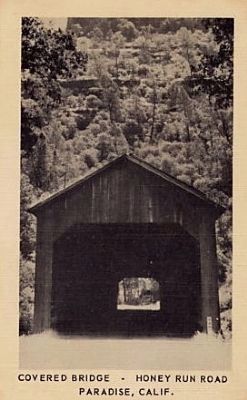
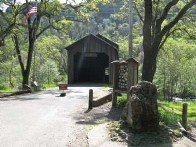
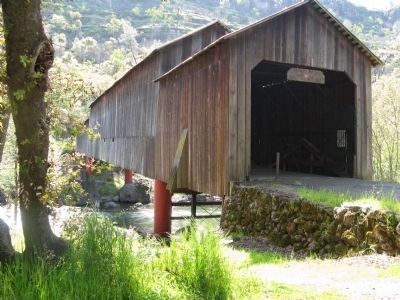
The bridge was a three-span covered timber structure, which is still standing. It was built with the “Pratt” type trusses with timber compression members and steel rods or members in the three spans, which are 80 feet, 128 feet and 30 feet long, respectfully. It is unique and picturesque due to its design with the end structures having a lower roof level than the main center section. It was built by S.A. Martindale, with George Miller as the inspector.
In 1960, the Honey Run Covered Bridge was then sixty-six years old, and reported to have only two planks of the original flooring replaced.
In 1961, the Butte County Public Works Director, Clay Castleberry, reported that
“it is beginning to show its age.”
And in 1965, a wayward panel van came down the hill and smashed into the east section, hitting crucial supports that knocked the entire section into the swollen waters of the creek.
In ensuing years, as funds were raised for its restoration, Clay Castleberry found the original bids, plans and specifications in the county archives, which were used to restore the structure in historical exactness. Some of the old iron plates, bars and other ironworks were used to copy and cast exact replicas for use in the reconstruction.
In 1972 the replacement section was completed, and only the bright newness of the comparable lumber as compared to the 80-year old weather beaten boards of the two original sections tell the secret of the bridge, restored now as an historical memento for posterity.
— Submitted April 11, 2010.
2. How It Got Its Name
This information was provided by Lois H. Colman and is posted on the kiosk at the bridge.
The early Western heritage of names, one finds, has little recorded or official history. Some of the most colorful pioneer names derive from several versions of early day lore. So it is with the Honey Run Covered Bridge.
One version is that the name came from the fact that many wild bee’s nests were located in the high rimrock near the top of the ridge, or perhaps from the fact that there were several “bee trees” full of honey in the ravine where the road was built.
Another favorite version is that the wild honeysuckle vines growing along the sides of the steep lava caps looked like liquid honey when the sun shone on the yellow flowers in the late afternoon.
A third version, and the one most familiar adhere to, concerns a young couple walking in the area one spring day. Suddenly they were confronted by a bear. The young man immediately shouted, “Run, Honey…Run.” While he set about to drive off the bear, supposedly, someone heard his shout and the road to the bridge was dubbed “Honey Run” as a consequence.
— Submitted April 11, 2010.
3. Bridge Gone
The Honey Run bridge completely burned down on November
9, 2018, in the Creek Fire. The related marker had already been removed and replaced in 2017 by the NDGW Bidwell Parlor. The 2017 replacement marker did survive the fire, according to a report and photo by the SF Chronicle.
— Submitted November 11, 2018, by Andrew Ruppenstein of Lamorinda, California.
Credits. This page was last revised on November 11, 2018. It was originally submitted on April 11, 2010, by Syd Whittle of Mesa, Arizona. This page has been viewed 2,917 times since then and 68 times this year. Photos: 1, 2, 3, 4. submitted on April 11, 2010, by Syd Whittle of Mesa, Arizona. 5. submitted on April 21, 2010, by Syd Whittle of Mesa, Arizona. 6, 7, 8, 9. submitted on April 11, 2010, by Syd Whittle of Mesa, Arizona.
