Marker Logo HMdb.org THE HISTORICAL
MARKER DATABASE
“Bite-Size Bits of Local, National, and Global History”
Spring Hill in Berkeley County, South Carolina — The American South (South Atlantic)
 

Spring Hill Methodist Church


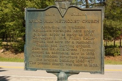
Spring Hill Methodist Church Marker image. Click for full size.
Photographed By Mike Stroud, 2010
1. Spring Hill Methodist Church Marker
Inscription. According to tradition, Methodists worshiped here under a brush arbor as early as 1800. On August 2, 1814, Phillip Keller deeded one acre for a Methodist Church and burying ground. Eden and Rebecca Green Thrower deeded an additional acre in 1839. A new wooden structure replaced the original building in 1846-47. The present church was built in 1958.
 
Erected 1963 by The Williams Family Association. (Marker Number 8-14.)
 
Topics. This historical marker is listed in this topic list: Churches & Religion. A significant historical year for this entry is 1800.
 
Location. 33° 13.897′ N, 80° 19.474′ W. Marker is in Spring Hill, South Carolina, in Berkeley County. Marker is on Old Gilliard Road (State Highway 27) north of Spring Hill Church Road, on the left when traveling north. Touch for map. Marker is in this post office area: Ridgeville SC 29472, United States of America. Touch for directions.
 
Other nearby markers. At least 8 other markers are within 8 miles of this marker, measured as the crow flies. Berkeley County (approx. 3.4 miles away); Four Holes Swamp Bridge / Harley's Tavern (approx. 6.4 miles away); Revolutionary War Cannon (approx. 6.4 miles away); Four Holes Swamp (approx. 6.4 miles away); Moorefield Memorial Highway, (Southern Terminus) (approx.
Paid Advertisement
Click on the ad for more information.
Please report objectionable advertising to the Editor.
Click or scan to see
this page online
6.4 miles away); a different marker also named Berkeley County (approx. 6.7 miles away); Harleyville (approx. 7.2 miles away); Dorchester (approx. 7.6 miles away).
 
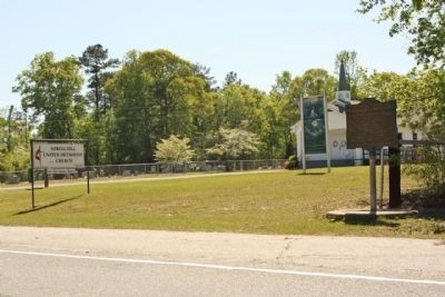
Spring Hill Methodist Church and Marker image. Click for full size.
Photographed By Mike Stroud, April 11, 2010
2. Spring Hill Methodist Church and Marker
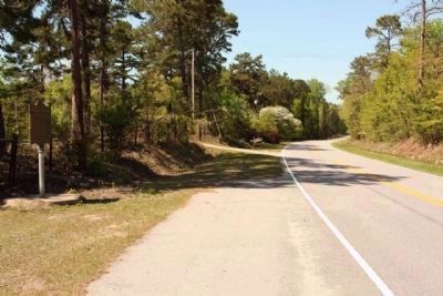
Spring Hill Methodist Church Marker, (left), looking north along Old Gilliard Road (SC 27) image. Click for full size.
Photographed By Mike Stroud, April 11, 2010
3. Spring Hill Methodist Church Marker, (left), looking north along Old Gilliard Road (SC 27)
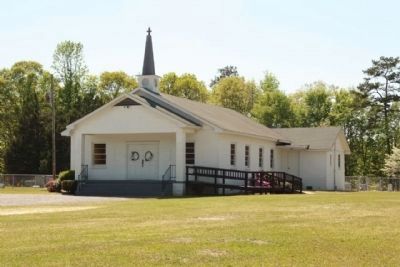
Spring Hill Methodist Church image. Click for full size.
Photographed By Mike Stroud, April 11, 2010
4. Spring Hill Methodist Church
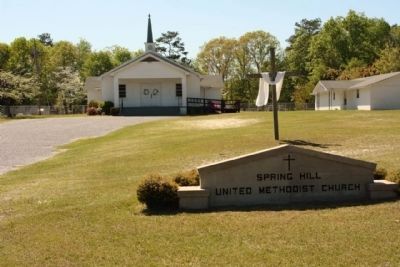
Spring Hill Methodist Church image. Click for full size.
Photographed By Mike Stroud, April 11, 2010
5. Spring Hill Methodist Church
 
 
Credits. This page was last revised on June 16, 2016. It was originally submitted on April 11, 2010, by Mike Stroud of Bluffton, South Carolina. This page has been viewed 1,392 times since then and 155 times this year. Photos:   1, 2, 3, 4, 5. submitted on April 11, 2010, by Mike Stroud of Bluffton, South Carolina. • Syd Whittle was the editor who published this page.
Share this page.  
Share on Tumblr
m=29703

CeraNet Cloud Computing sponsors the Historical Marker Database.
This website earns income from purchases you make after using our links to Amazon.com. We appreciate your support.
Paid Advertisement
May. 1, 2024