Marker Logo HMdb.org THE HISTORICAL
MARKER DATABASE
“Bite-Size Bits of Local, National, and Global History”
Near Esmont in Albemarle County, Virginia — The American South (Mid-Atlantic)
 

Ballenger Church


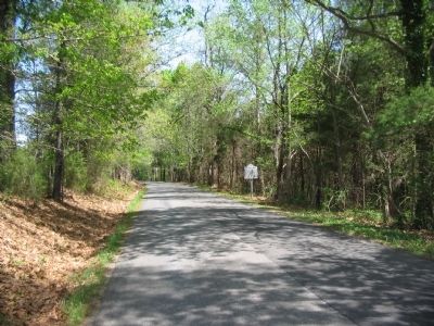
Ballenger Church Marker image. Click for full size.
Photographed By Craig Swain, April 17, 2010
1. Ballenger Church Marker
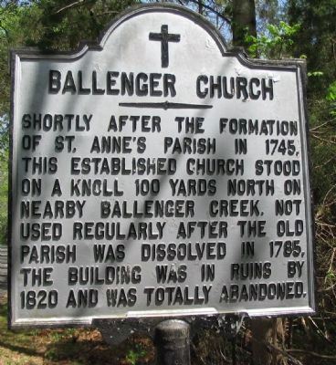
Inscription. Shortly after the formation of St. Anne's Parish in 1745, this established church stood on a knoll 100 yards north on nearby Ballenger Creek. Not used regularly after the old parish was dissolved in 1785, the building was in ruins by 1820 and was totally abandoned.
 
Topics. This historical marker is listed in this topic list: Churches & Religion. A significant historical year for this entry is 1745.
 
Location. 37° 46.679′ N, 78° 35.62′ W. Marker is near Esmont, Virginia, in Albemarle County. Marker is on James River Road (County Route 626) 0.6 miles east of Chestnut Grove Road (County Route 723), on the right when traveling east. Touch for map. Marker is in this post office area: Esmont VA 22937, United States of America. Touch for directions.
 
Other nearby markers. At least 8 other markers are within 6 miles of this marker, measured as the crow flies. Wilson Cary Nicholas (approx. 2.1 miles away); The Glebe (approx. 2.1 miles away); Hatton Ferry (approx. 4.6 miles away); a different marker also named Hatton Ferry (approx. 4.6 miles away); a different marker also named Hatton Ferry (approx. 5.4 miles away); Hurricane Camille (approx. 5˝ miles away); Scottsville Confederate Cemetery (approx. 5.6 miles away); Historic Scottsville (approx. 5.6 miles away).
 
Paid Advertisement
Click on the ad for more information.
Please report objectionable advertising to the Editor.
Click or scan to see
this page online
Ballenger Church Marker image. Click for full size.
Photographed By Craig Swain, April 17, 2010
2. Ballenger Church Marker
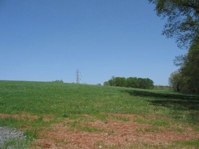
Knoll to the North of the Marker image. Click for full size.
Photographed By Craig Swain, April 17, 2010
3. Knoll to the North of the Marker
Just north of the marker is this knoll, roughly in the location cited on the marker where the church stood. Ballenger Creek runs about 300 yards east of this point.
 
 
Credits. This page was last revised on February 2, 2023. It was originally submitted on April 20, 2010, by Craig Swain of Leesburg, Virginia. This page has been viewed 2,024 times since then and 91 times this year. Photos:   1, 2, 3. submitted on April 20, 2010, by Craig Swain of Leesburg, Virginia.
Share this page.  
Share on Tumblr
m=29953

CeraNet Cloud Computing sponsors the Historical Marker Database.
This website earns income from purchases you make after using our links to Amazon.com. We appreciate your support.
Paid Advertisement
May. 7, 2024