Brooklyn Heights in Kings County, New York — The American Northeast (Mid-Atlantic)
Brookland Ferry Landing

Photographed by Bill Coughlin, April 24, 2010
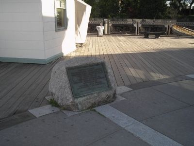
1. Brookland Ferry Landing Marker
The plaque is incorrect. Washington's General Orders are dated 2 July 1776.
Click for more information.
Click for more information.
This tablet marks the Brookland Ferry Landing from which point the American Army embarked during the night of August 29th, 1776 under the direction of General George Washington ably assisted by Colonel John Glover of Marblehead, Massachusetts
[Adjacent plaques:]
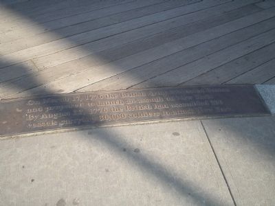
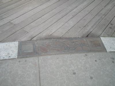
On March 17, 1776 the British Army evacuated Boston and prepared to launch an assault on New York. By August 22, 1776 the British had assembled 200 vessels carrying 30,000 soldiers to attack New York.
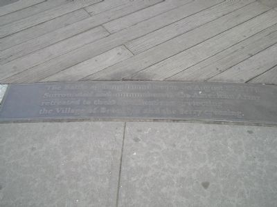
The Battle of Long Island began on August 27, 1776. Surrounded and outnumbered, the American Army retreated to their fortifications protecting the Village of Brooklyn and the ferry crossing.
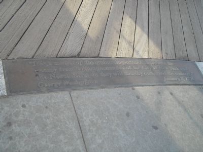
“It is a matter of the utmost importance to prevent the enemy from taking possession of the City of New York and the North River, as they will thereby command the country.”
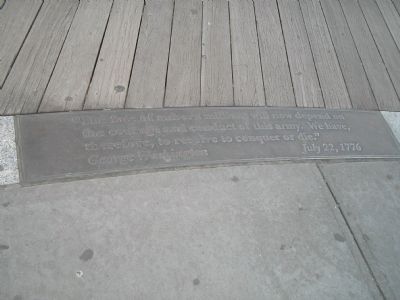
“The fate of unborn millions will now depend on the courage and conduct of this army. We have, therefore, to resolve to conquer or die.”
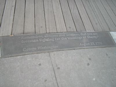
“Remember, officers and soldiers, that you are freemen fighting for the
this page online
Erected 1929 by Brooklyn Bridge Plaza Association.
Topics and series. This historical marker is listed in this topic list: War, US Revolutionary. In addition, it is included in the Former U.S. Presidents: #01 George Washington series list. A significant historical date for this entry is August 29, 1776.
Location. 40° 42.193′ N, 73° 59.697′ W. Marker is in Brooklyn, New York, in Kings County. It is in Brooklyn Heights. It is at the intersection of Old Fulton Street and Furman Street, on the right when traveling west on Old Fulton Street. Marker is located on the waterfront at the Fulton Ferry Landing. Touch for map. Marker is at or near this postal address: 1 Water St, Brooklyn NY 11201, United States of America. Touch for directions.

Regionally, this marker is in New York City and on Long Island. It is also in the American Northeast, in the Mid-Atlantic, and on the Eastern Seaboard. Globally, it is in the North Atlantic Region, North America, the Western Hemisphere, the Western World, and the Anglosphere. Historically, it finds itself in what was once New Netherland
Photographed by Bill Coughlin, April 24, 2010
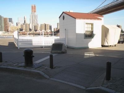
2. Brookland Ferry Landing Marker
Other nearby markers. At least 8 other markers are within walking distance of this marker: Fulton Street Pier (a few steps from this marker); History in the Park (within shouting distance of this marker); Brooklyn City Railroad Company Building (within shouting distance of this marker); The Builders of the Bridge (about 400 feet away, measured in a direct line); 1883 New York Harbor (about 400 feet away); Manhattan North of the Bridge to Canal Street (about 400 feet away); No. 1 Front Street Conversion (about 500 feet away); Emily Warren Roebling Plaza (about 500 feet away). Touch for a list and map of all markers in Brooklyn.
More about this marker. One of the adjacent markers contains a map of Brooklyn prior to the August 27, 1776 battle.
Also see . . . Brooklyn Ferry Landing. The Clio website entry (Submitted on August 20, 2026, by Larry Gertner of New York, New York.)
Photographed by Bill Coughlin, April 24, 2010
3. Marker on the Brooklyn Waterfront
Photographed by Bill Coughlin, April 24, 2010
4. Adjacent Marker #1
Photographed by Bill Coughlin, April 24, 2010
5. Adjacent Marker #2
Photographed by Bill Coughlin, April 24, 2010
6. Adjacent Marker #3
This marker contains an image of a map of the Brooklyn area during the time of the battle.
Photographed by Bill Coughlin, April 24, 2010
7. Adjacent Marker #4
Photographed by Bill Coughlin, April 24, 2010
8. Adjacent Marker #5
Photographed by Bill Coughlin, April 24, 2010
9. Adjacent Marker #6
Photographed by Bill Coughlin, April 24, 2010
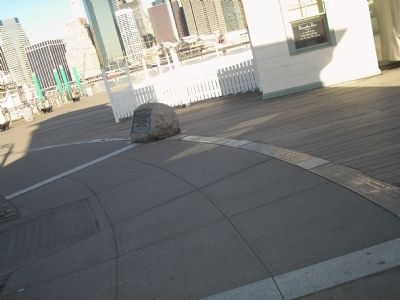
10. Markers at the Fulton Ferry Landing
The six markers can be seen in this photo flanking the Brookland Ferry Landing marker.
Photographed by R. C.
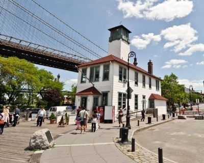
11. Brooklyn Ferry Landing Marker
The marker is located next to the Brooklyn Ice Cream Company which is itself housed in an historic fire boat house built in the 1920s.
Photographed by R. C.
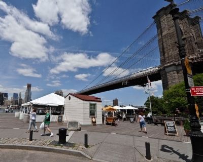
12. Brooklyn Ferry Landing Marker with the Brooklyn Bridge in background
Photographed by Bill Coughlin, April 24, 2010
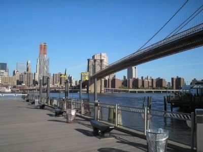
13. Manhattan from the Marker
This photo looks from the marker towards Manhattan, the destination of Washington's retreating army.
Credits. This page was last revised on August 20, 2026. It was originally submitted on April 24, 2010, by Bill Coughlin of Woodland Park, New Jersey. This page has been viewed 4,554 times since then and 251 times this year. Last updated on October 17, 2024, by Mark St. Martin of Kalamazoo, Michigan. Photos: 1, 2, 3, 4, 5, 6, 7, 8, 9, 10. submitted on April 24, 2010, by Bill Coughlin of Woodland Park, New Jersey. 11, 12. submitted on May 17, 2010, by Ronald Claiborne of College Station, Texas. 13. submitted on April 24, 2010, by Bill Coughlin of Woodland Park, New Jersey. • Devry Becker Jones was the editor who published this page.
