
Near Pamplin in Appomattox County, Virginia — The American South (Mid-Atlantic)
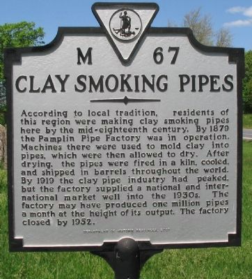
Clay Smoking Pipes
Photographed by Craig Swain, April 18, 2010
1. Clay Smoking Pipes Marker
Erected 2001 by Department of Historic Resources. (Marker Number M-67.)
Topics and series. This historical marker is listed in this topic list: Industry & Commerce. In addition, it is included in the Virginia Department of Historic Resources (DHR) series list. A significant historical year for this entry is 1879.
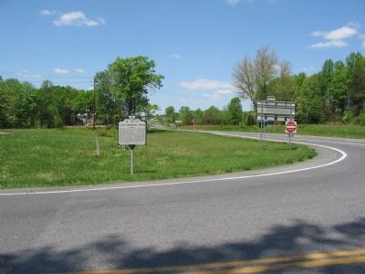
Location. 37° 16.531′ N, 78° 41.241′ W. Marker is near Pamplin, Virginia, in Appomattox County. It is at the intersection of Business U.S. 460 and U.S. 460, on the right when traveling south on U.S. 460Business . Touch for map.
this page online

Regionally, this marker is in the Piedmont and in Central Virginia. It is also in the American South and specifically in the Upper South. Globally, it is in North America, the Western Hemisphere, the Western World, and the Anglosphere. Historically, it finds itself in what was once the territory of the Mississippian Culture, one of the original Thirteen Colonies, one of the Confederate States of America, and the Antebellum South.
Other nearby markers. At least 8 other markers are within 10 miles of this marker, measured as the crow flies: Appomattox County / Prince Edward County (approx. 1.1 miles away); High Bridge Trail State Park (approx. 3.9 miles away); Sulphur Spring Baptist Church (approx. 5.3 miles away); Charlotte County / Appomattox County (approx. 8.4 miles away); Flag of Truce (approx. 8.9 miles away); "Now I see the white flag earnestly borne…" (approx. 9.1 miles away); Red House (approx. 9.1 miles away); The Isbell House (approx. 9.1 miles away).
Photographed by Craig Swain, April 18, 2010
2. Clay Smoking Pipes Marker
Photographed by Craig Swain, April 18, 2010
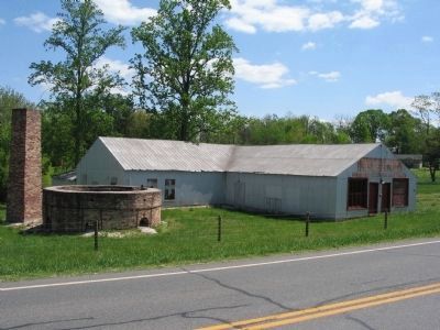
3. Pamplin Smoking Pipe & Manufacturing Company
Remains of the pipe factory. The kiln mentioned on the marker is to the left. The factory is located about one mile south on Business 480, near the intersection with Route T-1103.
Credits. This page was last revised on June 16, 2016. It was originally submitted on April 25, 2010, by Craig Swain of Leesburg, Virginia. This page has been viewed 1,736 times since then and 50 times this year. Photos: 1, 2, 3. submitted on April 25, 2010, by Craig Swain of Leesburg, Virginia.
